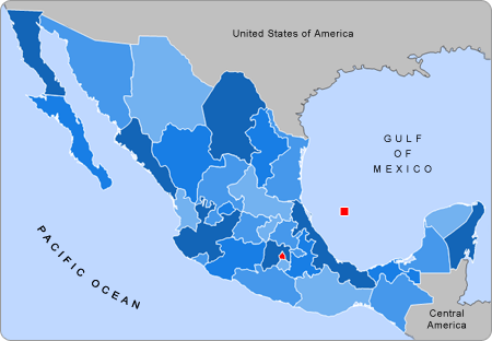
List of states of Mexico
The states of Mexico are first-level administrative territorial entities of the country of Mexico, which officially is named United Mexican States. There are 32 federal entities in Mexico (31 states and the capital, Mexico City, as a separate entity without being formally a state),[1][2][3][4]
Mexico City
The states are further divided into municipalities. In Mexico City the municipalities are known as alcaldías (similar to other state's municipalities but with different administrative powers).[5]
List
| State | Official Name (except Mexico City):
Estado Libre y Soberano de (English: "Free and Sovereign State of") : |
Flag | Capital | Largest city | Area[6] | Population (2010)[7] | Order of Admission to Federation |
Date of Admission to Federation |
|---|---|---|---|---|---|---|---|---|
| Aguascalientes | Aguascalientes | Aguascalientes | Aguascalientes | 5,618 km2 (2,169 sq mi) | 1,184,996 | 24 | 1857-02-05[8] | |
| Baja California | Baja California | Mexicali | Tijuana | 71,446 km2 (27,585 sq mi) | 3,155,070 | 29 | 1952-01-16[9] | |
| Baja California Sur | Baja California Sur | La Paz | La Paz | 73,922 km2 (28,541 sq mi) | 637,026 | 31 | 1974-10-08[10] | |
| Campeche | Campeche | San Francisco de Campeche | San Francisco de Campeche | 57,924 km2 (22,365 sq mi) | 822,441 | 25 | 1863-04-29[11] | |
| Chiapas | Chiapas | Tuxtla Gutiérrez | Tuxtla Gutiérrez | 73,289 km2 (28,297 sq mi) | 4,796,580 | 19 | 1824-09-14[12] | |
| Mexico City | Ciudad de México | Ciudad de México | Ciudad de México | 1,495 km2 (577 sq mi) | 8,918,653 | 32 | 2016-01-29 | |
| Chihuahua | Chihuahua | Chihuahua | Ciudad Juárez | 247,455 km2 (95,543 sq mi) | 3,406,465 | 18 | 1824-07-06[12] | |
| Coahuila1 4 | Coahuila de Zaragoza | Saltillo | Saltillo | 151,563 km2 (58,519 sq mi) | 2,748,391 | 16 | 1824-05-07[12] | |
| Colima6 | Colima | Colima | Manzanillo | 5,625 km2 (2,172 sq mi) | 650,555 | 23 | 1856-09-12[13][14] | |
| Durango | Durango | Victoria de Durango | Victoria de Durango | 123,451 km2 (47,665 sq mi) | 1,632,934 | 17 | 1824-05-22[12] | |
| Guanajuato | Guanajuato | Guanajuato | León | 30,608 km2 (11,818 sq mi) | 5,486,372 | 2 | 1823-12-20[12] | |
| Guerrero | Guerrero | Chilpancingo | Acapulco | 63,621 km2 (24,564 sq mi) | 3,388,768 | 21 | 1849-10-27[15] | |
| Hidalgo | Hidalgo | Pachuca | Pachuca | 20,846 km2 (8,049 sq mi) | 2,665,018 | 26 | 1869-01-16[16] | |
| Jalisco | Jalisco | Guadalajara | Guadalajara | 78,599 km2 (30,347 sq mi) | 7,350,682 | 9 | 1823-12-23[12] | |
| México | México | Toluca de Lerdo | Ecatepec de Morelos | 22,357 km2 (8,632 sq mi) | 15,175,862 | 1 | 1823-12-20[12] | |
| Michoacán | Michoacán de Ocampo | Morelia | Morelia | 58,643 km2 (22,642 sq mi) | 4,351,037 | 5 | 1823-12-22[12] | |
| Morelos | Morelos | Cuernavaca | Cuernavaca | 4,893 km2 (1,889 sq mi) | 1,777,227 | 27 | 1869-04-17[17] | |
| Nayarit | Nayarit | Tepic | Tepic | 27,815 km2 (10,739 sq mi) | 1,084,979 | 28 | 1917-01-26[18] | |
| Nuevo León4 | Nuevo León | Monterrey | Monterrey | 64,220 km2 (24,800 sq mi) | 4,653,458 | 15 | 1824-05-07[12] | |
| Oaxaca | Oaxaca | Oaxaca | Oaxaca | 93,793 km2 (36,214 sq mi) | 3,801,962 | 3 | 1823-12-21[12] | |
| Puebla | Puebla | Puebla | Puebla City | 34,290 km2 (13,240 sq mi) | 5,779,829 | 4 | 1823-12-21[12] | |
| Querétaro | Querétaro de Arteaga | Querétaro | Querétaro | 11,684 km2 (4,511 sq mi) | 1,827,937 | 11 | 1823-12-23[12] | |
| Quintana Roo | Quintana Roo | Chetumal | Cancún | 42,361 km2 (16,356 sq mi) | 1,325,578 | 30 | 1974-10-08[19] | |
| San Luis Potosí | San Luis Potosí | San Luis Potosí | San Luis Potosí | 60,983 km2 (23,546 sq mi) | 2,585,518 | 6 | 1823-12-22[12] | |
| Sinaloa | Sinaloa | Culiacán | Culiacán | 58,200 km2 (22,500 sq mi) | 3,216,000 | 20 | 1830-10-14[20] | |
| Sonora2 | Sonora | Hermosillo | Hermosillo | 179,503 km2 (69,306 sq mi) | 2,662,480 | 12 | 1824-01-10[12] | |
| Tabasco5 | Tabasco | Villahermosa | Villahermosa | 24,738 km2 (9,551 sq mi) | 2,238,603 | 13 | 1824-02-07[12] | |
| Tamaulipas4 | Tamaulipas | Ciudad Victoria | Reynosa | 80,175 km2 (30,956 sq mi) | 3,268,554 | 14 | 1824-02-07[12] | |
| Tlaxcala | Tlaxcala | Tlaxcala | Vicente Guerrero | 3,991 km2 (1,541 sq mi) | 1,169,936 | 22 | 1856-12-09[21] | |
| Veracruz | Veracruz de Ignacio de la Llave |
Xalapa | Veracruz | 71,820 km2 (27,730 sq mi) | 7,643,194 | 7 | 1823-12-22[12] | |
| Yucatán3 | Yucatán | Mérida | Mérida | 39,612 km2 (15,294 sq mi) | 1,955,577 | 8 | 1823-12-23[12] | |
| Zacatecas | Zacatecas | Zacatecas | Zacatecas | 75,539 km2 (29,166 sq mi) | 1,490,668 | 10 | 1823-12-23[12] | |
Notes:
- Joined the federation with the name of Coahuila y Texas.
- Joined the federation with the name of Estado de Occidente also recognized as Sonora y Sinaloa.
- Joined the federation as República Federada de Yucatán[22] (English: Federated Republic of Yucatán) formed by the current states of Yucatán, Campeche and Quintana Roo. Became independent in 1841 constituting the second Republic of Yucatán and definitively rejoined in 1848.
- States of Nuevo León, Tamaulipas and Coahuila became independent de facto in 1840 to form the República del Río Grande (English: Republic of the Rio Grande); never consolidated its independence because independent forces were defeated by the centralist forces.[23]
- The State of Tabasco seceded from Mexico on two occasions, the first on February 13, 1841, rejoining again on December 2, 1842. And the second time was from November 9, 1846 to December 9, 1846
- Inc the remote Revillagigedo Islands, which are federally administered.
See also
- Administrative divisions of Mexico
- State flags of Mexico
- List of Mexican state legislatures (Current composition)
- List of current state governors in Mexico
- List of Mexican state demonyms
- List of Mexican state governors
- List of Mexican states by area
- List of Mexican states by HDI
- List of Mexican states by population
- Territorial evolution of Mexico
- Mexican state name etymologies
- Ranked list of Mexican states
- State governments of Mexico
References
- Agren, David (29 January 2015). "Mexico City officially changes its name to – Mexico City". The Guardian. Retrieved 30 January 2016.
- El Diario de México. "La Ciudad de México no será estado, sino entidad federal autónoma" (in Spanish). Retrieved February 29, 2016.
- "Artículo 43 de la Constitución Política de los Estados Unidos Mexicanos" (PDF).
- "DF no es el estado 32, aclaran legisladores".
- "Municipalities of Mexico City".
- "INEGI". Archived from the original on 2011-07-23.
- Censo 2010 Archived 2011-04-06 at the Wayback Machine
- "Calendario de Eventos Cívicos - Febrero". Archived from the original on 2010-04-11.
- "Transformación Política de Territorio Norte de la Baja California a Estado 29".
- "Secretaria de Educación Publica". Archived from the original on 2010-08-10. Retrieved 2015-06-16.
- "Secretaria de Educación Publica". Archived from the original on 2011-10-26.
- "Las Diputaciones Provinciales" (PDF) (in Spanish). p. 15.
- "Portal Ciudadano de Baja California".
- "Universidad de Colima". Archived from the original on 2010-08-10. Retrieved 2015-06-16.
- "Erección del Estado de Guerrero". Archived from the original on 2007-10-17. Retrieved 2015-06-16.
- "Congreso del Estado Libre y Soberano de Hidalgo". Archived from the original on 2008-07-24. Retrieved 2015-06-16.
- "Enciclopedia de los Municipios de México". Archived from the original on 2011-07-18.
- "Gobierno del Estado de Tlaxcala". Archived from the original on 2010-02-18. Retrieved 2015-06-16.
- "Gobierno del Estado de Quintana Roo". Archived from the original on 2011-08-17. Retrieved 2015-06-16.
- "500 años de México en documentos".
- "Portal Gobierno del Estado de Tlaxcala". Archived from the original on 2009-12-27.
- "La historia de la República de Yucatán".
- "República de Río Grande, el País que no pudo ser" (in Spanish). Archived from the original on 2010-01-22. Retrieved 2015-06-16.
| Ranked | |
|---|---|
| Social | |
| Political | |
| Economy | |
| Other | |
This article is issued from Wikipedia. The text is licensed under Creative Commons - Attribution - Sharealike. Additional terms may apply for the media files.