List of airports in Uzbekistan
This is a list of airports in Uzbekistan, sorted by location.
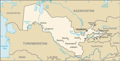
Map of Uzbekistan
Uzbekistan, officially the Republic of Uzbekistan (Uzbek: O‘zbekiston Respublikasi, Ўзбекистон Республикаси) is a country in Central Asia; before 1991 it was part of the Soviet Union. It shares borders with Kazakhstan to the west and to the north, Kyrgyzstan and Tajikistan to the east, and Afghanistan and Turkmenistan to the south.
Uzbekistan is divided into 12 regions, one autonomous republic, and one independent city. The provinces in turn are divided into 160 districts.
Airports
Airport names shown in bold have scheduled passenger service on commercial airlines.
Military Airports
| Location served | Region | ICAO | IATA | Airport name | Coordinates |
|---|---|---|---|---|---|
| Chirchik | Tashkent | Chirchik Air Base | 41°30′39″N 069°34′33″E | ||
| Jasliq | Karakalpakstan | Jasliq Air Base | 44°1′48″N 057°31′45″E | ||
| Jizzakh | Jizzakh | Pakhtakor Air Base | 40°15′10″N 067°54′38″E | ||
| Kakaydi | Surxondaryo | Kakaydy Air Base | 37°37′30″N 067°31′2″E | ||
| Kagan | Bukhara | Kagan South Air Base | 39°41′17″N 064°32′41″E | ||
| Karshi (Qarshi) | Qashqadaryo | UTSL | Karshi-Khanabad Air Base | 38°50′01″N 065°55′17″E |
See also
- Transport in Uzbekistan
- List of airports by ICAO code: U#UT - Tajikistan, Turkmenistan, Uzbekistan
- Wikipedia: WikiProject Aviation/Airline destination lists: Asia#Uzbekistan
References
- "ICAO Location Indicators by State" (PDF). International Civil Aviation Organization. 17 September 2010.
- "UN Location Codes: Uzbekistan". UN/LOCODE 2012-1. UNECE. 14 September 2012. - includes IATA codes
- "Airports in Uzbekistan". Great Circle Mapper. Retrieved 7 October 2012.
- "Airports in Uzbekistan". World Aero Data. Retrieved 7 October 2012.
List of airports in Asia | |
|---|---|
| Sovereign states |
|
| States with limited recognition |
|
| Dependencies and other territories |
|
| |
This article is issued from Wikipedia. The text is licensed under Creative Commons - Attribution - Sharealike. Additional terms may apply for the media files.