Licata
Licata (Italian: [liˈkaːta], Sicilian: [lɪˈkaːta]; Ancient Greek: Φιντίας, whence Latin: Phintias or Plintis), formerly also Alicata, is a city and comune located on the south coast of Sicily, at the mouth of the Salso River (the ancient Himera), about midway between Agrigento and Gela. It is a major seaport developed at the turn of the twentieth century, shipping sulphur, the refining of which has made Licata the largest European exporting centre, and asphalt, and at times shipping cheese.
Licata | |
|---|---|
| Comune di Licata | |
 View of Licata. | |
 Coat of arms | |
.svg.png) Licata within the Province of Agrigento | |
Location of Licata 
| |
 Licata Location of Licata in Italy 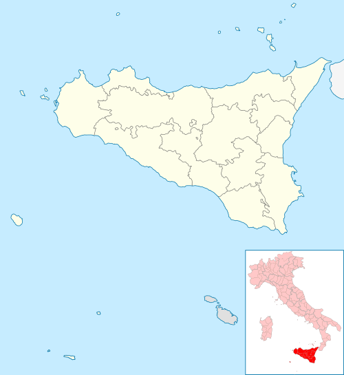 Licata Licata (Sicily) | |
| Coordinates: 37°06′30″N 13°56′49″E | |
| Country | Italy |
| Region | Sicily |
| Province | Agrigento (AG) |
| Frazioni | Mollarella, Torre di Gaffe |
| Government | |
| • Mayor | Giuseppe Galanti |
| Area | |
| • Total | 178 km2 (69 sq mi) |
| Elevation | 8 m (26 ft) |
| Population (31 January 2019)[2] | |
| • Total | 36,461 |
| • Density | 200/km2 (530/sq mi) |
| Demonym(s) | Licatesi |
| Time zone | UTC+1 (CET) |
| • Summer (DST) | UTC+2 (CEST) |
| Postal code | 92027 |
| Dialing code | 0922 |
| Patron saint | Sant'Angelo |
| Saint day | May 5 |
| Website | Official website |
West of the port city there is a series of pocket beaches separated by wave-cut headlands as high as 40 metres (130 ft). (Amore 2002).
History
Ancient
The site of archaic settlements,[3] the city was founded on the right bank of the Salso in 282 BCE, by Phintias, a tyrant of Agrigentum, who named it for himself, razing the city of Gela and resettling its population at his new settlement.[4] Phintias laid it out on a great scale, with its walls, temples, and agora. As late as the 1st century BCE, inscriptions and coins show that the inhabitants retained the name Geloi. The setting took advantage of a small natural harbour, about 80 metres (260 ft) across, which corresponds to a natural depression along the coast that is now infilled with construction. The site was protected by the headland now named Monte San Michele. At nearby Cape Ecnomus, in 256 BCE the Romans won a major battle in the First Punic War.
Phintias, however, never rose to a degree of importance at all to be compared to that of Gela: it is mentioned in the First Punic War (249 BC) as affording shelter to a Roman fleet, which was, however, attacked in the roadstead by that of the Carthaginians, and many of the ships sunk.[5] Cicero also alludes to it as a seaport, carrying on a considerable export trade in corn.[6] But in Strabo's time it seems to have fallen into the same state of decay with the other cities on the south coast of Sicily, as he does not mention it among the few exceptions.[7] Pliny, indeed, notices the Phintienses (or Phthinthienses as the name is written in some manuscripts) among the stipendiary towns of Sicily; and its name is found also in Ptolemy (who writes it Φθινθία); but it is strange that both these writers reckon it among the inland towns of Sicily, though its maritime position is clearly attested both by Diodorus and Cicero. The Antonine Itinerary also gives a place called Plintis, doubtless a corruption of Phintias, which it places on the road from Agrigentum along the coast towards Syracuse, at the distance of 23 miles (37 km) from the former city.[8] This distance agrees tolerably well with that from Agrigento to Licata, though somewhat below the truth. There is indeed no doubt, from existing remains on the hill immediately above Licata, that the site was occupied in ancient times; and, though these have been regarded by local antiquarians as the ruins of ancient Gela, there is little doubt of the correctness of the opinion advanced by Cluverius, that that city is to be placed on the site of then called Terranova since renamed to its ancient form, Gela, and the vestiges which remain at Licata are those of Phintias.[9]
Middle and Modern Ages
The historical centre of the town, near the coastal castle of Lympiados, dates from the period of Byzantine domination. In 827 the Arabs conquered Licata, and their rule lasted for more than two centuries, ending when the town was captured by the Normans on July 25, 1086. During the Norman-Hohenstaufen age the town flourished and was awarded the title of Cittè Demaniale ("Crown's City").
In 1270 Licata (then having some 7,000 inhabitants) rebelled against Angevine rule as part of the uprising known as the Sicilian Vespers. Thereafter the town came under the control of the Aragonese, who in 1447 granted it the title of fidelissima ("Most Faithful"). In 1553, after the city was sacked by Dragut's corsairs, it was decided to rebuild the walls, together with a large tower which was erected on the summit of Sant'Angelo hill.
Licata began to flourish once more in the 16th century, thanks in part to the presence of a community of Maltese immigrants, and this period of prosperity continued well into the 17th century, when the first settlements appeared outside the wall, housing the growing Maltese community, and numerous buildings were constructed or rebuilt in the Baroque style. The port also enjoyed a period of prosperity, largely resulting from the export of grain.
Contemporary era
In 1820 Licata rose against the Bourbon rulers of the Kingdom of the Two Sicilies, led by patriot Matteo Vecchio Verderame. During the Expedition of the Thousand under Giuseppe Garibaldi, the town contributed with a whole corps, and housed for a night Garibaldi's son Menotti and his general Nino Bixio.
The 1870s saw the construction of two bridges connecting to the sulphur mines inland, and five refineries (including the then largest in Europe) were built. This brought a considerable economic expansion, leading to the creation of several elegant residences in Licata.

Licata.[10] served as an Allied landing point during the 1943 Operation HUSKY Allied invasion of Sicily of World War II.[11] War damage and the decline in competitiveness in the sulphur industry caused economic decline, forcing many people to emigrate to northern Italy or abroad. As a town occupied by the Allies, it served as a model for John Hersey's novel A Bell for Adano.[12]

Licata has however maintained its artistic importance, and tourism has begun to flourish again in recent times. Nevertheless, the economy is heavily reliant on the fishing industry.
The Museo Civico displays many archaeological finds, notably material from burial grounds dating from prehistoric times to the 3rd century BC.
Geography
The municipality borders with Butera (CL), Camastra, Campobello di Licata, Naro, Palma di Montechiaro and Ravanusa.[13] It counts the hamlets (frazioni) of Mollarella and Torre di Gaffe.
Main sights
- Archaeological remains of the ancient Greek city, at Monte Sant'Angelo. The 17th century Castel Sant'Angelo is located nearby.
- The necropolis of Monte Petrulla
- The Grangela, and hydraulic work of Pre-Hellenistic times
- Frourion of Falaride, a Greek fortress
- The lighthouse, which is the third tallest in Italy
- Church of Santa Maria La Nova, built in the 15th century but renovated in later years. It houses the Black Christ's Chapel.
- the Carmine (13th century), including a church and a convent, rebuilt in the 18th century under design by Giovanni Biagio Amico.
- Palazzo di Città, a noteworthy example of Sicilian Liberty style, designed by Ernesto Basile.
See also
Notes
- "Superficie di Comuni Province e Regioni italiane al 9 ottobre 2011". Istat. Retrieved 16 March 2019.
- "Popolazione Residente al 1° Gennaio 2018". Istat. Retrieved 16 March 2019.
- Attested by chance finds of Corinthian, Ionic, and Geloan pottery and figurines, now in the museums of Palermo and Agrigento (Stillwell).
- Diod. xxii. 2, p. 495.
- Diod. xxiv. 1, p. 508.
- Cicero In Verrem iii. 8. 3.
- Strabo vi. p. 272.
- Itin. Ant. p. 95.
- Cluverius Sicil. pp. 200, 214.
- Samuel Eliot Morison (2002). Sicily-Salerno-Anzio. University of Illinois press. Archived from the original on 2017-08-09. Retrieved 2017-06-27.
- Info at Google Books
- Info at militarystory.org
- 39190 Licata on OpenStreetMap
References

- C. Amore et al., "Historical evolution of the Salso River mouth, with respoect to the Licata harbour system" in Eurocoast/EUCC, Littoral 2002 (on-line)
- Richard Stillwell, ed. Princeton Encyclopedia of Classical Sites, 1976: "Phintias (Licata) Sicily"
External links
| Wikimedia Commons has media related to Licata. |
- (in Italian) Licata official website
- (in Italian) Licata Today website
- . Encyclopædia Britannica (11th ed.). 1911.
| Authority control |
|
|---|