Sambuca di Sicilia
Sambuca di Sicilia (Sicilian: Sammuca) is a comune (municipality) in the Province of Agrigento in the Italian region Sicily, located about 68 kilometres (42 mi) southwest of Palermo and about 89 kilometres (55 mi) northwest of Agrigento.
Sambuca di Sicilia | |
|---|---|
| Comune di Sambuca di Sicilia | |
 | |
Location of Sambuca di Sicilia 
| |
 Sambuca di Sicilia Location of Sambuca di Sicilia in Italy 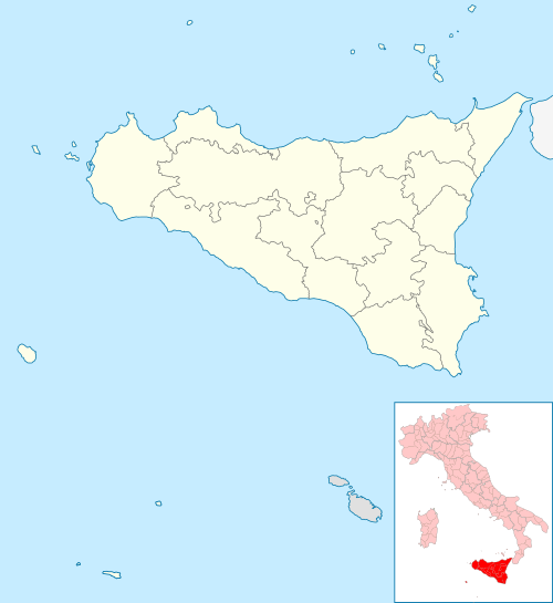 Sambuca di Sicilia Sambuca di Sicilia (Sicily) | |
| Coordinates: 37°39′N 13°6′E | |
| Country | Italy |
| Region | Sicily |
| Province | Agrigento (AG) |
| Government | |
| • Mayor | Leonardo Ciaccio |
| Area | |
| • Total | 96.37 km2 (37.21 sq mi) |
| Elevation | 364 m (1,194 ft) |
| Population (30 November 2016)[2] | |
| • Total | 5,878 |
| • Density | 61/km2 (160/sq mi) |
| Demonym(s) | Sambucese |
| Time zone | UTC+1 (CET) |
| • Summer (DST) | UTC+2 (CEST) |
| Postal code | 92017 |
| Dialing code | 0925 |
| Patron saint | St. George |
| Saint day | 23 April |
| Website | Official website |
Sambuca di Sicilia borders the following municipalities: Bisacquino, Caltabellotta, Contessa Entellina, Giuliana, Menfi, Santa Margherita di Belice, Sciacca.
History
The origins of the name are uncertain. The main assumptions: Sambuca as a Greek musical instrument in the shape of a harp or the implantation of the old town. Sambuca from the elderberry plants, widespread in antiquity in the valley of Lake Orange. Leonardo Sciascia breaks down the current name Sambuca in as-Sabuqah and interprets it as a "remote place". Until 1928 the town was called Sambuca Zabut. In 1928, Benito Mussolini removed 'Zabut' and added "of Sicily".
Sambuca, originally founded by ancient Greek colonists, rose to regional prominence as a trading hub after invading Arab Muslims took over around 830, just a few years after their landing in Sicily. It was called Zabuth, in remembrance of the emir Zabut ("The Splendid One") Al-Arab, who built a castle at that place, on the slopes of Mount Genuardo, between the rivers Belice and Sosius, 350 meters above sea level. Zabut Al-Maghrebi was a follower of the ascetic Ibn Mankud Conqueror 's "Burning Warrior of faith," Lord of the independent Kabyle of Trapani, Marsala, Sciacca. Zabut was inhabited by a Muslim population until the thirteenth century, when it was conquered by Frederick II. From the fifteenth to the nineteenth century Sambuca experienced alternating extremes of prosperity and plagues, splendor and earthquakes. But despite all, Sambuca progressed. The court passed the Roman family Barberini and new neighborhoods were built, the city wall was expanded, and palaces, baronial mansions, churches, monasteries and convents were built. The Land of Sambuca was promoted from Barony to Marquessate with the privilege of Philip II of Spain (Madrid 15 November 1570). On 16 September 1666 the Marquessate of Sambuca passed to the Beccadelli family from Bologna, who had risen to the rank of princes of the Principality of Camporeale. Sambuca in the nineteenth century was rich with culture, and in those years an enlightened middle class emerged. The writer, poet and patriot Vincenzo Navarro died there in 1867.
The town has suffered a major decline in population due to its lacking economy and low birth rate, the population counts currently 5834 and still in decline. Since the 2012 census the town has seen a decrease of over 200 inhabitants.
It garnered international media attention in January 2019 for selling homes in an auction with a starting price of 1 euro in hopes of attracting foreign residents to stop the area's depopulation.[3][4] Efforts picked up by Project City that has made it its very own campaign and that has brought great hopes for the revitalisation of the town's economic development.
Geography
Sambuca di Sicilia is located at 37°39′2″N 13°6′42″E. The city has a total area of 37 square miles (95.88 km²). The territory of Sambuca di Sicilia is located in the South-West of Sicily, 42.25 miles (68 km) from Palermo, about 21 miles (34 km) from the archaeological park of Selinunte, and about 13 miles (21 km) from Menfi, that has beaches still pristine and the Blue Flag beach for its sea. Perched on a hill, the town of Sambuca di Sicilia is surrounded in the North-East from hills and woods, including the towering peak of Mount Genuardo (3305 feet - 1.180 m), in the South-West by the valleys of the river Carboj that form the reservoir of Lake Arancio. The beautiful woods surrounding the town are full of local legends and myths.
Main sights
On Adranon mountain there is the archaeological complex of the 4th century BC and the old Arab house in the holiday area of Adragna.
- setti vaneddi (seven Saracen alleyways)
- Mother church
- Belvedere terrace
- remains of the castle of the Emir.
- palace Panitteri (17th century), home of the ethno-anthropological museum)
- Palazzo dell'Arpa (town hall)
- Palazzo Ciaccio
- Church of the Carmine with an Antonello Gagini's marble statue of the Madonna dell'Udienza (Our Lady of the Audience)
- Church of St. Michael Archangel with its wooden equestrian statue of St. George, patron Saint of Sambuca di Sicilia, slaying the dragon.
Outside the center, are the ancient towers of Pandolfina and Cellaro, the Fortino di Mazzallakkar which emerge only in the summer months when the lake level is lowered.
Twin towns

References
- "Superficie di Comuni Province e Regioni italiane al 9 ottobre 2011". Istat. Retrieved 16 March 2019.
- All demographics and other statistics: Italian statistical institute Istat.
- Marchetti, Silvia (16 January 2019). "Pretty Italian town sells homes for $1". CNN Travel. CNN. Retrieved 16 January 2019.
- Lorenzo Tondo (9 May 2019). "Foreign buyers snap up Sicilian homes at €1 auction". The Guardian. Retrieved 9 May 2019.
External links
- Official website
- Pro loco "L'Araba Fenicia" - Tourism promotion organization
- Sambuca di Sicilia on MySpace
- Theprojectcity.com
| Authority control |
|
|---|