Leyner, Colorado
Leyner is a census-designated place (CDP) in Boulder County, Colorado, United States. The population as of the 2010 Census was 29.[2]
Leyner, Colorado | |
|---|---|
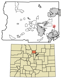 Location of Leyner in Boulder County, Colorado. | |
 Leyner Location of Leyner in Boulder County, Colorado. | |
| Coordinates: 40°2′59″N 105°6′9″W | |
| Country | |
| State | |
| County | Boulder[1] |
| Area | |
| • Total | 0.2 sq mi (0.5 km2) |
| • Land | 0.2 sq mi (0.4 km2) |
| • Water | 0.04 sq mi (0.1 km2) |
| Elevation | 5,029 ft (1,533 m) |
| Population (2010) | |
| • Total | 29 |
| • Density | 204/sq mi (78.8/km2) |
| Time zone | UTC-7 (MST) |
| • Summer (DST) | UTC-6 (MDT) |
| GNIS feature ID | 08-44695 |
Geography
Leyner is located in eastern Boulder County along the west side of U.S. Route 287, 4 miles (6 km) north of Lafayette. Boulder Creek forms the northern edge of the CDP.
According to the U.S. Census Bureau, the Leyner CDP has an area of 0.19 square miles (0.5 km2), of which 0.039 square miles (0.1 km2), or 21.66%, is water.[3]
See also
- Outline of Colorado
- State of Colorado
- Colorado cities and towns
- Colorado census designated places
- Colorado counties
- Colorado metropolitan areas
- Front Range Urban Corridor
- North Central Colorado Urban Area
- Denver-Aurora-Boulder, CO Combined Statistical Area
- Boulder, CO Metropolitan Statistical Area
- Colorado cities and towns
References
- "US Board on Geographic Names". United States Geological Survey. 2007-10-25. Retrieved 2008-01-31.
- Colorado Trend Report 2: State and Complete Places (Sub-state 2010 Census Data). Missouri Census Data Center. Accessed 2011-02-25.
- "Geographic Identifiers: 2010 Demographic Profile Data (G001): Leyner CDP, Colorado". U.S. Census Bureau, American Factfinder. Archived from the original on February 12, 2020. Retrieved October 17, 2013.
- "Census of Population and Housing". Census.gov. Retrieved June 4, 2016.
| Wikimedia Commons has media related to Leyner, Colorado. |
Municipalities and communities of Boulder County, Colorado, United States | ||
|---|---|---|
| Cities | 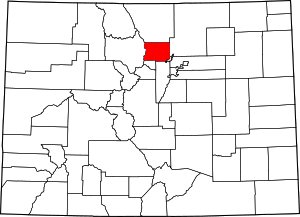 Map of Colorado highlighting Boulder County | |
| Towns | ||
| CDPs | ||
| Unincorporated communities | ||
| Ghost town | ||
| Footnotes | ‡This populated place also has portions in an adjacent county or counties | |
This article is issued from Wikipedia. The text is licensed under Creative Commons - Attribution - Sharealike. Additional terms may apply for the media files.