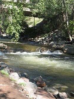
Boulder Creek (Colorado)
Boulder Creek is a 31.4-mile-long (50.5 km)[2] creek draining the Rocky Mountains to the west of Boulder, Colorado, as well as the city itself and surrounding plains.
| Boulder Creek[1] | |
|---|---|
 | |
| Physical characteristics | |
| Source | |
| ⁃ location | Confluence of North Boulder Creek and Middle Boulder Creek |
| ⁃ coordinates | 40°00′15″N 105°24′21″W |
| Mouth | |
⁃ location | Confluence with Saint Vrain |
⁃ coordinates | 40°09′33″N 105°00′35″W |
⁃ elevation | 4,852 ft (1,479 m) |
| Basin features | |
| Progression | Saint Vrain—South Platte—Platte— Missouri—Mississippi |
Route
The creek is formed by two main tributaries rising along the Continental Divide: North and Middle Boulder Creek; and later joined by South Boulder Creek.
North Boulder Creek forms in a valley between Navajo Peak and Arikaree Peak on the Continental Divide, in the Green Lakes chain of lakes. The creek flows 17.8 miles (28.6 km)[2] past the community of Switzerland Park to join Middle Boulder Creek.
Middle Boulder Creek rises as two forks from the Continental Divide: the North Fork rises in a cirque below Mount Neva and flows 7.5 miles (12.1 km) to the South Fork.[2] The South Fork rises at Rollins Pass on the Continental Divide and flows 5.5 miles (8.9 km) to the North Fork.[2] From the junction of the two forks, Middle Boulder Creek, 13.7 miles (22.0 km) long,[2] flows east through the towns of Eldora and Nederland into Barker Meadow Reservoir, a water supply for the city of Boulder,[3] before joining North Boulder Creek to form the main stem of Boulder Creek.
From its source at the confluence of the North and Middle Boulder forks, Boulder Creek flows down Boulder Canyon and through downtown Boulder. On the east edge of the city, the creek receives South Boulder Creek, which rises at Rogers Pass on the Continental Divide, just south of the Moffat Tunnel. South Boulder Creek flows 40.0 miles (64.4 km) through Rollinsville, Gross Reservoir, and Eldorado Canyon before leaving the mountains and curving past the south and east sides of Boulder to its mouth at Boulder Creek.[2]
After leaving the city, Boulder Creek flows northeast into Weld County, where it joins St. Vrain Creek, and on to a confluence with the Platte River. Its waters ultimately flow into the Mississippi River and the Gulf of Mexico.
Recreation
Boulder Creek is a summer recreational spot for outdoor activities including tubing, fly fishing, and wading. The annual Boulder Creek Festival, held along the creekside civic area between the library and Central Park, opens the summer season on Memorial Day weekend.
Fish species
Fish surveys from 1990, 1995, and 2006 found the following species of fish in Boulder Creek.[4][5][6]
| Common name | Scientific name | Native to Colorado? | Image |
|---|---|---|---|
| Sand Shiner | Notropis stramineus | Yes | 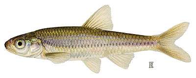 |
| Iowa Darter | Etheostoma exile | Yes | 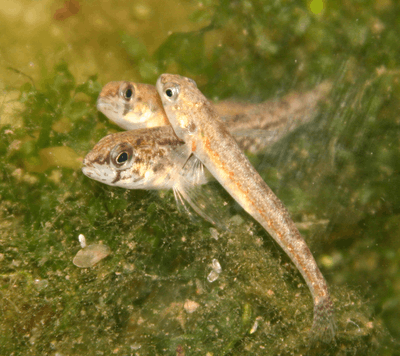 |
| White Sucker | Catostomus commersoni | Yes | 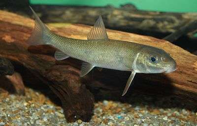 |
| Creek Chub | Semotilus atromaculatus | Yes | .jpg) |
| Longnose Sucker | Catostomus catostomus | Yes |  |
| Fathead Minnow | Pimephalus promelas | Yes | 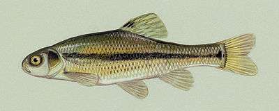 |
| Longnose dace | Rhinichthys cataractae | Yes | 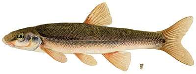 |
| Largemouth Bass | Micropterus salmoides | No | 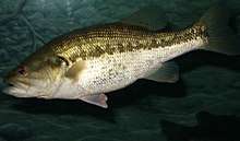 |
| Bluegill | Lepomis macrochirus | No | .jpg) |
| Common Carp | Cyprinus carpio | No | 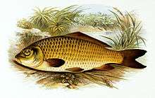 |
| Yellow Perch | Perca flavescens | No | 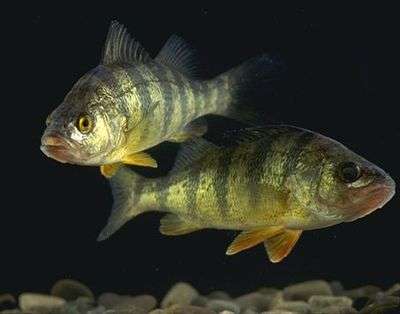 |
| Plains topminnow | Fundulus sciadicus | Yes | 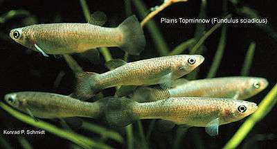 |
| Black Crappie | Promoxis nigromaculatus | No |  |
| Brown Trout | Salmo trutta | No |  |
| Rainbow Trout | Oncorhynchus mykiss | No | 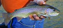 |
| Cutbow Trout | Oncorhynchus clarkia x mykiss | No | 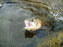 |
| Golden Shiner | Notemigonus crysoleucas | No | 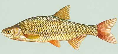 |
| Green Sunfish | Lepomis cyanellus | Yes | 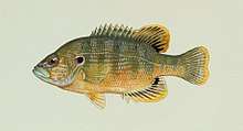 |
| Pumpkinseed | Lepomis gibbosus | No | 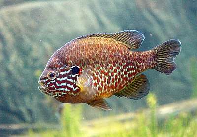 |
| Western Mosquitofish | Gambusia affinis | No | 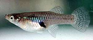 |
| Central stoneroller | Campostoma anomalum | Yes | |
| Orangespotted sunfish | Lepomis humilis | Yes | 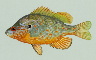 |
See also
References
- "Boulder Creek". Geographic Names Information System. United States Geological Survey. Retrieved 2011-01-26.
- U.S. Geological Survey. National Hydrography Dataset high-resolution flowline data. The National Map Archived 2012-04-05 at WebCite, accessed March 25, 2011
- "Archived copy". Archived from the original on 2011-07-18. Retrieved 2008-06-11.CS1 maint: archived copy as title (link)
- Haworth, M. R., & Bestgen, K. R. (2016). Survey of Fishes and Habitat of South Boulder Creek, Colorado, within City of Boulder Open Space and Mountain Parks Property (pp. 1–57, Rep.). Fort Collins, CO: Colorado State University. doi:https://warnercnr.colostate.edu/wp-content/uploads/sites/2/2017/10/LFL-202-Haworth-and-Bestgen-2017-S-Boulder-Ck.pdf
- Bestgen, K.R., & Kondratieff, B. (1996). Fishes, Macroinvertebrates, and Habitat of South Boulder Creek, Colorado, within City of Boulder Open Space Property. 10.13140/RG.2.2.27446.29769.
- Steinmann, D. B., & Windell, J. T. (1990). Boulder Creek Fish Survey Application of Rabid Bioassessment Protocol V-Fish and The Index of Biotic Integrity at Boulder Creek Before and After Implementation Of Best Management Practices. E.P.O. Biology University of Colorado.
| Wikimedia Commons has media related to Boulder Creek (Colorado). |