Leshara, Nebraska
Leshara is a village in Saunders County, Nebraska, United States. The population was 112 at the 2010 census.
Leshara, Nebraska | |
|---|---|
 Main Street in Leshara, Nebraska | |
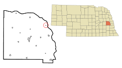 Location of Leshara, Nebraska | |
| Coordinates: 41°19′48″N 96°25′44″W | |
| Country | United States |
| State | Nebraska |
| County | Saunders |
| Area | |
| • Total | 0.07 sq mi (0.18 km2) |
| • Land | 0.07 sq mi (0.18 km2) |
| • Water | 0.00 sq mi (0.00 km2) |
| Elevation | 1,168 ft (356 m) |
| Population | |
| • Total | 112 |
| • Estimate (2017)[3] | 114 |
| • Density | 1,652.17/sq mi (637.73/km2) |
| Time zone | UTC-6 (Central (CST)) |
| • Summer (DST) | UTC-5 (CDT) |
| FIPS code | 31-26630[4] |
| GNIS feature ID | 0830681[5] |
History
Leshara had its start in the year 1905 when the railroad established a station there.[6] It was named after a Pawnee leader, Petalesharo.[7]
Geography
Leshara is located at 41°19′48″N 96°25′44″W (41.330124, -96.428996).[8]
According to the United States Census Bureau, the village has a total area of 0.07 square miles (0.18 km2), all land.[9]
Demographics
| Historical population | |||
|---|---|---|---|
| Census | Pop. | %± | |
| 1910 | 86 | — | |
| 1920 | 102 | 18.6% | |
| 1930 | 110 | 7.8% | |
| 1940 | 84 | −23.6% | |
| 1950 | 61 | −27.4% | |
| 1960 | 103 | 68.9% | |
| 1970 | 102 | −1.0% | |
| 1980 | 133 | 30.4% | |
| 1990 | 118 | −11.3% | |
| 2000 | 111 | −5.9% | |
| 2010 | 112 | 0.9% | |
| Est. 2017 | 114 | [3] | 1.8% |
| U.S. Decennial Census[10] | |||
2010 census
At the 2010 census there were 112 people, 48 households, and 27 families living in the village. The population density was 1,600.0 inhabitants per square mile (617.8/km2). There were 52 housing units at an average density of 742.9 per square mile (286.8/km2). The racial makeup of the village was 85.7% White, 1.8% African American, 0.9% Native American, 0.9% Asian, 8.0% from other races, and 2.7% from two or more races. Hispanic or Latino of any race were 9.8%.[2]
Of the 48 households 25.0% had children under the age of 18 living with them, 43.8% were married couples living together, 4.2% had a female householder with no husband present, 8.3% had a male householder with no wife present, and 43.8% were non-families. 31.3% of households were one person and 16.7% were one person aged 65 or older. The average household size was 2.33 and the average family size was 3.07.
The median age in the village was 42 years. 17.9% of residents were under the age of 18; 10.8% were between the ages of 18 and 24; 27.7% were from 25 to 44; 30.3% were from 45 to 64; and 13.4% were 65 or older. The gender makeup of the village was 48.2% male and 51.8% female.
2000 census
At the 2000 census there were 111 people, 50 households, and 27 families living in the village. The population density was 1,637.7 people per square mile (612.2/km2). There were 51 housing units at an average density of 752.5 per square mile (281.3/km2). The racial makeup of the village was 89.19% White, 1.80% Native American, 5.41% from other races, and 3.60% from two or more races. Hispanic or Latino of any race were 4.50%.[4]
Of the 50 households 16.0% had children under the age of 18 living with them, 50.0% were married couples living together, and 46.0% were non-families. 36.0% of households were one person and 16.0% were one person aged 65 or older. The average household size was 2.22 and the average family size was 3.04.
The age distribution was 17.1% under the age of 18, 10.8% from 18 to 24, 30.6% from 25 to 44, 26.1% from 45 to 64, and 15.3% 65 or older. The median age was 40 years. For every 100 females, there were 101.8 males. For every 100 females age 18 and over, there were 100.0 males.
The median household income was $31,750, and the median family income was $55,625. Males had a median income of $31,250 versus $21,250 for females. The per capita income for the village was $16,746. There were 6.5% of families and 8.5% of the population living below the poverty line, including 13.6% of under eighteens and none of those over 64.
References
- "2017 U.S. Gazetteer Files". United States Census Bureau. Retrieved Jan 12, 2019.
- "U.S. Census website". United States Census Bureau. Retrieved 2012-06-24.
- "Population and Housing Unit Estimates". Retrieved March 24, 2018.
- "U.S. Census website". United States Census Bureau. Retrieved 2008-01-31.
- "US Board on Geographic Names". United States Geological Survey. 2007-10-25. Retrieved 2008-01-31.
- "Leshara, Saunders County". Center for Advanced Land Management Information Technologies. University of Nebraska. Retrieved 23 August 2014.
- Bright, William (2004). Native American Placenames of the United States. Norman, OK: University of Oklahoma Press. p. 252.
- "US Gazetteer files: 2010, 2000, and 1990". United States Census Bureau. 2011-02-12. Retrieved 2011-04-23.
- "US Gazetteer files 2010". United States Census Bureau. Archived from the original on January 12, 2012. Retrieved 2012-06-24.
- "Census of Population and Housing". Census.gov. Retrieved June 4, 2015.
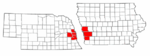
Municipalities and communities of Saunders County, Nebraska, United States | ||
|---|---|---|
| Cities | Map of Nebraska highlighting Saunders County | |
| Villages | ||
| Townships | ||
| CDP | ||
| Unincorporated communities | ||
Metropolitan area of Omaha–Council Bluffs | ||||||
|---|---|---|---|---|---|---|
| Primary cities |
|  | ||||
| Cities over 10,000 (per 2010 Census) |
| |||||
| Cities of 5,000 to 10,000 (per 2010 Census) |
| |||||
| Cities of 1,000 to 5,000 (per 2010 Census) |
| |||||
| Census-designated places |
| |||||
| Cities and villages of fewer than 1,000 (per 2010 Census) |
| |||||
| Counties |
| |||||