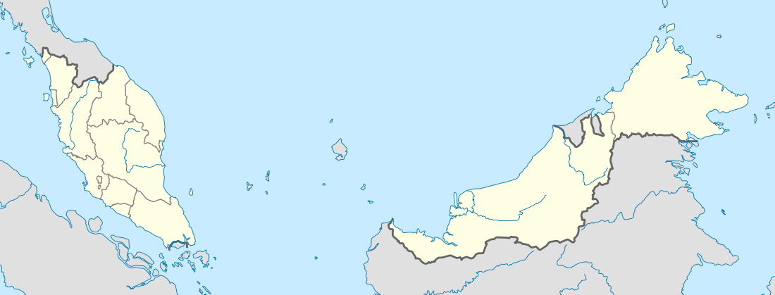
Kota Bharu
Kota Bharu (Jawi: كوت بهارو; Chinese: 哥打峇魯; Tamil: கோத்தா பாரு; occasionally referred to as Kota Baharu) is a city in Malaysia that serves as the state capital and royal seat of Kelantan. It is also the name of the territory (jajahan) or district in which Kota Bharu City is situated. The name means 'new city' or 'new castle/fort' in Malay. Kota Bharu is situated in the northeastern part of Peninsular Malaysia, and lies near the mouth of the Kelantan River at 6°8′N 102°15′E. The northeastern Malaysian city is close to the Thailand border.
Kota Bharu كوت بهارو | |
|---|---|
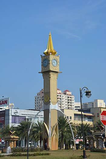 Tuan Padang roundabout clock tower at Kota Bharu. | |
 Flag | |
| Nickname(s): Bandaraya Islam The Islamic City | |
 Kota Bharu | |
| Coordinates: 6°8′N 102°15′E | |
| Country | |
| State | |
| District | |
| First settled | 1844 |
| Granted municipality status | 1 January 1979 |
| Government | |
| • Yang DiPertua | Tuan Zainal Abidin Bin Tuan Yusuf (Since Sept 2018) |
| Area | |
| • Total | 115.64 km2 (44.65 sq mi) |
| Population (2010)[2] | |
| • Total | 314,964 |
| • Density | 2,700/km2 (7,100/sq mi) |
| Time zone | UTC+8 (MST) |
| • Summer (DST) | Not observed |
| Postcode | 15xxx |
| Area code(s) | +60-09-7 |
| Website | mpkbbri |
Kota Bharu is home to many mosques, various museums, the unique architecture of the old royal palaces (still occupied by the sultan and sultanah and off-limits to visitors but viewable from outside) and former royal buildings (which can be visited) in the centre of town.
The City is served by Keretapi Tanah Melayu's East Coast Line at the nearby Wakaf Bharu Terminal Station, in the town of Wakaf Bharu across the Kelantan River and Sultan Ismail Petra Airport, located in Pengkalan Chepa.
History
Kota Bharu was founded during the late 19th century. Before the establishment, Kota Bharu was home to Kelantan's Royal Palace, then established by Sultan Muhammad II of Kelantan in 1844 as Kelantan's state capital who wanted the new state capital built in his honour.[3] Prior to this, Kota Bharu was known as Kuala Kelantan. Before Kota Bharu assumed the role, the Kelantanese capital was divided into two which were Kota Kubang Labu and Kota Pengkalan Datu.[4] During the 19th century, Kelantan was a prosperous and populous state with a population of around 30,000 to 50,000 people including a thousand Chinese. Production from within the state include gold, tin ore, black pepper, areca nut, rice, rattan, bamboo, agarwood and songket. Kota Bharu acts as entrepot for goods due to its strategic location beside the Kelantan River.[5]
Pantai Sabak, about 10 km (6.2 mi) from Kota Bharu, was the initial landing point of the Japanese invasion forces on 8 December 1941 in their Malayan campaign, when they successfully engaged the British in jungle warfare[6] and ultimately captured Singapore.
Demographics
The vast majority of Kota Bharu's population is ethnically Kelantanese Malay. The language spoken in Kota Bharu is Bahasa Melayu Kelantan, which is a dialect commonly referred to as "Kecek Kelate". There is also a fairly large Chinese, a minority Indian, Siamese and Orang Asli population within the city. The total population of Kota Bharu city as of 2010 is 314,964. [2]
Religion
Kota Bharu city's population is 93% Muslim with the remainder consisting of Buddhists, Hindus and Christians. The indigenous people that reside in the city's outskirts are generally practicing Christians. The predominantly urban local Chinese community mainly practices Buddhism. The local state government is helmed by the Pan-Malaysian Islamic Party; Kota Bharu was declared an Islamic City vis-à-vis Kota Bharu Bandaraya Islam. The Jawi script is used in street names and restaurants.
Social activities that do not contradict Islamic norms are allowed. Government offices and many stores are closed on Fridays and Saturdays, but the vibrant markets remain open except during Islamic prayer time on Friday afternoon. The conservative Kelantanese state government under PAS has implemented some Islamic laws. These include separate check-out counters in supermarkets for males and females, and khalwat, the Islamic rule on proximity between males and females.
The Kota Bharu Municipal Council, the local government authority, discourages the use of "indecent attire" by female employees in retail outlets and restaurants.[7] Those who are caught for "dressing indecently" may be fined up to RM 500. The definition of "indecent dressing" includes "body hugging outfits which show off the body, blouses which show the navel, see through blouses, mini-skirts and tight pants."[7]
Overcrowding
Years of failed state development plans resulted in Kelantan experiencing imbalance population and scattered pattern of main towns. This can be solved by moving the capital city southwards to further stimulating population growth away from overcrowded Kota Bharu.
Potential candidates for the new capital are Machang and Dabong. Barisan Nasional Kelantan has proposed to move the capital to Machang and develop a new international airport in Labok located in the outskirt of Machang.
Dabong on the other hand, is a very strategic town and potentially be chosen as the new capital of Kelantan as its location in the middle of Kelantan state and equally accessible from all parts of Kelantan.
Culture
The Kelantanese culture is highly distinctive as compared to other state of Malaysia but also with some influences from Thailand due to its geographical proximity. The Chinese and Indians are much more assimilated to local culture than those in other parts of Malaysia. Much of the food is sweet, with rice as the primary staple. Traditional dances like Mak Yong and Wayang Kulit were once widely practised, but are actively suppressed by local authorities because of perceived Hindu influences thought to contradict Islam.
Food
Nasi berlauk, nasi dagang, nasi lemak and nasi kerabu are popular elements of the local cuisine. Sweet cakes, or kuih, are also popular amongst the Kelantanese. Other popular foods include nasi tumpang, etok, apom, akok, lompat tikam, netbak, pisang goreng, and curry puffs.
Climate
Kota Bharu features a tropical monsoon climate bordering on a tropical rainforest climate. Kota Bharu does not have a true dry season although the city experiences noticeably heavier rainfall from August through January. Also, Kota Bharu experiences slightly cooler temperatures between December and February than during the rest of the year, making it one of the most "seasonal" cities in Malaysia. The city sees on average about 2,600 millimetres (100 in) of precipitation annually.
| Climate data for Kota Bharu (1981–2010) | |||||||||||||
|---|---|---|---|---|---|---|---|---|---|---|---|---|---|
| Month | Jan | Feb | Mar | Apr | May | Jun | Jul | Aug | Sep | Oct | Nov | Dec | Year |
| Record high °C (°F) | 32.6 (90.7) |
33.0 (91.4) |
34.4 (93.9) |
35.6 (96.1) |
35.8 (96.4) |
34.4 (93.9) |
34.4 (93.9) |
34.4 (93.9) |
34.4 (93.9) |
33.3 (91.9) |
33.3 (91.9) |
32.2 (90.0) |
35.8 (96.4) |
| Average high °C (°F) | 29.4 (84.9) |
30.3 (86.5) |
31.4 (88.5) |
32.6 (90.7) |
32.8 (91.0) |
32.7 (90.9) |
32.2 (90.0) |
32.1 (89.8) |
31.8 (89.2) |
31.1 (88.0) |
29.8 (85.6) |
29.1 (84.4) |
31.3 (88.3) |
| Daily mean °C (°F) | 26.1 (79.0) |
26.5 (79.7) |
27.3 (81.1) |
28.2 (82.8) |
28.2 (82.8) |
27.9 (82.2) |
27.5 (81.5) |
27.3 (81.1) |
27.0 (80.6) |
26.9 (80.4) |
26.3 (79.3) |
26.1 (79.0) |
27.1 (80.8) |
| Average low °C (°F) | 23.3 (73.9) |
23.2 (73.8) |
23.8 (74.8) |
24.4 (75.9) |
24.6 (76.3) |
24.3 (75.7) |
23.9 (75.0) |
23.8 (74.8) |
23.7 (74.7) |
23.7 (74.7) |
23.7 (74.7) |
23.6 (74.5) |
23.8 (74.8) |
| Record low °C (°F) | 16.7 (62.1) |
17.8 (64.0) |
17.8 (64.0) |
18.3 (64.9) |
21.7 (71.1) |
21.1 (70.0) |
20.6 (69.1) |
21.1 (70.0) |
20.6 (69.1) |
20.6 (69.1) |
18.9 (66.0) |
18.9 (66.0) |
16.7 (62.1) |
| Average rainfall mm (inches) | 89 (3.5) |
58 (2.3) |
136 (5.4) |
94 (3.7) |
112 (4.4) |
110 (4.3) |
155 (6.1) |
154 (6.1) |
177 (7.0) |
260 (10.2) |
644 (25.4) |
566 (22.3) |
2,555 (100.6) |
| Average rainy days (≥ 1.0 mm) | 13 | 6 | 9 | 8 | 11 | 11 | 13 | 15 | 17 | 18 | 22 | 20 | 163 |
| Average relative humidity (%) | 84 | 84 | 83 | 82 | 83 | 83 | 83 | 84 | 84 | 86 | 88 | 87 | 84 |
| Mean monthly sunshine hours | 161 | 190 | 207 | 214 | 194 | 186 | 184 | 187 | 187 | 174 | 139 | 130 | 2,153 |
| Source 1: Ogimet[8] | |||||||||||||
| Source 2: NOAA,[9] Deutscher Wetterdienst (extremes and humidity)[10] | |||||||||||||
Transportation
Public transportation
Grab Car services, available for 24 hours a day, are provided in Kota Bharu since April 2017.[11]
Kota Bharu is serviced by Sultan Ismail Petra Airport, the busiest airport in east coast of Peninsular Malaysia (IATA: KBR).
The closest railway station is the Wakaf Bharu station on the other side of the river, 6 km from the city centre.
Drive
Highway 8 is the main highway leading Kota Bharu to the federal capital Kuala Lumpur. Highway 3 connects Kota Bharu to Pasir Mas and the Thailand border in the west, or Kuala Terengganu, Kuantan or even Johor Bahru due south. Connection to Penang is possible via highway 4. The Lebuhraya Rakyat, or People's Expressway, is a planned expressway that is to connect Kota Bharu to Kuala Krai in southern Kelantan. The project has been integrated into the Central Spine Road project (assigned as highway 34), scheduled to be complete by 2020.
Education
Notable educational establishments include Open University Malaysia, Universiti Tun Abdul Razak, MSU College and Wadi Sofia International School. However, the most plentiful type of school are national schools,[12] which include
- Sekolah Menengah Kebangsaan Dato' Ahmad Maher, Jln. Long Yunus, 15200 Kota Bharu
- Sekolah Menengah Kebangsaan Dewan Beta, Jalan Dewan Beta, 15100 Kota Bharu
- Sekolah Menengah Kebangsaan Ismail Petra, Kompleks Sekolah-Sekolah, Wakaf Mek Zainab, 15300 Kota Bharu
- Sekolah Menengah Kebangsaan Kadok, Km 16 Jalan Kuala Krai, 16450 Ketereh, Kota Bharu
- Sekolah Menengah Kebangsaan Kampung Chengal, Jalan Kuala Krai, 16450 Kota Bharu
- Sekolah Menengah Kebangsaan Kedai Buloh, Jalan Kuala Besar, Kedai Buloh, 15350 Kota Bharu
- Sekolah Menengah Kebangsaan Kemumin, Pengkalan Chepa, 16100 Kota Bharu
- Sekolah Menengah Kebangsaan Ketereh, Km 21, Jalan Kuala Krai, 16450 Ketereh
- Sekolah Menengah Kebangsaan Kok Lanas, Km 24, 16450 Ketereh
- Sekolah Menengah Kebangsaan Kota, Jalan Salor, Sebelah RTM Kelantan, Wakaf Che Yeh, 15100 Kota Bharu
- Sekolah Menengah Kebangsaan Kota Bharu, Kompleks Sekolah-Sekolah, Wakaf Mek Zainab, 15300 Kota Bharu
- Sekolah Menengah Kebangsaan Kubang Kerian 1, Jalan Raja Perempuan Zainab (Il), 16150 Kota Bharu
- Sekolah Menengah Kebangsaan Kubang Kerian 2, Kampung Chicha, 16150 Kota Bharu
- Sekolah Menengah Kebangsaan Long Gafar, Kubang Keranji, 16150 Kota Bharu
- Sekolah Menengah Kebangsaan Melor, Hadapan Petronas, Kg Melor, Jalan Pasir Puteh, 16400 Melor
- Sekolah Menengah Kebangsaan Mulong, Sebelah SK Mulong (1), Jalan Mulong Cbg 3 Pendek, 16010 Kota Bharu
- Sekolah Menengah Kebangsaan Pangkal Kalong, Selepas Politeknik Kok Lanas, 16450 Ketereh
- Sekolah Menengah Kebangsaan Panji, Jalan R. Perempuan Zainab II, 16100 Kota Bharu
- Sekolah Menengah Kebangsaan Pengkalan Chepa (1), Jalan Maktab, 16100 Kota Bharu
- Sekolah Menengah Kebangsaan Pengkalan Chepa (2), Jalan Maktab Perguruan, 16100 Kota Bharu
- Sekolah Menengah Kebangsaan Pintu Geng, Kg Pintu Geng, 15100 Kota Bharu
- Sekolah Menengah Kebangsaan Putera, Kompleks Sekolah-Sekolah, Wakaf Mek Zainab, 15300 Kota Bharu
- Sekolah Menengah Kebangsaan Puteri, Kompleks Sekolah-Sekolah, Wakaf Mek Zainab, 15300 Kota Bharu
- Sekolah Menengah Kebangsaan Raja Sakti, Kota Jembal, Kedai Lalat, 16020 Kota Bharu
- Sekolah Menengah Kebangsaan Salor, Jalan Salor, 15100 Kota Bharu
- Sekolah Menengah Kebangsaan Sering, Jalan Sultan Omar, Off Jalan Tawang, 16150 Kota Bharu
- Sekolah Menengah Kebangsaan Sultan Ismail, Jln. Telipot, 15150 Kota Bharu
- Sekolah Menengah Kebangsaan Tanjung Mas, Taman Uda Murni, Jalan Pengkalan Chepa, 15400 Kota Bharu
- Sekolah Menengah Kebangsaan Teknik Pengkalan Chepa, Depan Pusat Sumber, Pengkalan Chepa, 16100 Kota Bharu
- Sekolah Menengah Kebangsaan Zainab (1), Jln. Telipot, Belakang PPD, 15150 Kota Bharu
- Sekolah Menengah Kebangsaan Zainab (2), Jalan Belakang Istana, 15300 Kota Bharu
- Sekolah Menengah Kebangsaan Penambang, Jalan Pantai Cahaya Bulan, 15350 Kota Bharu
Shopping
The most famous shopping destination in Kota Bharu is Siti Khadijah Market. Most of its sellers are women. Next to Central Market is the Kota Bharu Trade Centre (KBTC) which was opened in August 2009, with Parkson and Giant Hypermarket as the anchor tenants for the mall.
Other shopping centres in Kota Bharu are the KB Mall, Kota Seri Mutiara, Pantai Timur, The Store and the Nirwana Maju (in Bandar Baru Kubang Kerian). A new Tesco hypermarket opened in 2008. In March 2010, the Mydin Mall in Bandar Baru Kubang Kerian opened. AEON Mall in Lembah Sireh opened in April 2016. A new Giant Hypermarket located in Bandar Baru Tunjong was opened on 2016,[13]as well as a Mydin store at Al-Waqf Mall in Bandar Baru Tunjong by 2017.
Tourism
Beaches
Strong surf threatens all major beaches in the vicinity of Kota Bharu with substantial erosion. The community has been implementing wave breakers by piling up massive amounts of boulders in an effort to protect the coastline. Regular beach activity has become impossible as visitors frequent beaches further south. In terms of tourism, the most famous beach in Kota Bharu is Pantai Cahaya Bulan.
Wreck diving
Diving in Kota Bharu is a relatively new activity. At present, only one dive shop operates in the area. Trips out to the wreck of the IJN Awazisan Maru (known locally as the "Japanese Invasion Wreck") are among the sites offered. This Japanese transport ship was the very first vessel to sink in the Pacific War. The wreck is a 30-minute boat journey from a jetty which is 10 minutes outside of Kota Bharu.
Notable people
- Academician & Corporate Figures
- Athletes
- Badhri Radzi, Kelantan FA midfielder
- Hafiz Hashim, former national badminton player.
- Khairul Fahmi Che Mat, National football goalkeeper
- Mohd Hashim Mustapha, former footballer
- Roslin Hashim, former national badminton player.
- Sidique Ali Merican, former sprinter.
- Entertainers
- Politics
- Ng Yen Yen
- Nik Aziz Nik Mat
- Tan Seng Giaw
- Tengku Razaleigh Hamzah
- Zaid Ibrahim
- Khalid Samad
Gallery
%2C_Kota_Bharu%2C_Kelantan_-_panoramio.jpg) World War Memorial, Padang Merdeka
World War Memorial, Padang Merdeka
 Sultan Ismail Petra Arch
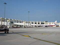
.jpg)
 Looking north from near the clocktower along Jalan Temenggong in Kota Bharu
_(14781748671).jpg) Palace of the Sultan of Kelantan, 1912.
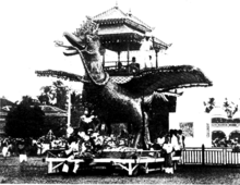
Palace of the Sultan of Kelantan, 1912. 1941 photo of a decoy Lockheed Hudson aircraft at RAF Kota Bharu
 Bachok Beach
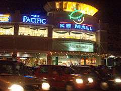 KB Mall
International relations
References
- primuscoreadmin (13 November 2015). "Latar Belakang".
- "TABURAN PENDUDUK MENGIKUT PBT & MUKIM 2010". Department of Statistics, Malaysia. Retrieved 15 December 2017.
- "Kota Bharu Municipal Council official website". Retrieved 20 May 2016.
- "Pusat Internet 1 Malaysia". Archived from the original on 24 June 2016. Retrieved 20 May 2016.
- "The Historical Development of the Malay Peninsula Economic And Malay Society Economic Nature Pre-Colonial Era" (PDF). International Journal of the Malay World and Civilisation. 2015. Retrieved 20 May 2016.
- "Malaysian Armed Forces Official Website". Archived from the original on 20 January 2007. Retrieved 4 February 2007.
- "MPKB:Cover up of else". The Star. 5 December 2006.
- "CLIMAT summary for 48615: Kota Bharu (Malaysia) – Section 2: Monthly Normals". CLIMAT monthly weather summaries. Ogimet. Retrieved 20 January 2019.
- "Kota Bharu Climate Normals 1961–1990". National Oceanic and Atmospheric Administration. Retrieved 1 June 2015.
- "Klimatafel von Kota Bharu / Malaysia" (PDF). Baseline climate means (1961–1990) from stations all over the world (in German). Deutscher Wetterdienst. Archived from the original (PDF) on 29 September 2019. Retrieved 29 September 2019.
- "Grab Now Provides the Widest Rides Network in Malaysia with its Expansion into Four New Cities - Grab MY". 20 April 2017. Archived from the original on 19 October 2017. Retrieved 29 May 2017.
- "Secondary Schools in Kelantan, Malaysia". 2007. Retrieved 10 December 2007.
- "GCH Retail to upgrade Giant hypermarkets". www.thesundaily.my.
- "A giant among men". 15 August 2015.
- "友好握手都市<コタバル市(マレーシア)/モービィロンガコミューン(スウェーデン)>" (in Japanese). Kasaoka City. 1 March 2011. Archived from the original on 21 December 2015. Retrieved 21 December 2015.
External links
| Wikimedia Commons has media related to Kota Bharu District. |
- Official website

- Daily life in Kota Bahru on YouTube
- Kelantan at Tourism Malaysia
Places adjacent to Kota Bharu | ||||||||||
|---|---|---|---|---|---|---|---|---|---|---|
| ||||||||||
Capital: Kota Bharu | |||||||
| Topics |
| ||||||
| Society |
| ||||||
| Administrative divisions |
| ||||||
| |||||||