Kita-ku, Sapporo
Kita-ku (北区, lit. "north ward") is a ward of Sapporo composed of residential neighborhoods mostly arranged in grid patterns, and each built surrounding a train station, broken up by areas of farmland and some light-industrial areas. With 260,000 people, it is the most populated ward in Sapporo.
Kita 北区 | |
|---|---|
| Kita Ward | |
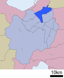 Location of Kita-ku in Sapporo | |
| Country | Japan |
| Prefecture | Hokkaidō |
| City | Sapporo |
| Established | April 1, 1972 |
| Area | |
| • Total | 63.57 km2 (24.54 sq mi) |
| Population (2014)[2] | |
| • Total | 282,427 |
| Estimation as of December 31, 2014 | |
| Time zone | UTC+9 (Japan Standard Time) |
| Postal | 001-8612 |
| Address | 6-1-1 Kita Nijuyonjyo, Kita-ku, Sapporo-shi, Hokkaido |
| Telephone | +81 11-757-2400 |
| Website | Kita Ward Office |

Geography
Kita-ku is located in the northern part of Sapporo. The southern end of the ward is more built up, essentially a continuation of the adjoining Chūō-ku ("central ward," downtown Sapporo). Ishikari River runs through and borders the northern part of Kita-ku.
Kita-ku is subject to a colder, windier climate than the rest of Sapporo, and as one rides the JR line through towards Ainosato (the north-easternmost part of Sapporo) in winter, one can watch the intensity of the snows increase.
Education
University
Private
- Fuji Women's University
- Health Sciences University of Hokkaido, Sapporo Ainosato Campus
High schools
Public
- Hokkaido Sapporo Kita High School
- Hokkaido Sapporo Hokuryo High School
- Hokkaido Sapporo Eiai High School
- Hokkaido Sapporo Technical High School
- Hokkaido Sapporo Intercultural and Technological High School
- Hokkaido Yuho High School
- Hokkaido Sapporo Shinkawa High School (city)
Private
- Sapporo Sosei High School
- Fuji High School
References
- Kita Ward Office
- City of Sapporo statistics Archived 2009-09-03 at the Wayback Machine
External links
- Kita-ku word office (in Japanese)
| Wikimedia Commons has media related to Kita-ku, Sapporo. |
Sapporo (capital) | ||||||||||
| ||||||||||
| ||||||||||
| ||||||||||
| ||||||||||
| ||||||||||
| ||||||||||
| ||||||||||
| ||||||||||
| ||||||||||
| ||||||||||
| ||||||||||
| ||||||||||
| ||||||||||
| ||||||||||
| Authority control |
|
|---|