Kahramankazan
Kahramankazan (previously named Kazan) is a town and district of the Ankara Province in the Central Anatolia region of Turkey, standing on the plain of Akıncı to the north west of the city of Ankara. According to 2010 census, population of the district is 39,537 of which 37,718 live in the town of Kahramankazan.[3][4] The district covers an area of 408 km2 (158 sq mi),[5] and the average elevation is 890 m (2,920 ft).
Kahramankazan | |
|---|---|
District | |
.jpg) | |
 Location of Kahramankazan, Ankara within Turkey. | |
 Kahramankazan Location of Kahramankazan, Ankara within Turkey. | |
| Coordinates: 40°14′N 32°41′E | |
| Country | |
| Region | Central Anatolia |
| Province | Ankara |
| Government | |
| • Governor | Özlem Bozkurt Gevrek |
| • Mayor | Lokman Ertürk (AKP) |
| Area | |
| • District | 407.83 km2 (157.46 sq mi) |
| Elevation | 890 m (2,920 ft) |
| Population (2012)[2] | |
| • Urban | 41,442 |
| • District | 43,308 |
| • District density | 110/km2 (280/sq mi) |
| Time zone | UTC+2 (EET) |
| • Summer (DST) | UTC+3 (EEST) |
| Postal code | 06980 |
| Area code(s) | 0312 |
| Licence plate | 06 |
| Website | Governorship Website Municipality Website |
History
Archaeological research reveals the plain has a long past, going back to prehistoric times, and findings during the excavation of the Bitik Höyük mound date back to the copper age.[6]
Kahramankazan today
Today the area is a popular weekend retreat for the people of Ankara. Kahramankazan is a busy small town. Industry in the city includes a brewery and a cement factory.
Opened in November 2011, the Turkish Satellite Assembly, Integration and Test Center (UMET), is situated in the Fethiye neighborhood of the city.
A large trona ore deposit, which lays 600 m (2,000 ft) underground, is mined and processed by Kazan Soda Elektrik of Ciner Holding in the city.[7]
Administrative divisions
Neighborhoods
Notes
- "Area of regions (including lakes), km²". Regional Statistics Database. Turkish Statistical Institute. 2002. Retrieved 2013-03-05.
- "Population of province/district centers and towns/villages by districts - 2012". Address Based Population Registration System (ABPRS) Database. Turkish Statistical Institute. Retrieved 2013-02-27.
- Statistical Institute
- GeoHive. "Statistical information on Turkey's administrative units". Archived from the original on 2007-10-19. Retrieved 2008-03-31.
- Statoids. "Statistical information on districts of Turkey". Retrieved 2008-05-03.
- "Archived copy". Archived from the original on 2016-03-04. Retrieved 2015-10-31.CS1 maint: archived copy as title (link)
- "Kazan Soda Elektrik" (in Turkish). Ciner Grup. Retrieved 2018-01-17.
References
- Falling Rain Genomics, Inc. "Geographical information on Kazan, Turkey". Retrieved 2008-03-31.
- Kenthaber.com. "General information on Kazan, Ankara" (in Turkish). Archived from the original on 2011-07-19. Retrieved 2008-03-31.
External links
- Kahramankazan Governorship's website (in Turkish)
- District municipality's official website (in Turkish)
- A scientific paper on the etymology of the name Kazan
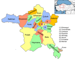
Kahramankazan in Ankara Province of Turkey | |||||||||||||||||||||||||||
|---|---|---|---|---|---|---|---|---|---|---|---|---|---|---|---|---|---|---|---|---|---|---|---|---|---|---|---|
| Districts | Districts of Ankara | ||||||||||||||||||||||||||
| |||||||||||||||||||||||||||
Metropolitan municipalities are bolded. | |||||||||||||||||||||||||||