Jordan Township, Clearfield County, Pennsylvania
Jordan Township is a township in Clearfield County, Pennsylvania, United States. The population was 461 at the 2010 census.[3]
Jordan Township, Clearfield County, Pennsylvania | |
|---|---|
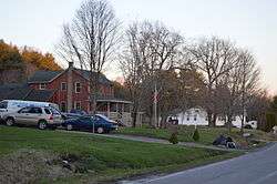 Irvona Road in Berwinsdale | |
Map of Clearfield County, Pennsylvania highlighting Jordan Township | |
Map of Clearfield County, Pennsylvania | |
| Country | United States |
| State | Pennsylvania |
| County | Clearfield |
| Settled | 1819 |
| Incorporated | 1835 |
| Area | |
| • Total | 23.35 sq mi (60.47 km2) |
| • Land | 23.26 sq mi (60.25 km2) |
| • Water | 0.09 sq mi (0.23 km2) |
| Population (2010) | |
| • Total | 461 |
| • Estimate (2018)[2] | 447 |
| • Density | 19.77/sq mi (7.64/km2) |
| Time zone | UTC-5 (Eastern (EST)) |
| • Summer (DST) | UTC-4 (EDT) |
| Area code(s) | 814 |
| FIPS code | 42-033-38432 |
Geography
According to the United States Census Bureau, the township has a total area of 24.2 square miles (63 km2), of which, 24.2 square miles (63 km2) of it is land and 0.04 square miles (0.10 km2) of it (0.08%) is water.
Communities
- Ansonville
- Berwinsdale
- Bretonville
- McCartney
- Morgans Land
Demographics
| Historical population | |||
|---|---|---|---|
| Census | Pop. | %± | |
| 2000 | 543 | — | |
| 2010 | 461 | −15.1% | |
| Est. 2018 | 447 | [2] | −3.0% |
| U.S. Decennial Census[4] | |||
At the 2000 census there were 543 people, 198 households, and 152 families living in the township. The population density was 22.4 people per square mile (8.7/km²). There were 259 housing units at an average density of 10.7/sq mi (4.1/km²). The racial makeup of the township was 99.82% White and 0.18% African American.[5] There were 198 households, 35.4% had children under the age of 18 living with them, 63.6% were married couples living together, 8.6% had a female householder with no husband present, and 23.2% were non-families. 20.2% of households were made up of individuals, and 10.6% were one person aged 65 or older. The average household size was 2.74 and the average family size was 3.16.
The age distribution was 25.4% under the age of 18, 9.2% from 18 to 24, 30.2% from 25 to 44, 22.1% from 45 to 64, and 13.1% 65 or older. The median age was 36 years. For every 100 females, there were 104.1 males. For every 100 females age 18 and over, there were 100.5 males.
The median household income was $29,375 and the median family income was $32,667. Males had a median income of $28,125 versus $18,500 for females. The per capita income for the township was $12,600. About 12.2% of families and 16.2% of the population were below the poverty line, including 19.4% of those under age 18 and 9.0% of those age 65 or over.
School districts
Moshannon Valley School District
References
- "2016 U.S. Gazetteer Files". United States Census Bureau. Retrieved Aug 13, 2017.
- Bureau, U. S. Census. "U.S. Census website". United States Census Bureau. US Census Bureau. Retrieved 30 November 2019.
- "2010 U.S. Census website". United States Census Bureau. Retrieved 2016-02-13.
- "Census of Population and Housing". Census.gov. Retrieved June 4, 2016.
- "U.S. Census website". United States Census Bureau. Retrieved 2008-01-31.
External links
Municipalities and communities of Clearfield County, Pennsylvania, United States | ||
|---|---|---|
| City | ||
| Boroughs | ||
| Townships | ||
| CDPs | ||
| Unincorporated communities | ||
| Footnotes | ‡This populated place also has portions in an adjacent county or counties | |