Burnside Township, Clearfield County, Pennsylvania
Burnside Township is a township in Clearfield County, Pennsylvania, United States. The population was 1,076 at the 2010 census.[3]
Burnside Township, Clearfield County, Pennsylvania | |
|---|---|
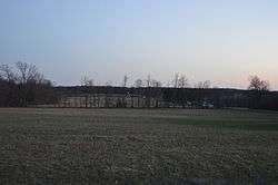 Countryside west of Westover at dusk | |
Map of Clearfield County, Pennsylvania highlighting Burnside Township | |
Map of Clearfield County, Pennsylvania | |
| Country | United States |
| State | Pennsylvania |
| County | Clearfield |
| Settled | 1816 |
| Incorporated | 1835 |
| Area | |
| • Total | 44.22 sq mi (114.54 km2) |
| • Land | 44.00 sq mi (113.96 km2) |
| • Water | 0.22 sq mi (0.57 km2) |
| Population (2010) | |
| • Total | 1,076 |
| • Estimate (2018)[2] | 1,045 |
| • Density | 23.95/sq mi (9.25/km2) |
| Time zone | UTC-5 (Eastern (EST)) |
| • Summer (DST) | UTC-4 (EDT) |
| Area code(s) | 814 |
| FIPS code | 42-033-10288 |
Geography
According to the United States Census Bureau, the township has a total area of 44.3 square miles (115 km2), all of it land.
Communities
- Harmony
- Patchinville
- Stifflertown
Demographics
| Historical population | |||
|---|---|---|---|
| Census | Pop. | %± | |
| 1970 | 1,020 | — | |
| 1980 | 1,246 | 22.2% | |
| 1990 | 1,137 | −8.7% | |
| 2000 | 1,128 | −0.8% | |
| 2010 | 1,076 | −4.6% | |
| Est. 2018 | 1,045 | [2] | −2.9% |
| U.S. Decennial Census[4] | |||
At the 2000 census there were 1,128 people in 424 households, including 331 families, in the township. The population density was 25.5 people per square mile (9.8/km²). There were 530 housing units at an average density of 12.0/sq mi (4.6/km²). The racial makeup of the township was 99.29% White, 0.18% Native American, 0.09% Asian, and 0.44% from two or more races. Hispanic or Latino of any race were 0.44%.[5]
There were 424 households, 29.7% had children under the age of 18 living with them, 66.7% were married couples living together, 7.5% had a female householder with no husband present, and 21.9% were non-families. 18.6% of households were made up of individuals, and 11.1% were one person aged 65 or older. The average household size was 2.64 and the average family size was 3.02.
The age distribution was 23.1% under the age of 18, 7.0% from 18 to 24, 28.1% from 25 to 44, 24.6% from 45 to 64, and 17.2% 65 or older. The median age was 40 years. For every 100 females there were 100.4 males. For every 100 females age 18 and over, there were 97.9 males.
The median household income was $31,302 and the median family income was $33,882. Males had a median income of $26,050 versus $17,917 for females. The per capita income for the township was $15,005. About 14.6% of families and 17.7% of the population were below the poverty line, including 22.4% of those under age 18 and 13.0% of those age 65 or over.
School Districts
Harmony Area School District
References
- "2016 U.S. Gazetteer Files". United States Census Bureau. Retrieved Aug 13, 2017.
- Bureau, U. S. Census. "U.S. Census website". United States Census Bureau. US Census Bureau. Retrieved 30 November 2019.
- "2010 U.S. Census website". United States Census Bureau. Retrieved 2015-05-25.
- "Census of Population and Housing". Census.gov. Retrieved June 4, 2016.
- "U.S. Census website". United States Census Bureau. Retrieved 2008-01-31.
Municipalities and communities of Clearfield County, Pennsylvania, United States | ||
|---|---|---|
| City | ||
| Boroughs | ||
| Townships | ||
| CDPs | ||
| Unincorporated communities | ||
| Footnotes | ‡This populated place also has portions in an adjacent county or counties | |