Jackson County, Ohio
Jackson County is a county located in the U.S. state of Ohio. As of the 2010 census, the population was 33,225.[2] Its county seat is Jackson.[3] The county is named for Andrew Jackson, a hero of the War of 1812 who was subsequently elected President of the United States.[4] It is known as "The Little Wales of Ohio."[5]
Jackson County | |
|---|---|
 Jackson County Courthouse | |
 Seal | |
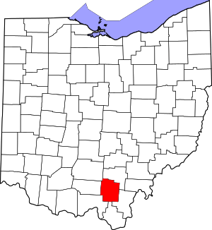 Location within the U.S. state of Ohio | |
 Ohio's location within the U.S. | |
| Coordinates: 39°01′N 82°37′W | |
| Country | |
| State | |
| Founded | March 1, 1816[1] |
| Named for | Andrew Jackson |
| Seat | Jackson |
| Largest city | Jackson |
| Area | |
| • Total | 422 sq mi (1,090 km2) |
| • Land | 420 sq mi (1,100 km2) |
| • Water | 1.2 sq mi (3 km2) 0.3%% |
| Population | |
| • Estimate (2019) | 32,413 |
| • Density | 79/sq mi (31/km2) |
| Time zone | UTC−5 (Eastern) |
| • Summer (DST) | UTC−4 (EDT) |
| Congressional district | 6th |
| Website | www |
Jackson County comprises the Jackson, OH Micropolitan Statistical Area.
Geography
According to the U.S. Census Bureau, the county has a total area of 422 square miles (1,090 km2), of which 420 square miles (1,100 km2) is land and 1.2 square miles (3.1 km2) (0.3%) is water.[6]
Adjacent counties
- Vinton County (north)
- Gallia County (east)
- Lawrence County (south)
- Scioto County (southwest)
- Pike County (west)
- Ross County (northwest)
National protected areas
- Wayne National Forest (part)
- Liberty Wildlife Area
Demographics
| Historical population | |||
|---|---|---|---|
| Census | Pop. | %± | |
| 1820 | 3,746 | — | |
| 1830 | 5,941 | 58.6% | |
| 1840 | 9,744 | 64.0% | |
| 1850 | 12,719 | 30.5% | |
| 1860 | 17,941 | 41.1% | |
| 1870 | 21,759 | 21.3% | |
| 1880 | 23,686 | 8.9% | |
| 1890 | 28,408 | 19.9% | |
| 1900 | 34,248 | 20.6% | |
| 1910 | 30,791 | −10.1% | |
| 1920 | 27,342 | −11.2% | |
| 1930 | 25,040 | −8.4% | |
| 1940 | 27,004 | 7.8% | |
| 1950 | 27,767 | 2.8% | |
| 1960 | 29,372 | 5.8% | |
| 1970 | 27,174 | −7.5% | |
| 1980 | 30,592 | 12.6% | |
| 1990 | 30,230 | −1.2% | |
| 2000 | 32,641 | 8.0% | |
| 2010 | 33,225 | 1.8% | |
| Est. 2019 | 32,413 | [7] | −2.4% |
| U.S. Decennial Census[8] 1790-1960[9] 1900-1990[10] 1990-2000[11] 2010-2019[2] | |||
2000 census
As of the census[12] of 2000, there were 32,641 people, 12,619 households, and 9,136 families living in the county. The population density was 78 people per square mile (30/km²). There were 13,909 housing units at an average density of 33 per square mile (13/km²). The racial makeup of the county was 97.89% White, 0.59% Black or African American, 0.34% Native American, 0.17% Asian, 0.02% Pacific Islander, 0.16% from other races, and 0.82% from two or more races. 0.60% of the population were Hispanic or Latino of any race. In 2010 16.5% were of German, 12.9% American, 11.3% Irish, 10.4% English, 5.2% Welsh, 2.4% Scottish, and 1.6% Ulster Scot.
There were 12,619 households out of which 34.5% had children under the age of 18 living with them, 55.4% were married couples living together, 12.0% had a female householder with no husband present, and 27.6% were non-families. 24.0% of all households were made up of individuals and 10.5% had someone living alone who was 65 years of age or older. The average household size was 2.55 and the average family size was 3.00.
In the county, the population was spread out with 26.0% under the age of 18, 8.7% from 18 to 24, 28.7% from 25 to 44, 23.0% from 45 to 64, and 13.6% who were 65 years of age or older. The median age was 36 years. For every 100 females there were 93.2 males. For every 100 females age 18 and over, there were 89.9 males.
The median income for a household in the county was $30,661, and the median income for a family was $36,022. Males had a median income of $30,651 versus $21,546 for females. The per capita income for the county was $14,789. About 13.6% of families and 16.5% of the population were below the poverty line, including 20.3% of those under age 18 and 16.1% of those age 65 or over.
2010 census
As of the 2010 United States Census, there were 33,225 people, 13,010 households, and 9,028 families living in the county.[13] The population density was 79.0 inhabitants per square mile (30.5/km2). There were 14,587 housing units at an average density of 34.7 per square mile (13.4/km2).[14] The racial makeup of the county was 97.1% white, 0.6% black or African American, 0.4% American Indian, 0.3% Asian, 0.2% from other races, and 1.4% from two or more races. Those of Hispanic or Latino origin made up 0.8% of the population.[13] In terms of ancestry, 16.1% were German, 12.3% were American, 11.6% were Irish, 10.6% were English and 4.4% were Welsh.[15]
Of the 13,010 households, 33.9% had children under the age of 18 living with them, 50.9% were married couples living together, 12.7% had a female householder with no husband present, 30.6% were non-families, and 25.9% of all households were made up of individuals. The average household size was 2.53 and the average family size was 3.01. The median age was 39.0 years.[13]
The median income for a household in the county was $34,044 and the median income for a family was $42,560. Males had a median income of $36,910 versus $28,618 for females. The per capita income for the county was $18,775. About 18.1% of families and 23.3% of the population were below the poverty line, including 36.5% of those under age 18 and 11.5% of those age 65 or over.[16]
Politics
Jackson County is a Republican stronghold in presidential elections, it has only voted for the Democratic candidate 5 times since 1856.
| Year | Republican | Democratic | Third parties |
|---|---|---|---|
| 2016 | 72.2% 9,949 | 23.4% 3,226 | 4.4% 601 |
| 2012 | 59.0% 7,904 | 38.5% 5,166 | 2.5% 334 |
| 2008 | 58.5% 8,219 | 38.4% 5,397 | 3.1% 431 |
| 2004 | 59.9% 8,585 | 39.8% 5,700 | 0.3% 49 |
| 2000 | 55.7% 6,958 | 41.1% 5,131 | 3.2% 401 |
| 1996 | 40.7% 4,922 | 45.8% 5,538 | 13.5% 1,635 |
| 1992 | 42.1% 5,422 | 38.9% 5,016 | 19.0% 2,445 |
| 1988 | 59.2% 6,671 | 40.0% 4,505 | 0.8% 91 |
| 1984 | 62.2% 7,411 | 36.7% 4,369 | 1.1% 128 |
| 1980 | 55.1% 5,902 | 41.1% 4,409 | 3.8% 408 |
| 1976 | 46.7% 5,987 | 52.3% 6,699 | 1.1% 136 |
| 1972 | 67.3% 7,351 | 31.2% 3,410 | 1.5% 162 |
| 1968 | 53.5% 5,870 | 36.7% 4,021 | 9.8% 1,077 |
| 1964 | 41.2% 4,949 | 58.8% 7,056 | |
| 1960 | 59.0% 7,973 | 41.0% 5,549 | |
| 1956 | 64.7% 8,106 | 35.4% 4,432 | |
| 1952 | 59.2% 7,223 | 40.8% 4,983 | |
| 1948 | 53.2% 5,782 | 46.5% 5,059 | 0.3% 33 |
| 1944 | 59.3% 6,786 | 40.7% 4,666 | |
| 1940 | 54.2% 7,551 | 45.8% 6,382 | |
| 1936 | 50.0% 6,853 | 49.7% 6,802 | 0.3% 39 |
| 1932 | 55.1% 6,932 | 44.0% 5,543 | 0.9% 115 |
| 1928 | 71.4% 7,129 | 27.8% 2,775 | 0.8% 81 |
| 1924 | 61.5% 5,977 | 29.3% 2,848 | 9.3% 902 |
| 1920 | 54.4% 5,949 | 44.6% 4,878 | 0.9% 102 |
| 1916 | 50.2% 3,116 | 47.1% 2,922 | 2.7% 165 |
| 1912 | 30.1% 1,860 | 33.1% 2,049 | 36.8% 2,278[18] |
| 1908 | 55.8% 4,489 | 40.2% 3,235 | 3.9% 315 |
| 1904 | 69.1% 5,353 | 26.8% 2,072 | 4.1% 319 |
| 1900 | 58.9% 4,932 | 39.6% 3,313 | 1.6% 130 |
| 1896 | 53.5% 4,439 | 45.6% 3,786 | 1.0% 79 |
| 1892 | 51.4% 3,323 | 40.5% 2,622 | 8.1% 525 |
| 1888 | 53.7% 3,570 | 39.5% 2,628 | 6.8% 454 |
| 1884 | 56.0% 3,427 | 42.1% 2,575 | 2.0% 121 |
| 1880 | 57.0% 2,763 | 41.9% 2,031 | 1.0% 50 |
| 1876 | 56.2% 2,522 | 43.6% 1,954 | 0.2% 8 |
| 1872 | 58.8% 2,258 | 40.5% 1,555 | 0.7% 25 |
| 1868 | 56.3% 2,083 | 43.6% 1,612 | |
| 1864 | 59.7% 1,957 | 40.2% 1,317 | |
| 1860 | 53.1% 1,738 | 43.9% 1,436 | 2.9% 95 |
| 1856 | 34.2% 938 | 50.5% 1,383 | 15.2% 416 |
Government
Jackson County has a three-member Board of County Commissioners that administers and oversees the various County departments, similar to all but two of the 88 Ohio counties.
Jackson County's elected officials are:
- County Commissioners: Ed Armstrong (R), Jon Hensler (R), and Paul Haller (R)
- County Auditor: Tiffany Ridgeway (R)
- Clerk Of Courts: Seth Michael (R)
- Common Pleas Court: Judge Honorable Christopher Regan (R)
- County Coroner: Dr. Alice Frazier (R)
- County Engineer: Melissa Miller, P.E., P.S. (R)
- Juvenile Court: Judge Honorable Stephen Michael (R)
- Municipal Court: Judge Honorable Mark T. Musick (D)
- Probate Court: Judge Honorable Stephen Michael (R)
- Prosecuting Attorney: Justin Lovett (R)
- County Recorder: Rose Cherrington Walters (R)
- County Sheriff: Tedd Frazier (R)
- County Treasurer: B. Lee Hubbard, CPA (R)
Communities

Unincorporated communities
- Altoona
- Banner
- Big Rock
- Blackfork Junction
- Brocks Corner
- Buckeye
- Buffalo
- Byer
- Camba
- Chapman
- Clay
- Comet
- Davisville
- Englishville
- Four Mile
- Garfield
- Glade
- Glen Nell
- Glen Roy
- Goldsboro
- Horeb
- Ironton Junction
- Jackson Heights
- Jonestown
- Keystone
- Kitchen
- Leo
- Lesmil
- Limerick
- Mabee Corner
- Monroe
- Mulga
- Oakland
- Orpheus
- Pattonsville
- Petersburg
- Petrea
- Pyro
- Ratchford
- Rempel
- Roads
- Rocky Hill
- Savageville
- Tom Corwin
- Wainwright
- Winchester
- Vega
See also
References
- "Ohio County Profiles: Jackson County" (PDF). Ohio Department of Development. Archived from the original (PDF) on 2007-06-21. Retrieved 2007-04-28.
- "State & County QuickFacts". United States Census Bureau. Archived from the original on June 6, 2011. Retrieved February 8, 2015.
- "Find a County". National Association of Counties. Archived from the original on May 31, 2011. Retrieved 2011-06-07.
- Gannett, Henry (1905). The Origin of Certain Place Names in the United States. Govt. Print. Off. pp. 167.
- "Welcome to the Welsh Surname Shop, Celebrating the Surnames and Names of Wales". thewelshsurnameshop.com. Retrieved 10 April 2018.
- "2010 Census Gazetteer Files". United States Census Bureau. August 22, 2012. Archived from the original on May 4, 2014. Retrieved February 8, 2015.
- "Population and Housing Unit Estimates". Retrieved March 26, 2020.
- "U.S. Decennial Census". United States Census Bureau. Retrieved February 8, 2015.
- "Historical Census Browser". University of Virginia Library. Retrieved February 8, 2015.
- Forstall, Richard L., ed. (March 27, 1995). "Population of Counties by Decennial Census: 1900 to 1990". United States Census Bureau. Retrieved February 8, 2015.
- "Census 2000 PHC-T-4. Ranking Tables for Counties: 1990 and 2000" (PDF). United States Census Bureau. April 2, 2001. Retrieved February 8, 2015.
- "U.S. Census website". United States Census Bureau. Retrieved 2008-01-31.
- "DP-1 Profile of General Population and Housing Characteristics: 2010 Demographic Profile Data". United States Census Bureau. Archived from the original on 2020-02-13. Retrieved 2015-12-27.
- "Population, Housing Units, Area, and Density: 2010 - County". United States Census Bureau. Archived from the original on 2020-02-13. Retrieved 2015-12-27.
- "DP02 Selected Social Characteristics in the United States – 2006-2010 American Community Survey 5-Year Estimates". United States Census Bureau. Archived from the original on 2020-02-13. Retrieved 2015-12-27.
- "DP03 Selected Economic Characteristics – 2006-2010 American Community Survey 5-Year Estimates". United States Census Bureau. Archived from the original on 2020-02-13. Retrieved 2015-12-27.
- Leip, David. "Dave Leip's Atlas of U.S. Presidential Elections". uselectionatlas.org. Retrieved 10 April 2018.
- The leading "other" candidate, Progressive Theodore Roosevelt, received 1,584 votes, while Socialist candidate Eugene Debs received 612 votes, Prohibition candidate Eugene Chafin received 53 votes, and Socialist Labor candidate Arthur Reimer received 29 votes.
External links
- County website
- Jackson Area Chamber of Commerce
- Jackson County Emergency Management Agency
- Jackson County Geographic Information System
- Jackson County Sheriff's Office
- History of Jackson County, Ohio
- Buckeye Furnace - reconstructed charcoal-fired iron blast furnace with original stack
Places adjacent to Jackson County, Ohio | ||||||||||
|---|---|---|---|---|---|---|---|---|---|---|
| ||||||||||
Municipalities and communities of Jackson County, Ohio, United States | ||
|---|---|---|
| Cities | Map of Ohio highlighting Jackson County | |
| Villages | ||
| Townships | ||
| Unincorporated communities |
| |
.svg.png)
| Authority control |
|
|---|