Interstate 205 (Oregon–Washington)
Interstate 205 (I-205) is an auxiliary Interstate Highway in the Portland–Vancouver metropolitan area in the U.S. states of Oregon and Washington. It serves as a bypass route of I-5 that travels north–south along the east side of both cities and their suburbs, intersecting several major highways and serving the Portland International Airport.
| |||||||||
|---|---|---|---|---|---|---|---|---|---|
%26groups%3D_1502c3013c6befb562b4eef4c20f4c1c6985d180.svg)
I-205 highlighted in red | |||||||||
| Route information | |||||||||
| Auxiliary route of I-5 | |||||||||
| Length | 37.13 mi[1][2] (59.75 km) | ||||||||
| Existed | 1975–present | ||||||||
| Major junctions | |||||||||
| South end | |||||||||
| |||||||||
| North end | |||||||||
| Location | |||||||||
| States | Oregon, Washington | ||||||||
| Counties | OR: Washington, Clackamas, Multnomah WA: Clark | ||||||||
| Highway system | |||||||||
| |||||||||

The southern terminus is in the Portland suburb of Tualatin and the northern terminus of the highway is located in the suburb of Salmon Creek, north of Vancouver. I-205 is officially named the War Veterans Memorial Freeway in both states, and is known as the East Portland Freeway No. 64 in Oregon (see Oregon highways and routes).
Route description

I-205 starts in Tualatin, Oregon, at a semi-directional T interchange with I-5.[3] From I-5, the highway heads east towards the towns of West Linn and Oregon City where it crosses the Willamette River between interchanges for Oregon Route 43 (OR 43) and OR 99E. In West Linn, there is a view point exit for the northbound lanes, providing a scenic overlook of Willamette Falls. In Oregon City, the highway curves northward, crossing the Clackamas River concurrent with OR 213 and entering the town of Gladstone.[4]
OR 213 splits from I-205 again at exit 13 in Clackamas, and the next exit north on I-205 provides access to Sunnyside Road and Clackamas Town Center.[5] North of Clackamas, the freeway crosses the Portland city limits, passing through the eastern portion of the city, where it intersects I-84 and U.S. Route 26 (US 26).[6] On the northern side of the city, just before crossing the Columbia River on the Glenn Jackson Bridge, I-205 has an exit for Airport Way, which provides access to Portland International Airport.[7]
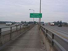
On the Washington side of the river, I-205 serves the eastern parts of the city of Vancouver, and has interchanges with two freeways, State Route 14 (SR 14) just north of the Columbia, and SR 500 near Vancouver Mall.[7][8] From the SR 500 interchange, I-205 curves northwest back towards I-5, where it ends in the town of Salmon Creek. This interchange with I-5 is not complete, as there is no direct access from I-5 northbound to I-205 southbound, or from I-205 northbound to I-5 southbound. These missing movements are completed via Northeast 134th Street, one exit to the south.[9]
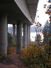
A bicycle and pedestrian trail follows I-205 for much of its distance in the Portland metropolitan area, and connects to the Springwater Corridor trail near the Foster Road exit.
History
The final section of I-205 to be completed, the section between SE Division Street and the southern interchange of the Glenn Jackson Bridge over the Columbia River, opened to traffic in March 1983.[10] The approximately 10-mile (16 km) section on the Washington side of the river had opened in summer 1982,[10] and the bridge opened in December 1982.[11]
Construction of I-205 included a graded but unfinished transitway between SE Foster Road and NE Columbia Boulevard. The section between NE Columbia Boulevard and the I-205/I-84 junction became part of the MAX Red Line, and the section from E Burnside Street to SE Foster Road is used as part of the Green Line. The short portion between these sections was used by the first rail line, now known as the Blue Line.
Bike path
The Interstate 205 Bike Path is a bicycle and pedestrian trail running along Interstate 205 from Vancouver, Washington to Oregon City, Oregon, United States. It parallels the highway and the I-205 Transitway. It has a paved surface.[12] It was constructed in the early 1980s, and is over 11 miles (18 km) long, running from SE 23rd Street (east of Ellsworth Road and north of the Evergreen Highway) on the Vancouver side of the Columbia River to a mile south of Clackamas Town Center.[13] The multi-use path is managed by the Oregon Department of Transportation.
The MAX Green Line, which opened in fall 2009, parallels much of the Interstate 205 Bike Path.
Future
Due to the tremendous growth in the Portland metropolitan area and the suburb of Vancouver, the Washington and Oregon departments of transportation (WSDOT, ODOT) are currently planning improvements on I-205 to improve traffic flow between the two states. In Vancouver, WSDOT and Clark County's Regional Transportation Commission are planning several new ramps to new arterials, grade-separating existing ramps with new ramps, and additional lanes. In Portland, ODOT is beginning to plan improvements, but no details have been released yet.
Another solution being floated around is a light rail line serving most or all the entire I-205 corridor, though the plan is being met with opposition from Clark County residents. Additionally, statements have been made by the Columbia River Crossing group that the Glenn Jackson Bridge was not properly engineered to carry light rail.
Exit list
| State | County | Location[1] | mi[1][2] | km | Exit | Destinations | Notes |
|---|---|---|---|---|---|---|---|
| Oregon | Washington | Tualatin | 0.00 | 0.00 | Southern terminus | ||
| Clackamas | | 3.16 | 5.09 | 3 | Stafford Road – Lake Oswego | ||
| West Linn | 6.40 | 10.30 | 6 | 10th Street | |||
| 8.82 | 14.19 | 8 | Bicycles permitted southbound and prohibited northbound | ||||
| Willamette River | 9.13 | 14.69 | |||||
| Oregon City | 9.29 | 14.95 | 9 | ||||
| 10.24 | 16.48 | 10 | Southern end of OR 213 concurrency | ||||
| Gladstone | 11.05 | 17.78 | 11 | Gladstone | |||
| | 12.67 | 20.39 | 12 | Northbound signage | |||
| 12A | Southbound signage | ||||||
| 12B | Roots Road – Johnson City | ||||||
| | 13.11– 13.32 | 21.10– 21.44 | 13 | Northbound signage; northern end of OR 213 concurrency | |||
| Southbound signage | |||||||
| | 13.95– 14.53 | 22.45– 23.38 | 14 | Sunnybrook Boulevard / Sunnyside Road | |||
| | 16.24 | 26.14 | 16 | Johnson Creek Boulevard | |||
| Multnomah | Portland | 17.85 | 28.73 | 17 | Foster Road | ||
| 18.89– 19.60 | 30.40– 31.54 | 19 | |||||
| 20.33– 21.23 | 32.72– 34.17 | 20 | Washington Street / Stark Street | Northbound signage | |||
| 21A | Glisan Street | ||||||
| Glisan Street / Stark Street | Southbound signage | ||||||
| 20.99– 21.39 | 33.78– 34.42 | 21B | Formerly I-80N | ||||
| 22.22– 22.61 | 35.76– 36.39 | 22 | Formerly I-80N | ||||
| 23.68 | 38.11 | 23A | |||||
| 23B | |||||||
| 24.65 | 39.67 | 24 | Signed as exits 24A (west) and 24B (east) northbound | ||||
| Columbia River | 26.56 | 42.74 | Glenn L. Jackson Memorial Bridge; Oregon–Washington state line | ||||
| Washington | Clark | Vancouver | 27.06 | 43.55 | 27 | Bicycles permitted northbound and prohibited southbound (must connect to bike path via | |
| 28.30 | 45.54 | 28 | Mill Plain Boulevard | Signed as exits 28A (east) and 28B (west) northbound | |||
| 28C | Northeast 112th Avenue | Northbound exit only | |||||
| 29.31 | 47.17 | 29 | Northeast 18th Street | Northbound exit and southbound entrance | |||
| 30.87 | 49.68 | 30A | Northeast Gher Road / Northeast 112th Avenue | Southbound exit is via exit 30. | |||
| 30 | Signed as exits 30B (east) and 30C (west) northbound | ||||||
| 31.08 | 50.02 | Vancouver Mall (Fourth Plain Boulevard) | No northbound exit | ||||
| 33.01 | 53.12 | 32 | Padden Parkway / Northeast Andresen Road – Battle Ground | ||||
| | 36.72 | 59.10 | 36 | Northeast 134th Street – WSU Vancouver | |||
| | 37.13 | 59.75 | Northern terminus; northbound exit and southbound entrance | ||||
1.000 mi = 1.609 km; 1.000 km = 0.621 mi
| |||||||
References
- Road Inventory and Classification Services Unit. "Straightline Charts". Transportation Development Division, Oregon Department of Transportation. Retrieved September 25, 2016.
- East Portland Freeway Highway No. 64 (April 2014)
- Staff (2006). "State Highway Log" (PDF). Washington State Department of Transportation. Archived from the original (PDF) on June 16, 2010. Retrieved August 15, 2011.
- Portland Street Guide (Map) (32nd ed.). Rand McNally. 2010. p. 685. § F5. ISBN 978-0-528-87450-5.
- Portland Street Guide (Map) (32nd ed.). Rand McNally. 2010. p. 687. § C6, F2. ISBN 978-0-528-87450-5.
- Portland Street Guide (Map) (32nd ed.). Rand McNally. 2010. p. 657. § F6, G4. ISBN 978-0-528-87450-5.
- Portland Street Guide (Map) (32nd ed.). Rand McNally. 2010. pp. 597, 627. ISBN 978-0-528-87450-5.
- Portland Street Guide (Map) (32nd ed.). Rand McNally. 2010. p. 567. ISBN 978-0-528-87450-5.
- Portland Street Guide (Map) (32nd ed.). Rand McNally. 2010. p. 537. § G1. ISBN 978-0-528-87450-5.
- Portland Street Guide (Map) (32nd ed.). Rand McNally. 2010. p. 476. § H6. ISBN 978-0-528-87450-5.
- Federman, Stan (March 6, 1983). "I-205 opening paves way to future". The Sunday Oregonian. p. E2.
- Callister, Scotta (December 16, 1982). "Rain fails to faze bridge-crossers". The Oregonian. p. E12.
- http://www.dbmechanic.com/biking/ViewTrail.asp?TID=103
- "I-205 Bike Path". Retrieved 4 October 2014.