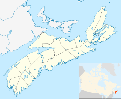
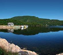
Ingonish
Ingonish is a Canadian rural community in northeastern Victoria County, Nova Scotia.
Overview
Located along the northeast coast of Cape Breton Island, Ingonish is situated on the Cabot Trail approximately 60 kilometres from the shire town of Baddeck. Ingonish consists of five communities:
- Ingonish Ferry
- Ingonish Harbour
- Ingonish Beach
- Ingonish Centre
- Ingonish
Ingonish lies at the eastern entrance to Cape Breton Highlands National Park. The regional economy is tied to the seasonal tourism and fishing industries. The community is in the federal electoral district of Sydney—Victoria. Ingonish was one of the first areas settled on Cape Breton Island, and is home to the Keltic Lodge resort, downhill skiing at Cape Smokey, and a public golf course, the Highlands Links.
History
The origin of the name is uncertain; it may originate from Portuguese fishermen who wintered in the area as early as 1521, or it may be Mi'kmaq.[1] French explorer Nicolas Denys was among the first Europeans to explore the area of present-day Ingonish in the 1600s, and he made note of the area's potential as a base of operations for French fishing fleets. In his book Description Geographique et Historique des Costes de l’Amerique Septentrionale which chronicled his efforts to found colonies in New France, Denys noted the area's harsh coastline, which he described as "extremely high, and, in the event of shipwreck as affording no chance of safety to the unfortunate persons." He wrote additionally: "It is not properly a harbour, but simply an entrance, between some small islands. Ships moor between the isles and the mainland, but they are not in safety. Nevertheless, it is well suited for carrying on fishing." Maps made by Denys of the area have been noted by historians as being woefully inaccurate[2]
By the early 1700s, utmost efforts were being made to establish colonies with fixed populations in present-day Victoria County, and these efforts "received little or no encouragement" according to historian G.G. Patterson, who noted that Ingonish bucked this trend and was in fact "in a flourishing state".[2]
In 1729 a large chapel was erected there, the remains of which were still to be seen as late as 1885. In 1854, local farmers Lawrence Brown and J.W. Burke were plowing a field near the site when then came across the chapel's buried bell. Upon the bell was the following inscription:
Pour la paroisse d’Inganiche jai ete nommee par Jean Decarette et par Francois Uril, parrain et marrain Le Josse Huet de St. Malo m’a faite. L’an 1729.
An 1885 English translation read:
For the parish of Ingonish I have been named by John Decarette and Francis Urail, Godfather and Godmother. The founder Huet made me in the year 1729.
The bell was described as being "nearly as large around as an ordinary flour barrel" and weighed 586 pounds. It was ultimately lost after being sold to a foundry owner in Halifax.[2]
In another part of Ingonish, the remains of a second church were found, a site which included a well containing "sacred vessels" hidden inside. Legends of the day had "unlimited supplies of money" buried in the vicinity of this second church, with the treasure's alleged location being marked by three Balm of Gilead trees. [2]
On the shores of the bay, a small cannon of French origin was found, testament to Ingonish’s early history as a French fishing port. Similar cannons have been located a short distance north at present-day Neil’s Harbour.[2]
According to an official report sent to the Board of Trade in 1749 by Captain Smith, commander of the guard ship at Canso, there were 48 schooners and 393 shallops fishing the grounds off Ingonish. The community's population at that time was estimated to be approximately 300.[2]
Mica was very plentiful and was mined to some extent at Ingonish prior to the late 1800s. A dispute arose over ownership of the land where mining operations were carried out, and production was halted while the courts attempted to settle the matter.[2]
Points of interest
- Highlands Links Golf Course
- Cape Breton Highlands National Park
- Cape Smokey Provincial Park
- Keltic Lodge
- Ski Cape Smokey
Communications
- The Postal Code is B0C 1L0 (Ingonish Ferry, Ingonish Harbour, Ingonish Beach), B0C 1K0 (Ingonish Centre, Ingonish)
- The telephone exchange is 902-285
- Internet - DSL is provided by Bell Aliant
Demographics
- Total Population 1925
- Total Dwellings 652
- Total Land Area 256.185 km²
Climate
Ingonish has a humid continental climate with extremely high precipitation for this climate (annual average precipitation being 69 inches, about the highest anywhere in Canada outside coastal British Columbia). Furthermore, Ingonish experiences its wettest months from November to January, with over 7.3 inches of precipitation each month, much of it falling as snow, while June and July are the driest months, but still averaging over 3.5 inches of precipitation each. Winters are long, cold, snowy and exceptionally stormy. In December and January, snow can fall nearly every day due to sea-effect snow showers which blow in from the unfrozen Gulf of St. Lawrence. Primarily from October to April, Ingonish is also prone to intense nor'easters - mid-latitude cyclones that approach from the U.S. Northeastern and New England states, bringing high winds and heavy precipitation, especially snowfall. As winter progresses, the surrounding waters become covered in ice which delays the onset of spring. Summer arrives quickly though, usually in mid to late June. The cold spring gives way to a beautiful summer, with lots of warm, sunny days. In summer, the weather pattern shifts to a warm southwest flow, and lasts into the fall. These warm southwest winds blow down-slope from the Cape Breton Highlands, drying out and warming as it descends. Although the surrounding water freezes during winter, it warms very quickly through the summer, with sea surface temperatures peaking around 21°C (70°F) in August. The highest temperature ever recorded was 37.7 °C (99.9 °F) on 10 August 2001.[3] The lowest temperature was −28.0 °C (−18.4 °F) on 18 January 1982.[4] Weather data has been recorded at Parks Canada in Ingonish Beach since 1950. In 2000, Environment Canada upgraded the climate station to an automated weather station.
| Climate data for Ingonish Beach, 1981–2010 normals, extremes 1950–present | |||||||||||||
|---|---|---|---|---|---|---|---|---|---|---|---|---|---|
| Month | Jan | Feb | Mar | Apr | May | Jun | Jul | Aug | Sep | Oct | Nov | Dec | Year |
| Record high °C (°F) | 17.5 (63.5) |
19.0 (66.2) |
21.3 (70.3) |
24.0 (75.2) |
31.1 (88.0) |
34.4 (93.9) |
36.0 (96.8) |
37.7 (99.9) |
34.9 (94.8) |
28.5 (83.3) |
25.5 (77.9) |
18.0 (64.4) |
37.7 (99.9) |
| Average high °C (°F) | −0.8 (30.6) |
−1.0 (30.2) |
2.0 (35.6) |
6.5 (43.7) |
13.0 (55.4) |
18.7 (65.7) |
23.3 (73.9) |
23.2 (73.8) |
19.0 (66.2) |
12.7 (54.9) |
7.1 (44.8) |
2.1 (35.8) |
10.5 (50.9) |
| Daily mean °C (°F) | −5 (23) |
−5.4 (22.3) |
−2.0 (28.4) |
2.7 (36.9) |
8.1 (46.6) |
13.6 (56.5) |
18.3 (64.9) |
18.5 (65.3) |
14.5 (58.1) |
8.8 (47.8) |
3.8 (38.8) |
−1.2 (29.8) |
6.2 (43.2) |
| Average low °C (°F) | −9.2 (15.4) |
−9.7 (14.5) |
−6.0 (21.2) |
−1.0 (30.2) |
3.2 (37.8) |
8.4 (47.1) |
13.3 (55.9) |
13.6 (56.5) |
9.9 (49.8) |
4.8 (40.6) |
0.5 (32.9) |
−4.6 (23.7) |
1.9 (35.4) |
| Record low °C (°F) | −28.0 (−18.4) |
−27.5 (−17.5) |
−24.9 (−12.8) |
−15.0 (5.0) |
−7.0 (19.4) |
−1.7 (28.9) |
3.9 (39.0) |
1.0 (33.8) |
−6.7 (19.9) |
−6.5 (20.3) |
−12.5 (9.5) |
−20.0 (−4.0) |
−28.0 (−18.4) |
| Average precipitation mm (inches) | 186.3 (7.33) |
139.7 (5.50) |
153.9 (6.06) |
168.6 (6.64) |
108.9 (4.29) |
90.6 (3.57) |
93.1 (3.67) |
114.2 (4.50) |
143.7 (5.66) |
175.6 (6.91) |
189.7 (7.47) |
188.3 (7.41) |
1,752.7 (69.00) |
| Average rainfall mm (inches) | 79.4 (3.13) |
62.0 (2.44) |
82.3 (3.24) |
132.4 (5.21) |
105.2 (4.14) |
90.6 (3.57) |
93.1 (3.67) |
114.2 (4.50) |
143.7 (5.66) |
175.4 (6.91) |
167.9 (6.61) |
112.4 (4.43) |
1,358.5 (53.48) |
| Average snowfall cm (inches) | 105.6 (41.6) |
77.8 (30.6) |
71.8 (28.3) |
36.1 (14.2) |
3.8 (1.5) |
0.0 (0.0) |
0.0 (0.0) |
0.0 (0.0) |
0.0 (0.0) |
0.2 (0.1) |
21.8 (8.6) |
76.0 (29.9) |
393.1 (154.8) |
| Average precipitation days (≥ 0.2 mm) | 21.9 | 16.0 | 16.4 | 16.5 | 16.3 | 13.2 | 13.1 | 14.3 | 16.4 | 19.9 | 21.9 | 21.4 | 207.1 |
| Average rainy days (≥ 0.2 mm) | 7.2 | 5.0 | 8.0 | 13.5 | 16.2 | 13.2 | 13.1 | 14.3 | 16.4 | 19.9 | 18.2 | 10.0 | 154.7 |
| Average snowy days (≥ 0.2 cm) | 18.2 | 13.0 | 10.8 | 5.0 | 0.45 | 0.0 | 0.0 | 0.0 | 0.0 | 0.16 | 6.1 | 14.2 | 67.7 |
| Mean monthly sunshine hours | 77.5 | 108.1 | 128.5 | 144.8 | 199.6 | 227.1 | 237.6 | 215.7 | 157.9 | 117.6 | 69.0 | 43.3 | 1,726.6 |
| Percent possible sunshine | 27.7 | 37.1 | 34.9 | 35.6 | 42.9 | 48.0 | 49.7 | 49.1 | 41.8 | 34.7 | 24.4 | 16.2 | 36.8 |
| Source: Environment Canada[4][5][6] | |||||||||||||
References
- "The Canadian Encyclopedia: Ingonish". Retrieved 19 January 2020.
- Patterson, G.G. (1885). History of Victoria County. College of Cape Breton Press. ISBN 0-920336-02-7.
- "Daily Data Report for August 2001". Canadian Climate Data. Environment Canada. Retrieved 8 April 2016.
- "Ingonish Beach, Nova Scotia". Canadian Climate Normals 1981–2010. Environment Canada. Retrieved 9 May 2015.
- "Ingonish Beach RCS". Canadian Climate Data. Environment Canada. Retrieved 8 April 2016.
- "Hourly Data Report for September 10, 2001". Canadian Climate Data. Environment Canada. Retrieved 8 April 2016.
External links
| Wikimedia Commons has media related to Ingonish, Nova Scotia. |
- Hike the Highlands Festival
- Northeast Highlands Chamber of Commerce
- Cape Breton Highlands
- Visit Victoria County
- Municipality of Victoria County
- Ingonish Information
| Historical counties | |
|---|---|
| Economic regions | |
| Regional municipalities | |
| County municipalities | |
| District municipalities | |
| Towns | |
| Villages | |
| Lists | |
| |