Indragiri Hilir Regency
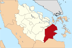
Indragiri Hilir is a regency (kabupaten) of Riau, Indonesia. It is located on the island of Sumatra. The regency has an area of 11,595.97 km² and had a population of 661,779 at the 2010 Census and 703,734 at the 2015 Census; the latest official estimate (as at 1 July 2019) was 717,803.[2] The administrative centre of the regency is the town of Tembilahan.
Indragiri Hilir Regency | |
|---|---|
 Flag Seal | |
| Motto(s): Berlayar sampai ke Pulau, Berjalan sampai ke Batas | |
 | |
| Country | Indonesia |
| Province | Riau |
| Regency seat | Tembilahan |
| Area | |
| • Total | 11,605.97 km2 (4,481.09 sq mi) |
| Population (mid 2019)[1] | |
| • Total | 717,803 |
| • Density | 62/km2 (160/sq mi) |
| Time zone | UTC+7 (WIB) |
| Website | www.inhilkab.go.id |
| leader = Prof. Dr. Andre Syahputra, M.Sc | |
Administrative districts
The regency is divided into twenty districts (kecamatan), listed below with their populations at the 2010 Census:[3]
| Name | Area in km2 | Population Census 2010 | Population Census 2015 |
|---|---|---|---|
| Keritang | 543.45 | 61,420 | 65,194 |
| Kemuning | 525.48 | 29,647 | 32,290 |
| Reteh | 407.75 | 42,213 | 44,595 |
| Sungai Batang | 145.99 | 11,837 | 12,490 |
| Enok | 880.86 | 32,987 | 34,870 |
| Tanah Merah | 721.56 | 29,820 | 31,462 |
| Kuala Indragiri | 511.63 | 18,733 | 19,785 |
| Concong | 160.29 | 12,852 | 13,644 |
| Tembilahan | 197.37 | 69,498 | 74,087 |
| Tembilahan Hulu | 180.62 | 42,675 | 45,604 |
| Tempuling | 691.19 | 29,584 | 31,403 |
| Kempas | 364.49 | 32,641 | 34,781 |
| Batang Tuaka | 1,050.25 | 26,412 | 28,068 |
| Gaung Anak Serka | 612.75 | 21,252 | 22,465 |
| Gaung | 1,021.74 | 38,573 | 40,893 |
| Mandah | 1,479.24 | 38,247 | 40,284 |
| Kateman | 561.09 | 43,783 | 46,734 |
| Pelangiran | 531.22 | 41,918 | 45,205 |
| Teluk Balengkong | 499.00 | 16,126 | 17,235 |
| Pulau Burung | 520.00 | 21,561 | 22,642 |
Airports
The only public airport in Indragiri Hilir is Tempuling Airport. There is also a private airport located in Pelangiran Subdistrict owned by PT THIP.
External links
References
- Badan Pusat Statistik, Jakarta, 2019.
- Badan Pusat Statistik, Jakarta, 2019.
- Biro Pusat Statistik, Jakarta, 2011.
Capital: Pekanbaru | ||
| Regencies | ||
| Cities | ||
| Towns |
| |
| Islands | ||
This article is issued from Wikipedia. The text is licensed under Creative Commons - Attribution - Sharealike. Additional terms may apply for the media files.