Independence, St. Louis County, Minnesota
Independence is an unincorporated community in New Independence Township, Saint Louis County, Minnesota, United States.
Independence | |
|---|---|
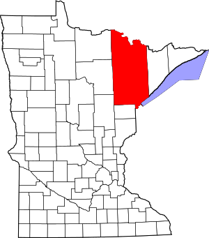
 Independence Location of the community of Independence within New Independence Township Saint Louis County  Independence Independence (the United States) | |
| Coordinates: 46°57′30″N 92°27′38″W | |
| Country | United States |
| State | Minnesota |
| County | Saint Louis |
| Township | New Independence Township |
| Elevation | 1,302 ft (397 m) |
| Population | |
| • Total | 10 |
| Time zone | UTC-6 (Central (CST)) |
| • Summer (DST) | UTC-5 (CDT) |
| ZIP code | 55779 |
| Area code(s) | 218 |
| GNIS feature ID | 661532[1] |
The community is located 22 miles northwest of the city of Duluth at the junction of U.S. Highway 53 and State Highway 33 (MN 33). Saint Louis County Highway 47 (CR 47) is also in the vicinity. Independence is located 17 miles north of the city of Cloquet.
The Cloquet River flows through the area. The community of Culver is nearby.
Local business establishments include the Wayside Corner Store Spur.
References
- Rand McNally Road Atlas – 2007 edition – Minnesota entry
- Official State of Minnesota Highway Map – 2011/2012 edition
This article is issued from Wikipedia. The text is licensed under Creative Commons - Attribution - Sharealike. Additional terms may apply for the media files.