Gnesen Township, St. Louis County, Minnesota
Gnesen Township is a township in Saint Louis County, Minnesota, United States. The population was 1,683 at the 2010 census.[3]
Gnesen Township, Minnesota | |
|---|---|
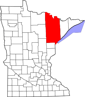
 Gnesen Township, Minnesota Location within the state of Minnesota | |
| Coordinates: 47°1′8″N 92°7′25″W | |
| Country | United States |
| State | Minnesota |
| County | Saint Louis |
| Area | |
| • Total | 71.6 sq mi (185.5 km2) |
| • Land | 61.5 sq mi (159.3 km2) |
| • Water | 10.1 sq mi (26.2 km2) |
| Elevation | 1,371 ft (418 m) |
| Population (2010) | |
| • Total | 1,683 |
| • Density | 24/sq mi (9.1/km2) |
| Time zone | UTC-6 (Central (CST)) |
| • Summer (DST) | UTC-5 (CDT) |
| ZIP codes | 55803 |
| Area code(s) | 218 |
| FIPS code | 27-24218[1] |
| GNIS feature ID | 0664284[2] |
| Website | gnesen.org |
Rice Lake Road (County Road 4) serves as a main route in Gnesen Township. Other routes include Normanna Road, Emerson Road, Howard Gnesen Road, Arnold Road, and West Pioneer Road.
Geography
According to the United States Census Bureau, the township has a total area of 71.6 square miles (185 km2); 61.5 square miles (159 km2) is land and 10.1 square miles (26 km2), or 14.10%, is water.
Island Lake and Boulder Lake are both partially located within Gnesen Township.
The Lester River rises in Gnesen Township and flows generally southeastwardly through the city of Rice Lake and Lakewood Township, turning southward as it nears Lake Superior. The river flows into Lake Superior in eastern Duluth.
Adjacent townships
The following are adjacent to Gnesen Township :
- The city of Rice Lake (south)
- Lakewood Township (southeast)
- Normanna Township (east)
- North Star Township (northeast)
- Marion Lake Unorganized Territory (northeast)
- Fredenberg Township (west)
- Canosia Township (southwest)
- Whiteface Reservoir Unorganized Territory (north)
The northern 1/4 portion of Gnesen Township is located within the Cloquet Valley State Forest of Saint Louis County.
Lismore Road runs east–west along Gnesen Township's southern boundary line with adjacent city of Rice Lake.
Jean Duluth Road (County Road 37) runs north–south along Gnesen Township's eastern boundary line with adjacent Normanna Township.
Three Lakes Road (County Road 49) runs east–west along Gnesen Township's northern boundary line.
Unincorporated communities
Demographics
At the 2000 census there were 1,468 people in 582 households, including 439 families, in the township. The population density was 23.9 people per square mile (9.2/km²). There were 689 housing units at an average density of 11.2/sq mi (4.3/km²). The racial makeup of the township was 98.09% White, 0.27% African American, 0.82% Native American, 0.27% Asian, 0.07% Pacific Islander, 0.20% from other races, and 0.27% from two or more races. Hispanic or Latino of any race were 0.48%.[1]
Of the 582 households 30.4% had children under the age of 18 living with them, 67.9% were married couples living together, 3.8% had a female householder with no husband present, and 24.4% were non-families. 19.4% of households were one person and 5.2% were one person aged 65 or older. The average household size was 2.52 and the average family size was 2.90.
The age distribution was 24.2% under the age of 18, 5.7% from 18 to 24, 28.4% from 25 to 44, 31.4% from 45 to 64, and 10.3% 65 or older. The median age was 41 years. For every 100 females, there were 108.5 males. For every 100 females age 18 and over, there were 110.4 males.
The median household income was $57,292 and the median family income was $62,569. Males had a median income of $41,333 versus $26,579 for females. The per capita income for the township was $26,202. About 3.0% of families and 4.5% of the population were below the poverty line, including 4.6% of those under age 18 and 1.4% of those age 65 or over.
See also
- Gniezno, city in Poland
References
- "U.S. Census website". United States Census Bureau. Retrieved 2008-01-31.
- "US Board on Geographic Names". United States Geological Survey. 2007-10-25. Retrieved 2008-01-31.
- "Race, Hispanic or Latino, Age, and Housing Occupancy: 2010 Census Redistricting Data (Public Law 94-171) Summary File (QT-PL), Gnesen township, St. Louis County, Minnesota". United States Census Bureau. Retrieved October 26, 2011.
- Upham, Warren (1920). Minnesota Geographic Names: Their Origin and Historic Significance. Minnesota Historical Society. p. 483.