Lakewood Township, St. Louis County, Minnesota
Lakewood Township is a township in Saint Louis County, Minnesota, United States. The population was 2,252 in 2018 as estimated by the Minnesota State Demographic Center.[2]
Lakewood Township, Minnesota | |
|---|---|
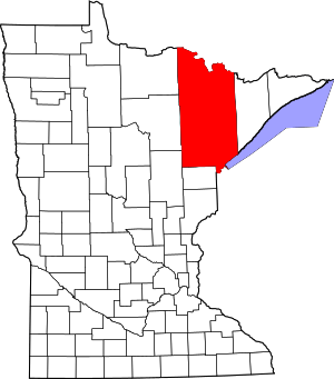
 Lakewood Township, Minnesota Location within the state of Minnesota | |
| Coordinates: 46°54′41″N 91°59′07″W | |
| Country | United States |
| State | Minnesota |
| County | Saint Louis |
| Area | |
| • Total | 27.8 sq mi (72 km2) |
| • Land | 27.8 sq mi (72 km2) |
| Population (2010) | |
| • Total | 2,190 |
| • Density | 79/sq mi (30/km2) |
| Time zone | UTC-6 (Central (CST)) |
| • Summer (DST) | UTC-5 (CDT) |
| ZIP codes | 55803 and 55804 |
| Area code(s) | 218 |
| FIPS code | 27-47120[1] |
| Website | www.lakewoodmn.org |
Jean Duluth Road, West Tischer Road, North Tischer Road, Lakewood Road, and Strand Road are five of the main routes in the township.
Lakewood Township was named for its groves.[3]
Geography
According to the United States Census Bureau, the township has a total area of 27.8 square miles (72 km2), all of it land.
The French River flows through the northeast corner of the township. The Lester River flows through the western portion of Lakewood Township. The Talmadge River also flows through the township.
Adjacent townships, cities, and communities
The following are adjacent to Lakewood Township :
- The city of Rice Lake (west)
- Duluth Township (east)
- Normanna Township (north)
- Gnesen Township (northwest)
- The city of Duluth (south)
- The neighborhood of Lakeside – Lester Park (south)
- The neighborhood of Morley Heights / Parkview (south)
- The neighborhood of North Shore (south)
Jean Duluth Road (County Road 37) runs north–south along Lakewood Township's western boundary line with adjacent city of Rice Lake.
McQuade Road runs north–south along Lakewood Township's eastern boundary line with adjacent Duluth Township.
Lismore Road runs east–west along Lakewood Township's northern boundary line with adjacent Normanna Township. Zimmerman Road is also in the vicinity.
Medin Road runs east–west near Lakewood Township's southern boundary line with adjacent city of Duluth in the southwest corner of the township. Oak Street follows the actual southern boundary line in two separate disjointed sections.
Lester River Road (County Road 12) runs north–south through the middle of the township.
Demographics
At the 2000 census there were 2,013 people, 710 households, and 553 families living in the township. The population density was 72.5 people per square mile (28.0/km²). There were 735 housing units at an average density of 26.5/sq mi (10.2/km²). The racial makeup of the township was 97.81% White, 0.35% African American, 0.50% Native American, 0.40% Asian, 0.15% from other races, and 0.79% from two or more races. Hispanic or Latino of any race were 0.40%.[1]
Of the 710 households 39.3% had children under the age of 18 living with them, 71.0% were married couples living together, 3.8% had a female householder with no husband present, and 22.0% were non-families. 17.9% of households were one person and 4.8% were one person aged 65 or older. The average household size was 2.84 and the average family size was 3.23.
The age distribution was 30.6% under the age of 18, 5.7% from 18 to 24, 29.0% from 25 to 44, 27.4% from 45 to 64, and 7.4% 65 or older. The median age was 39 years. For every 100 females, there were 105.4 males. For every 100 females age 18 and over, there were 102.0 males.
The median household income was $51,700 and the median family income was $56,833. Males had a median income of $40,329 versus $27,222 for females. The per capita income for the township was $21,086. About 3.5% of families and 6.3% of the population were below the poverty line, including 10.7% of those under the age of 18 and 2.1% of those age 65 or over.
See also
- Saint Louis County Road 37 – Jean Duluth Road
References
- "U.S. Census website". United States Census Bureau. Retrieved 2008-01-31.
- "Our Estimates". Minnesota State Demographic Center Department of Administration. 2019. Retrieved April 25, 2020.
- Upham, Warren (1920). Minnesota Geographic Names: Their Origin and Historic Significance. Minnesota Historical Society. p. 485.
External links
| Authority control |
|
|---|