Ice Age National Scientific Reserve
The Ice Age National Scientific Reserve is an affiliated area of the National Park System of the United States comprising nine sites in Wisconsin that preserve geological evidence of glaciation. To protect the scientific and scenic value of the landforms, the U.S. Congress authorized the creation of a cooperative reserve in 1964. The scientific reserve was established in 1971 and today encompasses some 32,500 acres (13,200 ha).[1][2] The landforms are the result of the Wisconsin glaciation during the last glacial period, which lasted from about 110,000 to 10,000 years ago.
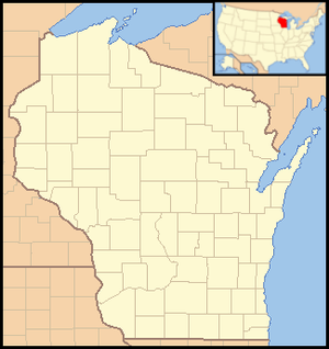
Hold cursor over locations to display park name;
click to go to unit article.
The nine units of the reserve, mostly Wisconsin state parks or other protected areas, are administered by the Wisconsin Department of Natural Resources. Several units are not yet developed for visitation, having only minimal trails and no interpretive installations. Planning was underway as of 2012 for the future development and management of the Cross Plains unit.[3] Several of the sites are joined by the Ice Age National Scenic Trail, but the reserve is a separate entity.[1] Units of the reserve that charge state park access fees also accept federal passes.[4]
Units
| Site Name | Location | Geologic features | Recreation |
|---|---|---|---|
| Campbellsport Drumlins State Park | Campbellsport | Drumlins | Scenic drive |
| Chippewa Moraine State Recreation Area | New Auburn | Kettle lakes and ponds, stagnant ice terrain, ice-walled lake plains | Interpretive center, camping, and trails |
| Cross Plains State Park | Cross Plains | Driftless Zone topography, glacial lakes, gorge | Trails |
| Devil's Lake State Park | Baraboo | Large kettle lake, terminal moraine | Interpretive center, camping, non-motorized boating, trails, swimming, picnicking |
| Horicon Marsh State Wildlife Area | Horicon | Extinct glacial lake, drumlin | Wildlife viewing, trails |
| Interstate State Park | St. Croix Falls | Dalles of the St. Croix River, glacial potholes | Interpretive center, camping, non-motorized boating, trails, swimming, picnicking, fishing |
| Kettle Moraine State Forest, Northern Unit | Glenbeulah and Kewaskum | Kettle Moraine, kames, eskers, kettle lakes | Interpretive center, camping, boating, trails, swimming, picnicking |
| Mill Bluff State Park | Camp Douglas | Former islands and lakebed of Glacial Lake Wisconsin | Camping, trails, swimming, picnicking |
| Two Creeks Buried Forest State Natural Area | Two Creeks | Exposed stratum with floral remains | Undeveloped |
References
- "The National Parks: Index 2009–2011" (PDF). National Park Service. 2009. Retrieved 2012-10-31. Cite journal requires
|journal=(help) - Black, Robert F. (1974). "Geology of Ice Age National Scientific Reserve of Wisconsin". National Park Service Scientific Monograph. 2. National Park Service. Retrieved November 11, 2017. Cite journal requires
|journal=(help) - Schuler, Pam; Dana White-Quam. "General Management Plan for Ice Age Complex at Cross Plains, WI". National Park Service. Retrieved 2012-10-31.
- "Ice Age National Scientific Reserve". Wisconsin Department of Natural Resources. 2012-10-03. Retrieved 2012-10-31.
External links
- Ice Age National Scientific Reserve–Wisconsin Department of Natural Resources
- Geology of Ice Age National Scientific Reserve
| Wikimedia Commons has media related to Ice Age National Scientific Reserve. |
| Authority control |
|
|---|