Huai Yot District
Huai Yot District (Thai: ห้วยยอด, pronounced [hûa̯j jɔ̂ːt]) is a district (amphoe) in the northern part of Trang Province, Thailand.
Huai Yot ห้วยยอด | |
|---|---|
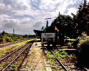 Huai Yot railway station, 2007 | |
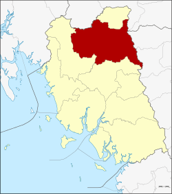 District location in Trang Province | |
| Coordinates: 7°47′6″N 99°38′6″E | |
| Country | Thailand |
| Province | Trang |
| Seat | Huai Yot |
| Area | |
| • Total | 753.4 km2 (290.9 sq mi) |
| Population (2005) | |
| • Total | 90,261 |
| • Density | 119.8/km2 (310/sq mi) |
| Time zone | UTC+7 (ICT) |
| Postal code | 92130 |
| Geocode | 9206 |
Geography
Neighboring districts are (from the north clockwise): Ratsada of Trang Province; Thung Song of Nakhon Si Thammarat Province; Pa Phayom and Si Banphot of Phatthalung Province; Mueang Trang and Wang Wiset of Trang Province; and Bang Khan of Nakhon Si Thammarat Province.
History
Originally named Khao Khao (เขาขาว), it was renamed Huai Yot in 1939.[1]
Administration
The district is divided into 16 sub-districts (tambons), which are further subdivided into 133 villages (mubans). There are three townships (thesaban tambons): Huai Yot covers parts of tambons Huai Yot and Khao Pun; Na Wong covers parts of tambons Na Wong, Bang Kung, and Wang Khiri; and Lam Phu Ra covers parts of tambon Lam Phu Ra. There are a further 16 tambon administrative organizations (TAO).
|
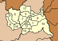 |
Missing numbers are tambons which now form Ratsada District.
References
- พระราชกฤษฎีกาเปลี่ยนนามอำเภอ กิ่งอำเภอ และตำบลบางแห่ง พุทธศักราช ๒๔๘๒ (PDF). Royal Gazette (in Thai). 56 (ก): 354–364. April 17, 1939.