Hobe Sound, Florida
Hobe Sound is an unincorporated area and census-designated place (CDP) in Martin County, Florida, United States. The population was 11,521 at the 2010 census.
Hobe Sound, Florida | |
|---|---|
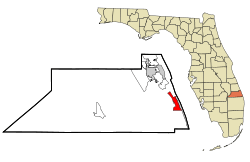 Location in Martin County and the state of Florida | |
 Hobe Sound Location in the contiguous United States and Florida  Hobe Sound Hobe Sound (Florida) | |
| Coordinates: 27°04′N 80°08′W | |
| Country | |
| State | |
| County | Martin |
| Area | |
| • Total | 5.7 sq mi (14.8 km2) |
| • Land | 5.5 sq mi (14.1 km2) |
| • Water | 0.3 sq mi (0.7 km2) |
| Elevation | 20 ft (6 m) |
| Population (2010) | |
| • Total | 11,521 |
| • Density | 2,082.8/sq mi (804.5/km2) |
| Time zone | UTC-5 (Eastern (EST)) |
| • Summer (DST) | UTC-4 (EDT) |
| ZIP codes | 33455, 33475 |
| Area code(s) | 772 |
| FIPS code | 12-30975[1] |
| GNIS feature ID | 0284064[2] |
Geography
Hobe Sound is located at 27°04′36″N 80°08′31″W.[3]
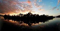
Hobe Sound is an exurban area in southern Martin County near the Atlantic Ocean. It stretches along the coast between Port Salerno and Jonathan Dickinson State Park but does include Jupiter Island. Hobe Sound is home to Hobe Sound Public Beach, one of Martin County's four guarded beaches.
History
Hobe Sound is the anglicized form of the name of a village of the Jaega, a Native American group that lived in the area before European settlement. The Spanish recorded the village name as Jobe or Jove [ˈxoβe].[4] Jonathan Dickinson, whose party was shipwrecked near the town in 1696, spelled the name of the village "Hoe-bey".[5]
Parts of Hobe Sound were included in the 12,000 acres (49 km2) of the Gomez grant given by Spain to Don Eusebio in 1815. In 1821, Gomez sold 8,000 acres (32 km2), including Jupiter Island, to Joseph Delespine for $1 per acre.
Shortly after the turn of the 20th century, Henry Flagler built his railroad along the east coast of Florida passing through Hobe Sound. This gradually created many opportunities including jobs, the birth of tourism, and other related industries.
During the land boom of the 1920s elaborate plans were announced for Hobe Sound by the Olympia Improvement Corporation. Their goal was to create a town, in Greek style, where motion pictures could be produced. Street names bore the Greek theme with names such as Zeus, Saturn, Mercury, Mars, Olympus, Venus, Pluto and Athena. For a brief time Hobe Sound was renamed "Picture City" and plans were presented for a movie picture production center. The boom collapsed after the 1928 Okeechobee hurricane and the original name was restored. Street names remained, however, as did the cement streetlights along Dixie Highway.
In 1924, the building which soon would become the new schoolhouse in Hobe Sound was constructed. The Martin County Board of Public Instruction secured the use of the new school building from the Picture City Corporation in 1925, and in October of that year, the Olympia School opened. The school was designated the "Picture City School" of Martin County. It remained in use as a school until 1962.
Other mementos of the past are gone, including the ice plant, which was south of Bridge Road, and the old train station, which now, refurbished and relocated west of Hobe Sound, serves as an office building for Becker Groves and the Texaco station east of the Winn-Dixie plaza, which no longer supplies gasoline but continues to serve the community with car rentals and a livery service, operated by its founding family.
Hobe Sound is positioned at the southern end of environmentally-sensitive Martin (named after Governor Martin) County. It has been stated that at Hobe Sound's front door lies the Gold Coast and that at her back door lies the Treasure Coast. Thus, Hobe Sound can lend to both while retaining its proud heritage and unique personality. Hobe Sound's proximity to the coast affords immediate access to the Atlantic Ocean and the deep-channeled Intracoastal Waterway, a 1,200-mile (1,900 km) water route that provides a sheltered passage for boats along the eastern seaboard.
Another significant historical association possessed by Hobe Sound is the brief stay there of former Defense Secretary James Forrestal in 1949 between his resignation from that post and his death.
March 15, 1997: During a stay at golfer Greg Norman's Jupiter Island Estate, after conversing late into the night, Norman was escorting then President Clinton to a cottage on his estate when the president fell while descending four dark-wood steps to a stone landing. In the darkness, he apparently misjudged the final step, said White House Press Secretary Michael D. McCurry. "He remembers his right knee buckling out. He heard a very loud pop," said Navy Capt. Connie Mariano, the president's personal physician. Alcohol was not a factor, Mariano told reporters while still in Florida. Paramedics at Norman's estate rushed to the president's side. They found Clinton lying on the ground being comforted by Norman and a Secret Service agent. The paramedics checked Clinton's vital signs, put ice and a splint on his leg and put him into an ambulance.
Hobe Sound is a predominantly wealthy community whose residents have included such celebrities as "Tiger" Woods, Alan Jackson, Celine Dion, and Burt Reynolds among others. Over the decades, it was home or a winter home for wealthy businessman and industrialists, politicians, and sports and entertainment celebrities.
Police protection for Hobe Sound is provided by the Martin County Sheriff's Department. The Martin County Fire Rescue Department provides modern fire, rescue, as well as EMS Services. State-of-the-art inter-facility EMS services are also provided by the Martin Health System.
Counties
Hobe Sound has been part of the following counties:
- St. Johns County 1821-1824
- Mosquito County, now Orange County 1824-1844
- Brevard County, 1844-1866 Note: The present day Brevard County was known as St. Lucie County from 1844-1855, but it was not the same county as today's St. Lucie County
- Dade County 1866-1909
- Palm Beach County 1909-1925
- Martin County 1925–present
Demographics
As of the census[1] of 2000, there were 11,376 people, 5,176 households, and 3,266 families residing in the CDP. The population density was 2,082.8 persons per square mile (804.5/km2). There were 6,042 housing units at an average density of 1,106.2 houses per square mile (427.3/km2). The racial makeup of the CDP was 91.98% White, 5.79% African American, 0.15% Native American, 0.60 Asian, 0.03% Pacific Islander, 0.64% from other races, and 0.81% from two or more races. Hispanic or Latino of any race were 2.22% of the population.
There were 5,176 households out of which 18.7% had children under the age of 18 living with them, 54.1% were married couples living together, 6.4% had a female householder with no husband present, and 36.9% were non-families. 31.2% of all households were made up of individuals and 17.0% had someone living alone who was 65 years of age or older. The average household size was 2.14 and the average family size was 2.66.
In the CDP, the population was spread out with 16.8% under the age of 18, 4.8% from 18 to 24, 20.5% from 25 to 44, 24.9% from 45 to 64, and 33.0% who were 65 years of age or older. The median age was 51 years. For every 100 females, there were 93.3 males. For every 100 females age 18 and over, there were 90.6 males.
The median income for a household in the CDP was $36,541, and the median income for a family was $45,412. Males had a median income of $36,943 versus $27,773 for females. The per capita income for the CDP was $21,603. About 3.7% of families and 5.5% of the population were below the poverty line, including 3.7% of those under age 18 and 6.0% of those age 65 or over.
Transportation
Travel in Hobe Sound is predominantly performed by private automobile. There are no interstate highways in Hobe Sound; the nearest, Interstate 95, is 7 miles (11 km) west. Hobe Sound is dominated by US 1, a four- and six-lane arterial road that runs north to south. Other important throughways include A1A (locally known as Dixie Highway), Bridge Road, Gomez Avenue, and Osprey Street. US 1 arguably represents the central business district though some commercial activity occurs on Dixie Highway (A1A) near Bridge Road.
Mass transit
Only a very limited public transport system exists in Hobe Sound. No fixed-route services exist in Hobe Sound. The Community Coach, a service of the Council on Aging of Martin County, is the public transportation service for Martin County. It operates a curb-to-curb, advance reservation, shared ride service and also operates fixed-route services in other parts of the county.
Railroads
The Florida East Coast Railway runs through Hobe Sound parallel to A1A. At-grade crossings can be found at (from north to south) A1A, Osprey Street, Crossrip Street, Pettway Street, Bridge Road, and Gleason Street.
Until 1963 long distance trains, East Coast Champion, City of Miami, Havana Special and South Wind, served Hope Sound's station. Until 1968 local Jacksonville to Miami trains made stops at Hobe Sound.
Education
The Hobe Sound Bible College is the only place of higher education in Hobe Sound. Private schools include the Hobe Sound Christian Academy. Publicly run schools include Hobe Sound Elementary and Seawind Elementary Schools. Residents of Hobe Sound attend Murray Middle School and South Fork High School.
The Pine School (formerly St. Michael's Independent) is now located on its new campus in Hobe Sound. This private school has a college preparatory program and educational opportunities for Kindergarten through 12th grade students. The campus offers education covering the basic arts (graphics, music, and media).
Notable people
- Ted Cabot, lawyer, politician, and judge
- Greg Norman, No. 1 ranked golfer in the 1980s and 90s
- Vanessa Rousso, professional poker player and Big Brother 17 contestant
- Mary Oliver,[6] poet
- Nathaniel Reed, Assistant Director Dept. of the Interior
- Tiger Woods, Legendary PGA Tour Golfer who has 15 Major Championships
Sources
- History, Hobe Sound Chamber of Commerce
References
- "U.S. Census website". United States Census Bureau. Retrieved January 31, 2008.
- "US Board on Geographic Names". United States Geological Survey. October 25, 2007. Retrieved January 31, 2008.
- "US Gazetteer files: 2010, 2000, and 1990". United States Census Bureau. February 12, 2011. Retrieved April 23, 2011.
- Hann, John H. (2003). Indians of Central and South Florida 1513-1763. Gainesville, Florida: University Press of Florida. pp. 61, 180. ISBN 0-8130-2645-8.
- Dickinson, Jonathan (1945) [1700]. Andrews, Evangeline Walker; Andrews, Charles McLean (eds.). God's Protecting Providence ... Jonathan Dickinson's Journal (Reprint (Florida Classics Library, 1981) ed.). Yale University Press. p. 19. LCCN 61-11399.
- 'Mary Oliver', Encyclopædia Britannica Online, retrieved January 30, 2019.
External links
- U.S. Geological Survey Geographic Names Information System: Hobe Sound, Florida
- Hobe Sound Chamber of Commerce
Municipalities and communities of Martin County, Florida, United States | ||
|---|---|---|
| City | 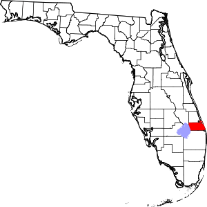 | |
| Towns | ||
| Village | ||
| CDPs | ||
| Unincorporated community | ||
| Authority control |
|
|---|