La Castellana, Negros Occidental
La Castellana, officially the Municipality of La Castellana, is a 1st class municipality in the province of Negros Occidental, Philippines. According to the 2015 census, it has a population of 74,855 people.[3]
La Castellana | |
|---|---|
| Municipality of La Castellana | |
 Seal | |
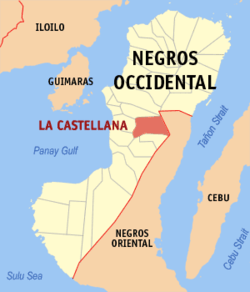 Map of Negros Occidental with La Castellana highlighted | |

| |
.svg.png) La Castellana Location within the Philippines | |
| Coordinates: 10°21′N 123°04′E | |
| Country | |
| Region | Western Visayas (Region VI) |
| Province | Negros Occidental |
| District | 5th district of Negros Occidental |
| Barangays | 13 (see Barangays) |
| Government | |
| • Type | Sangguniang Bayan |
| • Mayor | Rhumyla Nicor-Mangilimutan |
| • Vice Mayor | Manuel G. Vera |
| • Congressman | Maria Lourdes A. Lesaca |
| • Electorate | 44,767 voters (2019) |
| Area | |
| • Total | 185.22 km2 (71.51 sq mi) |
| Elevation | 64.0 m (210.0 ft) |
| Population (2015 census)[3] | |
| • Total | 74,855 |
| • Density | 400/km2 (1,000/sq mi) |
| • Households | 16,740 |
| Economy | |
| • Income class | 1st municipal income class |
| • Poverty incidence | 26.11% (2015)[4] |
| • Revenue (₱) | 152,816,885.33 (2016) |
| Time zone | UTC+8 (PST) |
| ZIP code | 6131 |
| PSGC | |
| IDD : area code | +63 (0)34 |
| Climate type | tropical climate |
| Native languages | Hiligaynon Tagalog |
The town is named after the famous "Paseo de la Castellana" in Madrid, Spain.
La Castellana is a rural town situated at the base of Kanlaon Volcano, known for its natural springs, water falls and scenic spots. It is an agricultural town engaged in sugarcane, rice and banana farming. It is home of many festivals namely Bailes de Luces, Banana Festival and Senior San Vicente Ferrer Feast Day where devotees far and near attend to for healing. Caduhada Spring Resort is a popular tourist spot located in Sitio Mambangon, Barangay Cabacungan.
Barangays
La Castellana is politically subdivided into 13 barangays.
- Biaknabato
- Cabacungan
- Cabagnaan
- Camandag
- Lalagsan
- Manghanoy
- Mansalanao
- Masulog
- Nato
- Puso
- Robles (Poblacion)
- Sag-Ang
- Talaptap
Climate
| Climate data for La Castellana, Negros Oriental | |||||||||||||
|---|---|---|---|---|---|---|---|---|---|---|---|---|---|
| Month | Jan | Feb | Mar | Apr | May | Jun | Jul | Aug | Sep | Oct | Nov | Dec | Year |
| Average high °C (°F) | 28 (82) |
29 (84) |
30 (86) |
32 (90) |
31 (88) |
30 (86) |
29 (84) |
29 (84) |
29 (84) |
29 (84) |
29 (84) |
28 (82) |
29 (85) |
| Average low °C (°F) | 20 (68) |
22 (72) |
23 (73) |
24 (75) |
25 (77) |
25 (77) |
24 (75) |
24 (75) |
24 (75) |
24 (75) |
24 (75) |
23 (73) |
24 (74) |
| Average precipitation mm (inches) | 100 (3.9) |
75 (3.0) |
90 (3.5) |
101 (4.0) |
183 (7.2) |
242 (9.5) |
215 (8.5) |
198 (7.8) |
205 (8.1) |
238 (9.4) |
194 (7.6) |
138 (5.4) |
1,979 (77.9) |
| Average rainy days | 14.9 | 11.3 | 14.5 | 17.4 | 26.4 | 28.4 | 28.5 | 27.5 | 26.9 | 28.4 | 24.2 | 17.2 | 265.6 |
| Source: Meteoblue [5] | |||||||||||||
Demographics
| Population census of La Castellana | ||
|---|---|---|
| Year | Pop. | ±% p.a. |
| 1903 | 5,329 | — |
| 1918 | 8,087 | +2.82% |
| 1939 | 16,861 | +3.56% |
| 1948 | 24,654 | +4.31% |
| 1960 | 35,630 | +3.12% |
| 1970 | 34,881 | −0.21% |
| 1975 | 41,821 | +3.71% |
| 1980 | 44,684 | +1.33% |
| 1990 | 54,368 | +1.98% |
| 1995 | 59,620 | +1.74% |
| 2000 | 59,102 | −0.19% |
| 2007 | 70,838 | +2.53% |
| 2010 | 71,013 | +0.09% |
| 2015 | 74,855 | +1.01% |
| Source: Philippine Statistics Authority[3][6][7][8] | ||
References
- "Municipality". Quezon City, Philippines: Department of the Interior and Local Government. Retrieved 31 May 2013.
- "Province:". PSGC Interactive. Quezon City, Philippines: Philippine Statistics Authority. Retrieved 12 November 2016.
- Census of Population (2015). "Region VI (Western Visayas)". Total Population by Province, City, Municipality and Barangay. PSA. Retrieved 20 June 2016.
- "PSA releases the 2015 Municipal and City Level Poverty Estimates". Quezon City, Philippines. Retrieved 12 October 2019.
- "La Castellana: Average Temperatures and Rainfall". Meteoblue. Retrieved 7 May 2020.
- Census of Population and Housing (2010). "Region VI (Western Visayas)". Total Population by Province, City, Municipality and Barangay. NSO. Retrieved 29 June 2016.
- Censuses of Population (1903–2007). "Region VI (Western Visayas)". Table 1. Population Enumerated in Various Censuses by Province/Highly Urbanized City: 1903 to 2007. NSO.
- "Province of". Municipality Population Data. Local Water Utilities Administration Research Division. Retrieved 17 December 2016.
External links
- La Castellana Profile at PhilAtlas.com
- Philippine Standard Geographic Code
- Philippine Census Information
- Local Governance Performance Management System
Places adjacent to La Castellana, Negros Occidental | ||||||||||
|---|---|---|---|---|---|---|---|---|---|---|
| ||||||||||
Bacolod (capital) | |
| Municipalities | |
| Component cities | |
| Highly urbanized city |
|