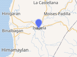
Isabela, Negros Occidental
Isabela, officially the Municipality of Isabela, is a 2nd class municipality in the province of Negros Occidental, Philippines. According to the 2015 census, it has a population of 62,146 people.[3]
Isabela | |
|---|---|
| Municipality of Isabela | |
 Barangay Camangcamang with Mabinay Mountains seen in the distance | |
| Nickname(s): The Sweet Heart of Negros | |
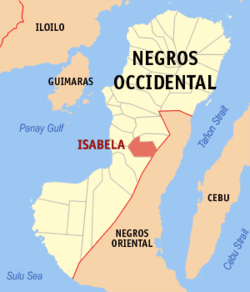 Map of Negros Occidental with Isabela highlighted | |
| |
.svg.png) Isabela Location within the Philippines | |
| Coordinates: 10°12′N 122°59′E | |
| Country | |
| Region | Western Visayas (Region VI) |
| Province | Negros Occidental |
| District | 5th district of Negros Occidental |
| Barangays | 30 (see Barangays) |
| Government | |
| • Type | Sangguniang Bayan |
| • Mayor | Irene C. Montilla |
| • Vice Mayor | Renato M. Malabor Jr. |
| • Congresswoman | Ma. Lourdes T. Arroyo |
| • Electorate | 40,017 voters (2019) |
| Area | |
| • Total | 178.76 km2 (69.02 sq mi) |
| Elevation | 29.0 m (95.1 ft) |
| Population (2015 census)[3] | |
| • Total | 62,146 |
| • Density | 350/km2 (900/sq mi) |
| • Households | 13,332 |
| Economy | |
| • Income class | 2nd municipal income class |
| • Poverty incidence | 26.84% (2015)[4] |
| • Revenue (₱) | 135,452,509.52 (2016) |
| Time zone | UTC+8 (PST) |
| ZIP code | 6128 |
| PSGC | |
| IDD : area code | +63 (0)34 |
| Climate type | tropical climate |
| Native languages | Hiligaynon Ati Tagalog |
| Website | www |
Isabela is known for BISCOM (Binalbagan Isabela Sugar Company) located in nearby Binalbagan town.
In 1951, the barrios of Magallon, Odiong and Guinpanaan were separated from Isabela and formed into the town of Magallon (now Moises Padilla).[5]
Barangays
Isabela is politically subdivided into 30 barangays ("Pob." means poblacion).
- Amin
- Banogbanog
- Bulad
- Bungahin
- Cabcab
- Camangcamang
- Camp Clark
- Cansalongon
- Guintubhan
- Libas
- Limalima
- Makilignit
- Mansablay
- Maytubig
- Panaquiao
- Barangay 1 (Poblacion)
- Barangay 2 (Poblacion)
- Barangay 3 (Poblacion)
- Barangay 4 (Poblacion)
- Barangay 5 (Poblacion)
- Barangay 6 (Poblacion)
- Barangay 7 (Poblacion)
- Barangay 8 (Poblacion)
- Barangay 9 (Poblacion)
- Riverside
- Rumirang
- San Agustin
- Sebucawan
- Sikatuna
- Tinongan
Climate
| Climate data for Isabela, Negros Occidental | |||||||||||||
|---|---|---|---|---|---|---|---|---|---|---|---|---|---|
| Month | Jan | Feb | Mar | Apr | May | Jun | Jul | Aug | Sep | Oct | Nov | Dec | Year |
| Average high °C (°F) | 30 (86) |
31 (88) |
32 (90) |
33 (91) |
32 (90) |
30 (86) |
29 (84) |
29 (84) |
29 (84) |
29 (84) |
30 (86) |
30 (86) |
30 (87) |
| Average low °C (°F) | 22 (72) |
22 (72) |
22 (72) |
24 (75) |
25 (77) |
25 (77) |
25 (77) |
24 (75) |
24 (75) |
24 (75) |
23 (73) |
23 (73) |
24 (74) |
| Average precipitation mm (inches) | 38 (1.5) |
29 (1.1) |
55 (2.2) |
65 (2.6) |
141 (5.6) |
210 (8.3) |
212 (8.3) |
176 (6.9) |
180 (7.1) |
180 (7.1) |
130 (5.1) |
70 (2.8) |
1,486 (58.6) |
| Average rainy days | 9.0 | 7.2 | 11.1 | 13.5 | 25.6 | 28.4 | 28.9 | 27.3 | 26.9 | 27.7 | 21.8 | 13.8 | 241.2 |
| Source: Meteoblue [6] | |||||||||||||
Demographics
| Population census of Isabela | ||
|---|---|---|
| Year | Pop. | ±% p.a. |
| 1903 | 12,836 | — |
| 1918 | 19,653 | +2.88% |
| 1939 | 43,509 | +3.86% |
| 1948 | 33,743 | −2.78% |
| 1960 | 29,769 | −1.04% |
| 1970 | 33,636 | +1.23% |
| 1975 | 37,400 | +2.15% |
| 1980 | 39,704 | +1.20% |
| 1990 | 47,010 | +1.70% |
| 1995 | 49,019 | +0.79% |
| 2000 | 48,719 | −0.13% |
| 2007 | 58,819 | +2.63% |
| 2010 | 59,523 | +0.43% |
| 2015 | 62,146 | +0.82% |
| Source: Philippine Statistics Authority[3][7][8][9] | ||
Festival
"Tigkalalag" is celebrated on the evening of Nov. 2 every year in the town of Isabela.[10] The Pana-ad victory of Tigkalalag festival is expected to boost the attraction of this unique festival that began in Purok Manacup beside the public cemetery in Isabela town where people would have fun during the night of All Souls Day that was capped with a beauty pageant called Search for the White Lady. It spun off into the municipal festival under Mayor Renato Malabor, when the town was searching for a festival that was going to be its tourism plank.
Tigkalalag festival of Isabela turned what otherwise are morbid concepts of coffins, candelabras and crashing tombs into a whimsical, tightly-designed, skillfully-choreographed presentation that sent it howling to success in yearly competition of all the festivals of Negros Occidental. Tigkalalag is Hiligaynon for All Souls' Day.
References
- "Municipality". Quezon City, Philippines: Department of the Interior and Local Government. Retrieved 31 May 2013.
- "Province:". PSGC Interactive. Quezon City, Philippines: Philippine Statistics Authority. Retrieved 12 November 2016.
- Census of Population (2015). "Region VI (Western Visayas)". Total Population by Province, City, Municipality and Barangay. PSA. Retrieved 20 June 2016.
- "PSA releases the 2015 Municipal and City Level Poverty Estimates". Quezon City, Philippines. Retrieved 12 October 2019.
- "An act creating the municipality of Magallon in the province of Negros Occidental". LawPH.com. Retrieved 2011-04-09.
- "Isabela: Average Temperatures and Rainfall". Meteoblue. Retrieved 7 May 2020.
- Census of Population and Housing (2010). "Region VI (Western Visayas)". Total Population by Province, City, Municipality and Barangay. NSO. Retrieved 29 June 2016.
- Censuses of Population (1903–2007). "Region VI (Western Visayas)". Table 1. Population Enumerated in Various Censuses by Province/Highly Urbanized City: 1903 to 2007. NSO.
- "Province of". Municipality Population Data. Local Water Utilities Administration Research Division. Retrieved 17 December 2016.
- "Municipality of Isabela". Negros Occidental Provincial Government. Retrieved 6 March 2013.
External links
- Isabela Profile at PhilAtlas.com
- Philippine Standard Geographic Code
- Isabela Profile at the Official Website of Negros Occidental
- Philippine Census Information
- Municipality of Isabela
- Local Governance Performance Management System
Places adjacent to Isabela, Negros Occidental | ||||||||||
|---|---|---|---|---|---|---|---|---|---|---|
| ||||||||||
Bacolod (capital) | |
| Municipalities | |
| Component cities | |
| Highly urbanized city |
|