Hart, Michigan
Hart is a city in the U.S. state of Michigan. The population was 2,126 at the 2010 census. It is the county seat of Oceana County.[6] The city is located within Hart Township, but is politically independent.
Hart, Michigan | |
|---|---|
 Location of Hart, Michigan | |
 Hart Location of Hart, Michigan  Hart Hart (the United States) | |
| Coordinates: 43°41′58″N 86°21′57″W | |
| Country | |
| State | |
| County | Oceana |
| Area | |
| • Total | 1.56 sq mi (4.05 km2) |
| • Land | 1.40 sq mi (3.63 km2) |
| • Water | 0.16 sq mi (0.42 km2) |
| Elevation | 682 ft (208 m) |
| Population | |
| • Total | 2,126 |
| • Estimate (2018)[3] | 2,091 |
| • Density | 1,500.71/sq mi (579.22/km2) |
| Time zone | UTC-5 (Eastern (EST)) |
| • Summer (DST) | UTC-4 (EDT) |
| ZIP code | 49420 |
| Area code(s) | 231 |
| FIPS code | 26-36920[4] |
| GNIS feature ID | 1620137[5] |
Hart is also home to the north end of the Hart-Montague Trail.
History
Hart was named from its central position in the "heart" of Oceana County.[7]
Hart was founded in 1856 by early pioneers including Nelson Grove. Hart Township was named after Wellington Hart.[8]
Geography
According to the United States Census Bureau, the city has a total area of 2.07 square miles (5.36 km2), of which 1.91 square miles (4.95 km2) is land and 0.16 square miles (0.41 km2) is water.[9]
Transportation
Demographics
| Historical population | |||
|---|---|---|---|
| Census | Pop. | %± | |
| 1880 | 464 | — | |
| 1890 | 757 | 63.1% | |
| 1900 | 1,134 | 49.8% | |
| 1910 | 1,555 | 37.1% | |
| 1920 | 1,590 | 2.3% | |
| 1930 | 1,690 | 6.3% | |
| 1940 | 1,922 | 13.7% | |
| 1950 | 2,172 | 13.0% | |
| 1960 | 1,990 | −8.4% | |
| 1970 | 2,139 | 7.5% | |
| 1980 | 1,888 | −11.7% | |
| 1990 | 1,942 | 2.9% | |
| 2000 | 1,950 | 0.4% | |
| 2010 | 2,126 | 9.0% | |
| Est. 2018 | 2,091 | [3] | −1.6% |
| U.S. Decennial Census[10] | |||
2010 census
As of the census[2] of 2010, there were 2,126 people, 757 households, and 478 families living in the city. The population density was 1,113.1 inhabitants per square mile (429.8/km2). There were 849 housing units at an average density of 444.5 per square mile (171.6/km2). The racial makeup of the city was 84.3% White, 0.5% African American, 0.8% Native American, 0.2% Asian, 12.6% from other races, and 1.6% from two or more races. Hispanic or Latino of any race were 25.7% of the population.
There were 757 households of which 35.3% had children under the age of 18 living with them, 41.9% were married couples living together, 17.3% had a female householder with no husband present, 4.0% had a male householder with no wife present, and 36.9% were non-families. 32.9% of all households were made up of individuals and 14.8% had someone living alone who was 65 years of age or older. The average household size was 2.58 and the average family size was 3.23.
The median age in the city was 37.3 years. 26.4% of residents were under the age of 18; 8.8% were between the ages of 18 and 24; 22.7% were from 25 to 44; 22.1% were from 45 to 64; and 19.9% were 65 years of age or older. The gender makeup of the city was 48.2% male and 51.8% female.
2000 census
As of the census[4] of 2000, there were 1,950 people, 759 households, and 481 families living in the city. The population density was 1,017.7 per square mile (392.1/km²). There were 832 housing units at an average density of 434.2 per square mile (167.3/km²). The racial makeup of the city was 87.69% White, 0.51% African American, 1.38% Native American, 0.26% Asian, 7.59% from other races, and 2.56% from two or more races. Hispanic or Latino of any race were 14.56% of the population.
There were 759 households out of which 31.6% had children under the age of 18 living with them, 44.7% were married couples living together, 13.8% had a female householder with no husband present, and 36.6% were non-families. 31.6% of all households were made up of individuals and 16.3% had someone living alone who was 65 years of age or older. The average household size was 2.45 and the average family size was 3.05.
In the city, the population was spread out with 27.4% under the age of 18, 8.3% from 18 to 24, 28.8% from 25 to 44, 18.3% from 45 to 64, and 17.2% who were 65 years of age or older. The median age was 35 years. For every 100 females, there were 90.2 males. For every 100 females age 18 and over, there were 87.4 males.
The median income for a household in the city was $25,855, and the median income for a family was $31,875. Males had a median income of $28,839 versus $20,125 for females. The per capita income for the city was $13,844. About 17.5% of families and 20.4% of the population were below the poverty line, including 30.6% of those under age 18 and 10.0% of those age 65 or over.
Notable people
- Larry Paul Kelley, founder of Shelby Gem Factory
- Seymour H. Knox I, Buffalo, New York businessman
- Donald W. Wolf, a World War II U.S. Marine Corps hero who was killed in action at Guadalcanal
- Walter Willett, an American physician and nutrition researcher
Climate
This climatic region is typified by large seasonal temperature differences, with warm to hot (and often humid) summers and cold (sometimes severely cold) winters. According to the Köppen Climate Classification system, Hart has a humid continental climate, abbreviated "Dfb" on climate maps.[11]
References
- "2017 U.S. Gazetteer Files". United States Census Bureau. Retrieved Jan 3, 2019.
- "U.S. Census website". United States Census Bureau. Retrieved 2012-11-25.
- "Population and Housing Unit Estimates". Retrieved December 20, 2019.
- "U.S. Census website". United States Census Bureau. Retrieved 2008-01-31.
- "US Board on Geographic Names". United States Geological Survey. 2007-10-25. Retrieved 2008-01-31.
- "Find a County". National Association of Counties. Retrieved 2011-06-07.
- Gannett, Henry (1905). The Origin of Certain Place Names in the United States. Govt. Print. Off. pp. 151.
- "Archived copy". Archived from the original on 2014-07-14. Retrieved 2014-07-11.CS1 maint: archived copy as title (link)
- "US Gazetteer files 2010". United States Census Bureau. Archived from the original on 2011-02-20. Retrieved 2012-11-25.
- "Census of Population and Housing". Census.gov. Retrieved June 4, 2015.
- "Hart, Michigan Köppen Climate Classification (Weatherbase)". Weatherbase.
External links
Municipalities and communities of Oceana County, Michigan, United States | ||
|---|---|---|
| City | 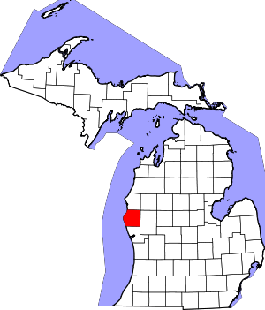 Map of Michigan highlighting Oceana County.svg | |
| Villages | ||
| Townships | ||
| Footnotes | ‡This populated place also has portions in an adjacent county or counties | |