Elbridge Township, Michigan
Elbridge Township is a civil township of Oceana County in the U.S. state of Michigan. The population was 1,233 at the 2000 census.
Elbridge Township, Michigan | |
|---|---|
 Elbridge Township, Michigan Location within the state of Michigan | |
| Coordinates: 43°40′45″N 86°13′41″W | |
| Country | United States |
| State | Michigan |
| County | Oceana |
| Area | |
| • Total | 36.3 sq mi (93.9 km2) |
| • Land | 36.2 sq mi (93.7 km2) |
| • Water | 0.1 sq mi (0.2 km2) |
| Elevation | 945 ft (287 m) |
| Population (2010) | |
| • Total | 971 |
| • Density | 26.7/sq mi (10.3/km2) |
| Time zone | UTC-5 (Eastern (EST)) |
| • Summer (DST) | UTC-4 (EDT) |
| FIPS code | 26-25200[1] |
| GNIS feature ID | 1626223[2] |
History
Elbridge Township was part of the Ottawa Indian Reservation created by treaty in 1855. The township was organized in 1858.[3]
Communities
- Elwood was a lumber settlement in the township. It had a post office from 1898 until 1901.[4]
Geography
According to the United States Census Bureau, the township has a total area of 36.3 square miles (94 km2), of which, 36.2 square miles (94 km2) of it is land and 0.1 square miles (0.26 km2) of it (0.22%) is water.
Demographics
As of the 2010 census Elbridge Township had a population of 971. The ethnic and racial composition of the population was 82.3% non-Hispanic white, 0.3% African American, 0.7% Native American, 0.1% Asian, 16.1% Hispanic or Latino and 1.3% reporting two or more races.[5]
As of the census[1] of 2000, there were 1,233 people, 344 households, and 259 families residing in the township. The population density was 34.1 per square mile (13.2/km²). There were 451 housing units at an average density of 12.5 per square mile (4.8/km²). The racial makeup of the township was 80.45% White, 0.41% African American, 0.89% Native American, 14.52% from other races, and 3.73% from two or more races. Hispanic or Latino of any race were 24.90% of the population.
There were 344 households out of which 36.6% had children under the age of 18 living with them, 59.6% were married couples living together, 9.6% had a female householder with no husband present, and 24.7% were non-families. 19.5% of all households were made up of individuals and 9.0% had someone living alone who was 65 years of age or older. The average household size was 2.95 and the average family size was 3.36.
In the township the population was spread out with 28.5% under the age of 18, 9.7% from 18 to 24, 25.8% from 25 to 44, 19.1% from 45 to 64, and 16.9% who were 65 years of age or older. The median age was 35 years. For every 100 females, there were 106.2 males. For every 100 females age 18 and over, there were 100.2 males.
The median income for a household in the township was $31,838, and the median income for a family was $35,662. Males had a median income of $30,658 versus $23,750 for females. The per capita income for the township was $11,755. About 14.7% of families and 25.4% of the population were below the poverty line, including 24.3% of those under age 18 and 38.9% of those age 65 or over.
References
Notes
- "U.S. Census website". United States Census Bureau. Retrieved 2008-01-31.
- U.S. Geological Survey Geographic Names Information System: Elbridge Township, Michigan
- Romig 1986, p. 178.
- Romig 1986, p. 182.
- 2010 census report for Elbridge Township, Michigan
Sources
- Romig, Walter (October 1, 1986) [1973]. Michigan Place Names: The History of the Founding and the Naming of More Than Five Thousand Past and Present Michigan Communities. Great Lakes Books Series (Paperback). Detroit, Michigan: Wayne State University Press. ISBN 081431838X. ISBN 978-0814318386.CS1 maint: ref=harv (link)
Municipalities and communities of Oceana County, Michigan, United States | ||
|---|---|---|
| City | 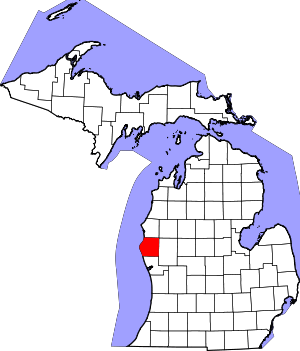 Map of Michigan highlighting Oceana County.svg | |
| Villages | ||
| Townships | ||
| Footnotes | ‡This populated place also has portions in an adjacent county or counties | |