Hamburg, Pennsylvania
Hamburg is a borough in Berks County, Pennsylvania, United States. The population was 4,289 at the 2010 census.[3] The town is named after Hamburg, Germany.
Hamburg, Pennsylvania | |
|---|---|
 House on North Fourth Street | |
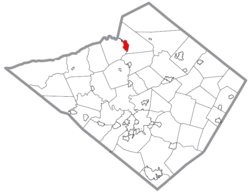 Location of Hamburg in Berks County, Pennsylvania. | |
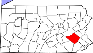
 Hamburg Location of Hamburg in Pennsylvania  Hamburg Hamburg (the United States) | |
| Coordinates: 40°33′N 75°59′W | |
| Country | United States |
| State | Pennsylvania |
| County | Berks |
| Area | |
| • Total | 1.96 sq mi (5.08 km2) |
| • Land | 1.89 sq mi (4.89 km2) |
| • Water | 0.07 sq mi (0.19 km2) |
| Elevation | 397 ft (121 m) |
| Population (2010) | |
| • Total | 4,289 |
| • Estimate (2018)[2] | 4,381 |
| • Density | 2,337.04/sq mi (902.14/km2) |
| Time zone | UTC-5 (EST) |
| • Summer (DST) | UTC-4 (EDT) |
| ZIP Code | 19526 |
| Area code(s) | 610 Exchange: 562 |
| FIPS code | 42-32120 |
| Website | hamburgboro |
Geography
Hamburg is located in northern Berks County at 40°33′0″N 75°59′0″W (40.556271, -75.982667),[4] on the east bank of the Schuylkill River. It is bordered on the north, east, and south by Windsor Township and on the west, across the river, by West Hamburg in Tilden Township.
According to the United States Census Bureau, Hamburg has a total area of 1.9 square miles (5.0 km2), of which 1.9 square miles (4.9 km2) is land and 0.08 square miles (0.2 km2), or 3.55%, is water.[3]
Demographics
| Historical population | |||
|---|---|---|---|
| Census | Pop. | %± | |
| 1800 | 329 | — | |
| 1830 | 560 | — | |
| 1850 | 1,035 | — | |
| 1860 | 1,334 | 28.9% | |
| 1870 | 1,590 | 19.2% | |
| 1880 | 2,010 | 26.4% | |
| 1890 | 2,127 | 5.8% | |
| 1900 | 2,315 | 8.8% | |
| 1910 | 2,301 | −0.6% | |
| 1920 | 2,764 | 20.1% | |
| 1930 | 3,637 | 31.6% | |
| 1940 | 3,717 | 2.2% | |
| 1950 | 3,805 | 2.4% | |
| 1960 | 3,747 | −1.5% | |
| 1970 | 3,909 | 4.3% | |
| 1980 | 4,011 | 2.6% | |
| 1990 | 3,987 | −0.6% | |
| 2000 | 4,114 | 3.2% | |
| 2010 | 4,289 | 4.3% | |
| Est. 2018 | 4,381 | [2] | 2.1% |
| Sources:[5][6][7] | |||
As of the census[6] of 2000, there were 4,114 people, 1,824 households, and 1,156 families residing in the borough. The population density was 2,212.2 people per square mile (854.0/km²). There were 1,932 housing units at an average density of 1,038.9 per square mile (401.0/km²). The racial makeup of the borough was 97.91% White, 0.34% African American, 0.12% Native American, 0.32% Asian, 0.49% from other races, and 0.83% from two or more races. Hispanic or Latino of any race were 0.83% of the population.
There were 1,824 households, out of which 25.7% had children under the age of 18 living with them, 50.7% were married couples living together, 9.1% had a female householder with no husband present, and 36.6% were non-families. 31.9% of all households were made up of individuals, and 16.9% had someone living alone who was 65 years of age or older. The average household size was 2.26 and the average family size was 2.82.
In the borough the population was spread out, with 21.1% under the age of 18, 7.2% from 18 to 24, 27.8% from 25 to 44, 23.4% from 45 to 64, and 20.6% who were 65 years of age or older. The median age was 40 years. For every 100 females, there were 88.8 males. For every 100 females age 18 and over, there were 84.1 males.
The median income for a household in the borough was $37,683, and the median income for a family was $50,957. Males had a median income of $37,650 versus $22,308 for females. The per capita income for the borough was $20,689. About 5.1% of families and 6.2% of the population were below the poverty line, including 11.4% of those under age 18 and 4.2% of those age 65 or over.
History
In 1779, Martin Kaercher Jr. received 250 acres (1.0 km2) of land from his father and divided it into building lots, naming the area "Kaercher Stadt". Hamburg was officially founded in 1787, named after the "German Hamburg" due to the largely German population of the region. On July 1, 1798 Hamburg became the second town with postal designation in Berks County, preceded only by Reading.
The Centre Turnpike was created in 1812 running between the two cities of Reading and Pottsville. Hamburg began to grow rapidly due to the close proximity of a major roadway. Eight years later (1820) the Schuylkill Canal was completed, followed quickly by railroad lines. Both of these advances in infrastructure had stops in Hamburg and boosted its population.
Hamburg Borough was officially organized in 1837.
The Hamburg Historic District, Hamburg Armory, and Hamburg Public Library are listed on the National Register of Historic Places.[8]
Schools
The Hamburg Area School District is geographically the largest in all of Berks County with a size of 103 square miles (270 km2). Within this area there are on average 2600 students, ranging from kindergarten to high school. The school district includes the towns of Hamburg and Shoemakersville, as well as the rural townships of Perry, Tilden, Upper Bern, Upper Tulpehocken, and Windsor.
There are two elementary schools, one located in Tilden Township and the other located in the Borough of Shoemakersville, that teach to students K-5. From there both schools combine into one middle school, grades 6-8, and then finally one high school, grades 9-12. Both the high school and middle school are located within Hamburg and are separated by less than 0.5 miles (800 m). There is also a nearby private high school, Blue Mountain Academy grades 9-12, that has an average enrollment of 204 students.
Of the 10 churches located in the Hamburg area, six of them offer a weekly Sunday or Sabbath school services. Many of these churches also have preschool programs for children too young to attend kindergarten.
Transportation
The Interstate 78/U.S. Route 22 freeway passes through the borough, with access from Exit 30 (North 4th Street). It is 28 miles (45 km) west of Allentown and 54 miles (87 km) east of Harrisburg, the state capital. Pennsylvania Route 61 passes through the southern part of the borough, leading south 16 miles (26 km) to Reading and north 18 miles (29 km) to Pottsville.
Berks Area Regional Transportation Authority (BARTA) provides bus service to Hamburg along Route 20, which heads south along PA 61 to the BARTA Transportation Center in Reading. There is a park and ride lot at the Redner's in Hamburg that is served by BARTA.[9] Schuylkill Transportation System provides bus service to Hamburg along Route 80, which heads north into Schuylkill County to Union Station Intermodal Transit Center in Pottsville.[10]
Passenger rail service connected Hamburg at one time to Reading and Philadelphia to the east and Pottsville to the west via the Philadelphia and Reading main line, later the Reading Railroad Pottsville Branch and later the Pottsville Line until 1981[11] when services ceased after all diesel services were discontinued by SEPTA.[12] The Reading Blue Mountain and Northern Railroad provides freight service to Hamburg, with a branch line running south from Hamburg to Temple and its Reading Division mainline passing through West Hamburg.[13]
Attractions
The Reading Railroad Heritage Museum , located at 500 S 3rd Street, is dedicated to the preservation of the Reading Railroad. Featuring a permanent model train layout and several pieces of rolling stock from various eras before the Conrail merger in 1976, the museum is open year-round on Saturdays and Sundays.
Notable people
- Jack Rowe, 19th Century baseball star, was born in Hamburg
- Richard Etchberger, United States Air Force member awarded Medal of Honor in Vietnam War, was born in Hamburg
- Fern Shollenberger, professional baseball player, was born in Hamburg
- Bill Beckley, Noted narrative/conceptual artist, was born in Hamburg
See also
References
- "2017 U.S. Gazetteer Files". United States Census Bureau. Retrieved Mar 24, 2019.
- "Population and Housing Unit Estimates". Retrieved October 14, 2019.
- "Geographic Identifiers: 2010 Demographic Profile Data (G001): Hamburg borough, Pennsylvania". U.S. Census Bureau, American Factfinder. Archived from the original on February 12, 2020. Retrieved March 6, 2014.
- "US Gazetteer files: 2010, 2000, and 1990". United States Census Bureau. 2011-02-12. Retrieved 2011-04-23.
- "Census of Population and Housing". U.S. Census Bureau. Retrieved 11 December 2013.
- "U.S. Census website". United States Census Bureau. Retrieved 2008-01-31.
- "Incorporated Places and Minor Civil Divisions Datasets: Subcounty Resident Population Estimates: April 1, 2010 to July 1, 2012". Population Estimates. U.S. Census Bureau. Archived from the original on 11 June 2013. Retrieved 11 December 2013.
- "National Register Information System". National Register of Historic Places. National Park Service. July 9, 2010.
- "Route 20 schedule" (PDF). BARTA. Retrieved February 21, 2017.
- "Southern Loop 80 bus schedule" (PDF). Schuylkill Transportation System. Retrieved December 9, 2019.
- Philadelphia and Reading Railroad: Passenger Time Table.
- Williams, Gerry (1998). Trains, Trolleys & Transit: A Guide to Philadelphia Area Rail Transit. Piscataway, New Jersey: Railpace Company. p. 47. ISBN 978-0-9621541-7-1.
- Reading & Northern Railroad System Map (Map). Reading Blue Mountain and Northern Railroad. Retrieved July 16, 2017.
External links
| Wikimedia Commons has media related to Hamburg, Pennsylvania. |
- Borough of Hamburg official website
- Historic Hamburg, visitors' website
- King Frost Parade
- Taste of Hamburg-er Festival
- Hamburg Area School District
- The Northern Berks Patriot Item
- Hamburg, Pennsylvania at city-data.com
| Authority control |
|
|---|