Green's Grant, New Hampshire
Green's Grant is a township located in Coos County, New Hampshire, United States. As of the 2010 census, the grant had a population of one.[1] The grant lies entirely within the White Mountain National Forest. The base of the Mount Washington Auto Road is located in Green's Grant.
Green's Grant, New Hampshire | |
|---|---|
_end_of_the_Mount_Washington_Auto_Road_in_Green's_Grant_Township%2C_Coos_County%2C_New_Hampshire.jpg) The bottom (east end) of the Mount Washington Auto Road is in Green's Grant. | |
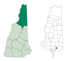 Location in Coos County, New Hampshire | |
| Coordinates: 44°18′02″N 71°13′19″W | |
| Country | United States |
| State | New Hampshire |
| County | Coos |
| Area | |
| • Total | 3.7 sq mi (9.6 km2) |
| • Land | 3.7 sq mi (9.6 km2) |
| • Water | 0 sq mi (0 km2) 0% |
| Elevation | 2,540 ft (770 m) |
| Population (2010) | |
| • Total | 1 |
| Time zone | UTC-5 (Eastern) |
| • Summer (DST) | UTC-4 (Eastern) |
| Area code(s) | 603 |
In New Hampshire, locations, grants, townships (which are different from towns), and purchases are unincorporated portions of a county which are not part of any town and have limited self-government (if any, as many are uninhabited).
History
John Wentworth, British colonial governor of New Hampshire, made the grant to Lieutenant Francis Green of Boston, one of the last land grants that Wentworth made to soldiers of the French and Indian Wars.[2]
Geography
According to the United States Census Bureau, the grant has a total area of 3.7 square miles (9.6 km2), none of which is covered by water bodies other than streams. The highest point in the grant is along its eastern boundary, on the lower slopes of Middle Carter Mountain, where the elevation reaches 2,540 feet (770 m) above sea level.
Demographics
| Historical population | |||
|---|---|---|---|
| Census | Pop. | %± | |
| 1860 | 14 | — | |
| 1870 | 71 | 407.1% | |
| 1880 | 8 | −88.7% | |
| 1890 | 30 | 275.0% | |
| 1900 | 13 | −56.7% | |
| 1910 | 4 | −69.2% | |
| 1920 | 5 | 25.0% | |
| 1930 | 4 | −20.0% | |
| 1940 | 3 | −25.0% | |
| 1950 | 0 | −100.0% | |
| 1960 | 2 | — | |
| 1970 | 0 | −100.0% | |
| 1980 | 0 | — | |
| 1990 | 0 | — | |
| 2000 | 0 | — | |
| 2010 | 1 | — | |
| Est. 2017 | 1 | [3] | 0.0% |
| U.S. Decennial Census[4] | |||
As of the 2010 census,[5] there was one person living in the grant.
References
- United States Census Bureau, American FactFinder, 2010 Census figures. Retrieved March 23, 2011.
- Julyan, Robert Hixson; Julyan, Mary (1993), Place Names of the White Mountains (Revised ed.), University Press of New England, p. 64, ISBN 978-0-87451-638-8
- "Annual Estimates of the Resident Population: April 1, 2010 to July 1, 2017 (PEPANNRES): Minor Civil Divisions – New Hampshire". Archived from the original on February 13, 2020. Retrieved November 14, 2018.
- "Census of Population and Housing". Census.gov. Retrieved June 4, 2016.
- "U.S. Census website". United States Census Bureau. Retrieved 2008-01-31.
Places adjacent to Green's Grant, New Hampshire | |
|---|---|
Municipalities and communities of Coös County, New Hampshire, United States | ||
|---|---|---|
| City |  Map of New Hampshire highlighting Coos County | |
| Towns | ||
| Townships |
| |
| CDPs | ||
| Other communities | ||