Gop, Odisha
Gop (also known as "Gope")[1][2][3] is a town and a NAC under jurisdiction of Puri district in the Indian state of Odisha. It is one of the main block covered under Puri district. It is famous for the Sun temple, Kathiawar (5th and 6th century AD) comprises square sanctum circumscribed by double courtyards.[4] The important villages like Biratunga(Swami Nigamananda's Ashram of Nilachala Saraswata Sangha, Puri is located here),[5] Begunia, Nimapara, Nagapur, Kakatpur, Bhaimapur, Ganeswarpur, Kusabhadra surround Gop.
Gop | |
|---|---|
city | |
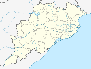 Gop Location in Odisha, India  Gop Gop (India) | |
| Coordinates: 19.98°N 86.01°E | |
| Country | |
| State | Odisha |
| District | Puri |
| Elevation | 6 m (20 ft) |
| Languages | |
| • Official | Odia |
| Time zone | UTC+5:30 (IST) |
| Vehicle registration | OD |
| Website | odisha |
Geography
Gop is located at 20.00°N 86.01°E.[6] It has an average elevation of 6 metres (20 ft).
It is about thirty kilometres from Puri, at the junction where the Konark road branches from the Bhubaneswar to Puri road.[7]
Politics
Gop is part of Jagatsinghpur (Lok Sabha constituency).[8]
See also
- Kushabhadra River
- Ganeswarpur
- Swami Nigamananda
- Basudeipur Sub Village
References
- Gop Map — Satellite Images of Gop
- Weather statistics for Gop in Odisha (India)
- Gop PIN Code, Puri
- Harish Chandra Das (1985). Cultural development in Orissa. Punthi Pustak. p. 262. Retrieved 13 June 2011.
- "Village Biratunga is located near Gop". Archived from the original on 17 June 2011. Retrieved 13 June 2011.
- Falling Rain Genomics, Inc - Gop
- various. Eng Mahabharata Revisited 1. Sahitya Akademi. pp. 2–. ISBN 978-81-260-2123-9. Retrieved 13 June 2011.
- "Assembly Constituencies - Corresponding Districts and Parliamentary Constituencies of Odisha" (PDF). Election Commission of India. Archived from the original (PDF) on 8 November 2005. Retrieved 17 September 2008.