Titlagarh
Titilagarh is a town and Municipality in Balangir district in the Indian state of Odisha.
Titilagarh | |
|---|---|
Town | |
| Nickname(s): TIG | |
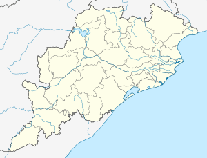 Titilagarh Location in Odisha, India | |
| Coordinates: 20.3°N 83.15°E | |
| Country | |
| State | Odisha |
| District | Bolangir |
| Government | |
| • Sub-Collector | Sudhakar Nayak (OAS) |
| • MLA | Gita Sahu (Tukuni) |
| • Municipality Chairperson | Gobardhan Nag |
| Elevation | 215 m (705 ft) |
| Population (2011) | |
| • Total | 31,258 |
| Languages | |
| • Official | Koshali |
| Time zone | UTC+5:30 (IST) |
| PIN | 767033 |
| Telephone code | 06655 |
| Vehicle registration | OD-03 |
| Coastline | 0 kilometres (0 mi) |
| Nearest city | Bolangir |
| Lok Sabha constituency | Balangir |
| Vidhan Sabha constituency | Titilagarh |
| Website | balangir |
Geography and Climate
Titilagarh is located at 20.3°N 83.15°E.[1] It has an average elevation of 215 metres (705 feet).
| Climate data for Titilagarh, India (1971-2000) | |||||||||||||
|---|---|---|---|---|---|---|---|---|---|---|---|---|---|
| Month | Jan | Feb | Mar | Apr | May | Jun | Jul | Aug | Sep | Oct | Nov | Dec | Year |
| Average high °C (°F) | 30.4 (86.7) |
33.5 (92.3) |
38.5 (101.3) |
42.0 (107.6) |
43.3 (109.9) |
38.5 (101.3) |
33.8 (92.8) |
32.7 (90.9) |
33.3 (91.9) |
34.1 (93.4) |
32.2 (90.0) |
30.2 (86.4) |
35.4 (95.7) |
| Average low °C (°F) | 14.2 (57.6) |
17.1 (62.8) |
21.3 (70.3) |
24.4 (75.9) |
26.6 (79.9) |
25.4 (77.7) |
24.5 (76.1) |
24.2 (75.6) |
24.1 (75.4) |
22.8 (73.0) |
18.1 (64.6) |
13.7 (56.7) |
21.4 (70.5) |
| Average precipitation mm (inches) | 13.7 (0.54) |
14.6 (0.57) |
17.2 (0.68) |
19.6 (0.77) |
39.4 (1.55) |
216.5 (8.52) |
369.3 (14.54) |
391.0 (15.39) |
216.0 (8.50) |
68.9 (2.71) |
13.0 (0.51) |
4.6 (0.18) |
1,384.1 (54.49) |
| Source: Indian Meteorological Department[2] | |||||||||||||
Demographics
As of 2001 India census,[3] Titilagarh had a population of 27,756. Males constitute 52% of the population and females 48%. Titilagarh has an average literacy rate of 67%, higher than the national average of 59.5%: male literacy is 75%, and female literacy is 57%. In Titilagarh, 12% of the population is under 6 years of age.
Transport
Titilagarh Junction railway station is a junction on the Jharsuguda - Vizianagaram line and Raipur - Vizianagaram line. Through this it is connected to all major cities of India. It was one of the major railway stations in the Sambalpur Railway Division under East Coast Railway Zone.
Titilagarh is near to NH-59 (previously known as NH-217), which runs between Gopalpur in Odisha and Raipur in Chhattisgarh. There is a state highway between Titilagarh and Balangir district via Saintala and between Titilagarh to Bhawanipatana via Sindhekela.
Notable people
- Sam Pitroda - Padma Bhushan awardee, Telecom engineer, inventor and entrepreneur.
- Jitendra Mishra - Film maker
- Humane Sagar - Playback Singer
- Saswat Joshi - Internationally acclaimed Odissi dancer
References
- Falling Rain Genomics, Inc - Titilagarh
- "CLIMATOLOGICAL TABLE PERIOD: 1971-2000". Indian Meteorological Department. Retrieved 31 January 2016.
- "Census of India 2001: Data from the 2001 Census, including cities, villages and towns (Provisional)". Census Commission of India. Archived from the original on 16 June 2004. Retrieved 1 November 2008.