Gabès Governorate
Gabès Governorate (Tunisian Arabic: ولاية ڨابس Wilāyat Gābis) is one of the 24 governorates of Tunisia and in south-eastern Tunisia. It covers an area of 7166 km²[1] and had a population of 374,300 as at the 2014 census.[2][3] The capital is Gabès.
Gabès ڨابس Gabis | |
|---|---|
Coat of arms | |
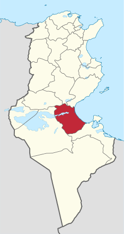 Map of Tunisia with Gabès highlighted | |
| Coordinates: 33°53′N 10°07′E | |
| Country | Tunisia |
| Created | June 21, 1956[1] |
| Capital | Gabès |
| Government | |
| • Governor | Abdelkarim Mesbah (DCR) |
| Area | |
| • Total | 7,166 km2 (2,767 sq mi) |
| Area rank | Ranked 8th of 24 |
| Population (2014) | |
| • Total | 374,300 |
| • Rank | Ranked 16th of 24 |
| • Density | 52/km2 (140/sq mi) |
| Demonym(s) | Gabesian (Arabic: قابسي, Gabsi) |
| Time zone | UTC+01 (CET) |
| Postal prefix | 60xx |
| Calling code | 75-2/75-3 |
| ISO 3166 code | TN-81 |
Geography
The governorate of Gabès is in southeast Tunisia on the coast of the Gulf of Gabès, 376 km south of the capital, Tunis.
Gabès has a hot Mediterranean climate. Gabès offers five contrasting landscapes: the beach, the mountains, the desert, small forest, oasis. It contains the eastern end of Chott el Fejej.
The coast is approximately half of that of the large bay. The gulf has several alternative names dating to antiquity and to an etymological association with onshore winds and sandbanks making navigation difficult, including Lesser Syrtis (see Gulf of Sidra which takes in also the mainly Libyan portion of the continental gulf).
Administrative divisions
Administratively, the governorate is divided into ten delegations (mutamadiyat), ten municipalities, nine rural councils, and 73 sectors (imadas).[1] The delegations and their populations from the 2004 and 2014 censuses,[2] are listed below:
| Delegation | Population in 2004 | Population in 2014 |
|---|---|---|
| El Hamma | 62,390 | 73,512 |
| El Metouia | 25,862 | 27,878 |
| Gabes Medina | 47,057 | 46,731 |
| Gabes Ouest | 28,389 | 31,768 |
| Gabes Sud | 61,699 | 74,422 |
| Ghannouch | 22,681 | 28,051 |
| Menzel El Habib | 11,477 | 10,148 |
| Mareth | 61,340 | 63,122 |
| Matmata | 5,766 | 4,444 |
| Nouvelle Matmata | 15,969 | 14,224 |
Ten municipalities are in Gabès Governorate:
| Code | Municipality | Population (2014)[4] |
|---|---|---|
| 5111 | Gabès | 130,984 |
| 5112 | Chenini Nahal | 14,803 |
| 5113 | Ghannouch | 28,051 |
| 5114 | Métouia | 10,716 |
| 5115 | Oudhref | 9,932 |
| 5116 | El Hamma | 41,607 |
| 5117 | Matmata | 1,847 |
| 5118 | Nouvelle Matmata | 7,526 |
| 5119 | Mareth | 11,678 |
| 5120 | Zarat | 5,627 |
Tourism
Matmata is a Berber-speaking town largely of underground homes conserved with a community-based pre-industrialized lifestyle. The south-centre of the Wilāyat has semi-desert mountains and natural features nearby include splendid oases and caves. Eclectic souqs feature in the main municipalities, with traditional wood, stone, metal and textile products.
References
- (in French) "tunisieindustrie.nat.tn". Archived from the original on 2014-12-19.
- "2014 Tunisian census data". Archived from the original on 2015-05-18.
- (in French) Census 2014 (National Institute of Statistics) Archived 2014-10-29 at the Wayback Machine
- Recensement Général de la Population et de l'Habitat 2014 – Population, logements et ménages par commune et arrondissement [Census 2014 results – population, accommodation and households per municipality and delegation] (Report) (in French). National Institute of Statistics. 1 April 2015. Retrieved 18 February 2016.
Governorates and regions of Tunisia | ||
|---|---|---|
| Governorates | ||
| Regions | ||
WikiProject Tunisia | ||