Mahdia Governorate
Mahdia Governorate (Tunisian Arabic: ولاية المهدية) is in central-eastern Tunisia, named after its largest town, its administrative centre. It comprises an area of coastal relative lowlands and is one of the twenty-four governorates (provinces). It covers an area of 2,966 km², extends further inland than its coastal length and has a population of 410,812 (as at the 2014 census).[1] Three districts neighbour, clockwise from south, Sfax, Kairouan and Sousse Governorates.
Mahdia ولاية المهدية | |
|---|---|
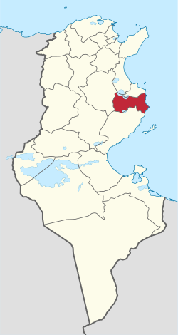 Map of Tunisia with Mahdia highlighted | |
| Coordinates: 35°30′N 11°04′E | |
| Country | Tunisia |
| Created | June 5, 1974 |
| Capital | Mahdia |
| Area | |
| • Total | 2,966 km2 (1,145 sq mi) |
| Area rank | Ranked 16th of 24 |
| Population (2014) | |
| • Total | 410,812 |
| • Rank | Ranked 14th of 24 |
| • Density | 140/km2 (360/sq mi) |
| Time zone | UTC+01 (CET) |
| Postal prefix | xx |
| ISO 3166 code | TN-53 |
Economic summary

Mahdia, the administrative centre, is a coastal resort with prominent weaving and fish processing industries.[2]
The other coastal urban centre is the small town of Chebba, on the headland of a bay. Ksour Essef is midway between these towns and approximately 2.5 km inland. El Djem is 13 km inland and a mid-sized town on a major crossroads of roads in the district and having Tunisia's main north-south railway. The nearest international airport is connected by road and rail and is 15 km north of Mahdia (the town), Monastir Habib Bourguiba International Airport.
Synopsis of history

The two main coastal cities are of historic note to Greek, Roman, and early Muslim societies. They include the Mahdia shipwreck – a sunken ship found off Mahdia's shore, containing Greek art treasures – dated to about 80 BC, the early part of Roman rule in this region. The old part of Mahdia corresponds to the Roman city called Aphrodisium and, later, called Africa (a name perhaps derived from the older name),[3][4] or Cape Africa.[5][6][7][8]
Climate
The climate is semiarid throughout particularly in the summer and due to the high albedo effects compared to provinces of the far north, nighttime temperatures tend to fall more, to a similar temperature to average upland parts of the north. Much of the developed area benefits from the Sousse area's advanced water distribution network from dammed rivers and lakes including those hundreds of miles to the west which provides water for domestic use and pools.
Administrative divisions
Eighteen municipalities are in Mahdia Governorate: Bou Merdes, Bradaa, Chebba, Chorbane, Eljem, Essouassi, Hebira, Hkaima, Kerker, Ksour Essef, Mahdia, Melloulèche, Ouled Chamekh, Rejiche, Sidi Alouane, Sidi Zid, Tlelsa and Zelba.
| Code | Municipality | Population (2014)[9] |
|---|---|---|
| 3311 | Mahdia | 51,833 |
| 3312 | Rejiche | 10,806 |
| 3313 | Bou Merdes | 4,338 |
| 3314 | Ouled Chamekh | 5,120 |
| 3315 | Chorbane | 5,700 |
| 3316 | Hebira | 3,248 |
| 3317 | Essouassi | 5,381 |
| 3318 | El Djem | 21,234 |
| 3319 | Kerker | 7,467 |
| 3320 | Chebba | 22,227 |
| 3321 | Melloulèche | 6,704 |
| 3322 | Sidi Alouane | 7,500 |
| 3323 | Ksour Essef | 28,842 |
| 3324 | El Bradâa | 7,404 |
Electorally and for some more national purposes, Mahdia has eleven delegations, most boundaries of which are similar to the governorates.
See also
References
- (in French) Census 2014 (National Institute of Statistics) Archived 2014-10-29 at the Wayback Machine
- "MAHDIA:Finger pointing at the sea". Lexicorient.com. Retrieved 2012-07-15.
- "Aphrodisium, which is now commonly called Africa, but by the Moors Mahdia" (Antique Map of Tunis, Mahdia & Peñon de Veles by Braun & Hogenberg
- Fiche technique des sites archéologiques de Mahdia
- Geographical Names: Cape Africa: Tunisia
- Satellite view of Cape Africa
- Kenneth Meyer Setton, The Papacy and the Levant, 1204-1571 (American Philosophical Society 1984 ISBN 978-0-87169161-3), p. 533
- Charles Tissot, Géographie comparée de la province romaine d'Afrique (Paris 1888), p. 176
- Recensement Général de la Population et de l'Habitat 2014 – Population, logements et ménages par commune et arrondissement [Census 2014 results – population, accommodation and households per municipality and delegation] (Report) (in French). National Institute of Statistics. 1 April 2015. Retrieved 18 February 2016.
Governorates and regions of Tunisia | ||
|---|---|---|
| Governorates | ||
| Regions | ||
WikiProject Tunisia | ||