Fasa
Fasa (Persian: فسا, also Romanized as Fassa)[2] is a city and capital of Fasa County, Fars Province, Iran. At the 2016 census, its population was 110,825, in 33,379 families. Fasa is the fourth most populous city of the province.[3] The city dates back to the Achaemenid period.[4]
Fasa فَسا | |
|---|---|
City | |
 | |
 Fasa | |
| Coordinates: 28°56′18″N 53°38′54″E | |
| Country | |
| Province | Fars |
| County | Fasa |
| Bakhsh | Central |
| Area | |
| • City | 25.5 km2 (9.8 sq mi) |
| Area rank | 3rd |
| Elevation | 1,150 m (3,770 ft) |
| Population (2016 Census) | |
| • Density | 4,346/km2 (11,260/sq mi) |
| • Urban | 110,825 [1] |
| • Population Rank | 4th |
| Time zone | UTC+3:30 (IRST) |
| • Summer (DST) | UTC+4:30 (IRDT) |
| Website | shfasa |
Fasa's economy is based on agriculture and Pastoralism. Jahrom, Darab, Sarvestan, Kherameh and Estahban are neighbours of Fasa. This city is located on the road from Shiraz to Kerman, This has made Fasa a strategic and important city.
Name
In the inscriptions of Persepolis, Fasa is mentioned as "Pashiya" or "Bashiya". Based on the contents of Tablet No. 53 of Persepolis Administrative Archives, George Glenn Cameron considers the location of the city of "Pashiya" or "Bashiya" to correspond to the current location of the city of Fasa. The word "Bashiya" is actually the Elamite form of the word Pasa. Due to the lack of the letter "P" in Arabic, the word was pronounced "Basa" and sometimes "Fasa" after the Muslim conquest of Persia and cultural exchanges. Fasa literally means "residence and camp". Researchers have also considered the meaning of the word Fasa "the city of the Persians".[4][5]
History
Fasa is one of the historical cities of Iran. The city dates back to the Achaemenid period, when the city's name was "Pasa" or "Pashiya". In the Sassanid period, the remains of the old city, the fortress and the Sassanid fire temple, and also the presence of the Fasaei people in the political and cultural affairs of that time, show that Fasa had a special position and prosperity during this period. Fasa was conquered by the Muslims in 638 after a fierce battle. Fasa was the second most important city of Darabgerd province in the tenth century. Urban Foundations of Fasa (Grand Mosque, Bazaar, Bath, etc.) was established during the Safavid period and expanded during the Afsharids. Epidemics, famines, political games, insecurity and looting were among the most important factors in the destruction and decline of Fasa's prosperity during the Qajar period.[4]
Climate
Fasa has a hot semi-arid climate (Köppen climate classification: BSh). Its average rainfall is about 290 millimetres (11 in) per year.
| Climate data for Fasa | |||||||||||||
|---|---|---|---|---|---|---|---|---|---|---|---|---|---|
| Month | Jan | Feb | Mar | Apr | May | Jun | Jul | Aug | Sep | Oct | Nov | Dec | Year |
| Record high °C (°F) | 20 (68) |
23 (73) |
27 (81) |
34 (93) |
37 (99) |
41 (106) |
42 (108) |
40 (104) |
39 (102) |
33 (91) |
30 (86) |
24 (75) |
42 (108) |
| Average high °C (°F) | 9 (48) |
13 (55) |
17 (63) |
23 (73) |
29 (84) |
34 (93) |
36 (97) |
36 (97) |
32 (90) |
26 (79) |
19 (66) |
13 (55) |
36 (97) |
| Daily mean °C (°F) | 8 (46) |
9 (48) |
12 (54) |
16 (61) |
22 (72) |
28 (82) |
31 (88) |
30 (86) |
27 (81) |
22 (72) |
16 (61) |
10 (50) |
18 (64) |
| Average low °C (°F) | 1 (34) |
3 (37) |
7 (45) |
12 (54) |
17 (63) |
22 (72) |
24 (75) |
23 (73) |
19 (66) |
13 (55) |
7 (45) |
4 (39) |
24 (75) |
| Record low °C (°F) | −12 (10) |
−2 (28) |
−3 (27) |
−2 (28) |
7 (45) |
11 (52) |
16 (61) |
13 (55) |
7 (45) |
3 (37) |
−5 (23) |
−5 (23) |
−12 (10) |
| Average precipitation mm (inches) | 68 (2.7) |
66 (2.6) |
49 (1.9) |
33 (1.3) |
7 (0.3) |
0 (0) |
0 (0) |
2 (0.1) |
0 (0) |
0 (0) |
10 (0.4) |
55 (2.2) |
292 (11.5) |
| Source: www.myforecast.com[6], Fars province Meteorological Organization[7] | |||||||||||||
Demographics
At the 2016 census, its population was 110,825, in 33,379 families.[8] people of Fasa speak Persian language. There is also a significant Khamseh Arab minority in Fasa. Almost all of the people are Shia Muslims.[4]
| Historical population | ||
|---|---|---|
| Year | Pop. | ±% |
| 1976 | 31,489 | — |
| 1986 | 64,771 | +105.7% |
| 1991 | 74,478 | +15.0% |
| 1996 | 81,706 | +9.7% |
| 2006 | 92,020 | +12.6% |
| 2011 | 104,809 | +13.9% |
| 2016 | 110,825 | +5.7% |
Economy
Fasa is thriving in terms of agriculture. Fasa is known as the city of wheat. Due to the favorable climate, palms, walnut trees, and citrus such as oranges, tangerines, pomegranates, pistachios, almonds, and walnuts are common in this city. Cotton cultivation has also flourished in Fasa.[9]
Pastoralism is the second base of Fasa's economy. A variety of livestock and dairy products, wool, leather, meat, are the products of the city.
There is also an under construction petrochemical project in the city. The construction stated in 2012 and after the complete operation, It will produce Low density polyethylenes.[10]
Education
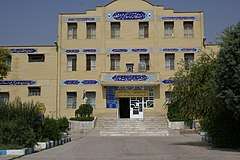
Health and Cure
Fasa has two hospitals in operation and one hospital under construction.
- Valie Asr Hospital
- Dr. Shariati Hospital
- Emam Hossein Hospital (under construction)[12]
Clinics
- Valie Asr Clinic
- Hamzeh Clinic
- Yasaei Clinic[12]
Transport
Roads
Shiraz-Fasa highway, The highway which connects Fasa to Shiraz is in operation. Fasa-Darab and Fasa-Estahban-Neyriz highway projects are also under construction.[13]
Railway
Currently, the Shiraz-Golgohar railway is passing through Fasa with the aim of connecting Shiraz to the Golgohar mines and Kerman province. The length of this route is 346 kilometres (215 mi), which is under construction in 4 phases and connects Shiraz to Golgohar through Sarvestan, Fasa, Estahban and Neyriz.[14]
Airport
Fasa Airport is an airport near Fasa. The airport is currently inactive, but studies of the airport's development plan, improving and increasing the length of the runway with the aim of resuming commercial flights are being done. The airport has a 1,982 metres (6,503 ft) runway.[15]
Attractions and Monuments
- Tale Zahak
- Tale Nalaki
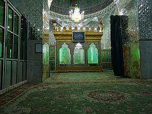
- Imamzadeh Hasan
- Imamzadeh Qasem
- Imamzadeh Ismael
- Mianjangal Jungle
- Kharmankooh mountain
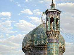
- Sassanid fire temple
- The Naghare-khane building[16]
References
- https://www.amar.org.ir/english
- Fasa can be found at GEOnet Names Server, at this link, by opening the Advanced Search box, entering "-3062808" in the "Unique Feature Id" form, and clicking on "Search Database".
- "Census of the Islamic Republic of Iran, 1395 (2016)" (Excel). Islamic Republic of Iran.
- Rezazadeh, Jalil (2009). From Pasa to Pasa. Fanoos Andisheh. ISBN 9786009085521.
- "About Fasa". University of Fasa. Retrieved 9 April 2020.
- "Fasa climate". www.myforecast.com. Retrieved 25 July 2010.
- "Fasa" (PDF). Fars province Meteorological Organization. Retrieved 2020-04-08.
- "Census of the Islamic Republic of Iran, 1395 (2016)" (Excel). Islamic Republic of Iran.
- "Fasa introduction". Fars Province Rural Cooperative Organization. Retrieved 8 April 2020.
- "Fasa petrochemical project". Shiraz Novin News. Retrieved 9 April 2020.
- "Fasaei bread, the sweet souvenirs of Fasa". IRIB News. Retrieved 9 April 2020.
- "Fasa university of medical sciences". Retrieved 8 April 2020.
- "Exploitation of 30 km of Fasa Darab highway by the end of this year". YJC. Retrieved 8 April 2020.
- "Allocation of 35 billion tomans to Shiraz-Golgohar railway". Shiraz 1400. Retrieved 8 April 2020.
- "Fasa Airport". Iran Airports Company. Retrieved 8 April 2020.
- "About Fasa". Fasa University of Medical Sciences (FUMS). Retrieved 9 April 2020.
External links
| Wikivoyage has a travel guide for Fasa. |
| Wikimedia Commons has media related to Fasa. |

| Capital | |||||||||||||||||||||||||||||||||||||||||
|---|---|---|---|---|---|---|---|---|---|---|---|---|---|---|---|---|---|---|---|---|---|---|---|---|---|---|---|---|---|---|---|---|---|---|---|---|---|---|---|---|---|
| Districts |
| ||||||||||||||||||||||||||||||||||||||||