Falun, Kansas
Falun is an unincorporated community and census-designated place in southwestern Saline County, Kansas, United States. It lies southwest of Salina and northwest of Lindsborg at the intersection of Forsse Road and Hedberg Road, about 7.5 miles west of Interstate 135 highway, or about 8 miles west of Assaria.[1] It lies next to an abandoned railroad.
Falun, Kansas | |
|---|---|
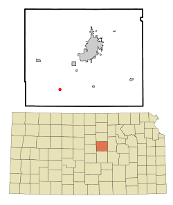 Location within Saline County and Kansas | |
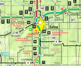 KDOT map of Saline County (legend) | |
| Coordinates: 38°40′16″N 97°45′34″W | |
| Country | United States |
| State | Kansas |
| County | Saline |
| Founded | 1870 |
| Time zone | UTC-6 (CST) |
| • Summer (DST) | UTC-5 (CDT) |
| ZIP code | 67442 |
| Area code | 785 |
History
The first post office in Falun was established in 1870.[2]
Although it is unincorporated, it has a post office, with the ZIP code of 67442.[3]
Geography
Its elevation is 1,348 feet (411 m), and it is located at 38°40′16″N 97°45′34″W (38.6711171, -97.7594855).[4]
Demographics
Falun is part of the Salina Micropolitan Statistical Area.[5]
Education
The community is served by Smoky Valley USD 400 public school district.
Notable people
- U. Alexis Johnson (1908-1997), United States diplomat was born in Falun.
References
- Rand McNally. The Road Atlas '08. Chicago: Rand McNally, 2008, p. 41.
- "Kansas Post Offices, 1828-1961". Kansas Historical Society. Archived from the original on October 9, 2013. Retrieved 23 June 2014.
- Zip Code Lookup
- Geographic Names Information System Feature Detail Report, Geographic Names Information System, 1978-10-13. Accessed 2008-04-12.
- Nussle, Jim (2008-11-20). "Micropolitan Statistical Areas" (PDF). List 1-9. Office of Management and Budget, Executive Office of the President. p. 97. Retrieved 2010-04-02.
Further reading
External links
| Wikimedia Commons has media related to Falun, Kansas. |
- Saline County Map, KDOT
Municipalities and communities of Saline County, Kansas, United States | ||
|---|---|---|
| Cities | 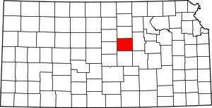 Map of Kansas highlighting Saline County | |
| CDPs | ||
| Unincorporated communities | ||
| Townships |
| |
| Footnotes | ‡This populated place also has portions in an adjacent county or counties | |
This article is issued from Wikipedia. The text is licensed under Creative Commons - Attribution - Sharealike. Additional terms may apply for the media files.