New Cambria, Kansas
New Cambria is a city in Saline County, Kansas, United States. As of the 2010 census, the city population was 126.[6]
New Cambria, Kansas | |
|---|---|
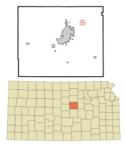 Location within Saline County and Kansas | |
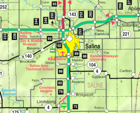 KDOT map of Saline County (legend) | |
| Coordinates: 38°52′43″N 97°30′21″W | |
| Country | United States |
| State | Kansas |
| County | Saline |
| Incorporated | 1913 |
| Named for | Cambria County, Pennsylvania |
| Area | |
| • Total | 0.22 sq mi (0.57 km2) |
| • Land | 0.22 sq mi (0.57 km2) |
| • Water | 0 sq mi (0 km2) |
| Elevation | 1,194 ft (364 m) |
| Population | |
| • Total | 126 |
| • Estimate (2016)[3] | 124 |
| • Density | 570/sq mi (220/km2) |
| Time zone | UTC-6 (CST) |
| • Summer (DST) | UTC-5 (CDT) |
| ZIP code | 67470 |
| Area code | 785 |
| FIPS code | 20-50300 [4] |
| GNIS ID | 0476643 [5] |
History
New Cambria was named after Cambria County, Pennsylvania, the native home of an early settler.[7]
The first post office in New Cambria was established in June 1873.[8]
Geography
New Cambria is located at 38°52′43″N 97°30′21″W (38.878504, -97.505730).[9] According to the United States Census Bureau, the city has a total area of 0.22 square miles (0.57 km2), all of it land.[1]
Demographics
| Historical population | |||
|---|---|---|---|
| Census | Pop. | %± | |
| 1880 | 47 | — | |
| 1920 | 127 | — | |
| 1930 | 130 | 2.4% | |
| 1940 | 144 | 10.8% | |
| 1950 | 160 | 11.1% | |
| 1960 | 187 | 16.9% | |
| 1970 | 160 | −14.4% | |
| 1980 | 175 | 9.4% | |
| 1990 | 152 | −13.1% | |
| 2000 | 150 | −1.3% | |
| 2010 | 126 | −16.0% | |
| Est. 2016 | 124 | [3] | −1.6% |
| U.S. Decennial Census | |||
It is part of the Salina Micropolitan Statistical Area.[10]
2010 census
As of the census[2] of 2010, there were 126 people, 56 households, and 37 families living in the city. The population density was 572.7 inhabitants per square mile (221.1/km2). There were 70 housing units at an average density of 318.2 per square mile (122.9/km2). The racial makeup of the city was 96.8% White, 0.8% Native American, and 2.4% from two or more races. Hispanic or Latino of any race were 0.8% of the population.
There were 56 households of which 21.4% had children under the age of 18 living with them, 50.0% were married couples living together, 10.7% had a female householder with no husband present, 5.4% had a male householder with no wife present, and 33.9% were non-families. 30.4% of all households were made up of individuals and 7.2% had someone living alone who was 65 years of age or older. The average household size was 2.25 and the average family size was 2.81.
The median age in the city was 46 years. 17.5% of residents were under the age of 18; 8.8% were between the ages of 18 and 24; 21.4% were from 25 to 44; 33.4% were from 45 to 64; and 19% were 65 years of age or older. The gender makeup of the city was 51.6% male and 48.4% female.
2000 census
As of the census[4] of 2000, there were 150 people, 57 households, and 44 families living in the city. The population density was 1,463.7 people per square mile (579.2/km²). There were 66 housing units at an average density of 644.0 per square mile (254.8/km²). The racial makeup of the city was 96.67% White, 1.33% African American, and 2.00% from two or more races.
There were 57 households out of which 36.8% had children under the age of 18 living with them, 59.6% were married couples living together, 12.3% had a female householder with no husband present, and 21.1% were non-families. 15.8% of all households were made up of individuals and 1.8% had someone living alone who was 65 years of age or older. The average household size was 2.63 and the average family size was 2.89.
In the city, the population was spread out with 27.3% under the age of 18, 7.3% from 18 to 24, 33.3% from 25 to 44, 22.7% from 45 to 64, and 9.3% who were 65 years of age or older. The median age was 36 years. For every 100 females, there were 123.9 males. For every 100 females age 18 and over, there were 113.7 males.
The median income for a household in the city was $36,607, and the median income for a family was $40,500. Males had a median income of $30,250 versus $23,125 for females. The per capita income for the city was $15,218. There were 2.0% of families and 5.5% of the population living below the poverty line, including 9.5% of under eighteens and none of those over 64.
Education
The community is served by Solomon USD 393 public school district.
References
- "US Gazetteer files 2010". United States Census Bureau. Archived from the original on 2012-01-25. Retrieved 2012-07-06.
- "U.S. Census website". United States Census Bureau. Retrieved 2012-07-06.
- "Population and Housing Unit Estimates". Retrieved June 9, 2017.
- "U.S. Census website". United States Census Bureau. Retrieved 2008-01-31.
- "US Board on Geographic Names". United States Geological Survey. 2007-10-25. Retrieved 2008-01-31.
- "2010 City Population and Housing Occupancy Status". U.S. Census Bureau. Retrieved March 6, 2011.
- Heim, Michael (2007). Exploring Kansas Highways. p. 39.
- "Kansas Post Offices, 1828-1961". Kansas Historical Society. Archived from the original on October 9, 2013. Retrieved 23 June 2014.
- "US Gazetteer files: 2010, 2000, and 1990". United States Census Bureau. 2011-02-12. Retrieved 2011-04-23.
- Nussle, Jim (2008-11-20). "Micropolitan Statistical Areas" (PDF). List 1-9. Office of Management and Budget, Executive Office of the President. p. 97. Retrieved 2010-04-02.
Further reading
External links
| Wikimedia Commons has media related to New Cambria, Kansas. |
- City
- Maps
- Saline County Map, KDOT
Municipalities and communities of Saline County, Kansas, United States | ||
|---|---|---|
| Cities | 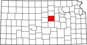 Map of Kansas highlighting Saline County | |
| CDPs | ||
| Unincorporated communities | ||
| Townships |
| |
| Footnotes | ‡This populated place also has portions in an adjacent county or counties | |