Fairview Downs
Fairview Downs is a suburb in eastern Hamilton in New Zealand.[1]
Fairview Downs | |
|---|---|
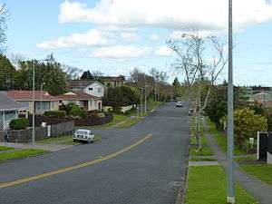 A neighbourhood in Fairview Downs, Hamilton. | |
| Country | New Zealand |
| Local authority | Hamilton, New Zealand |
| Electoral ward | Hamilton East |
| Established | 1970s |
| Population (2006 Census) | |
| • Total | 3,333 |
| Chedworth Park | Gordonton | Puketaha |
| Chartwell |
|
Newstead |
| Enderley | Greenhill Park | Silverdale |
It was developed in stages.
Tramway Road, the western boundary of Fairview, was shown as a proposed tramway on an 1865 map.[2] It seems to have been of double width to accommodate a tramway to Cambridge[3] and to have first been discussed by Kirikiriroa Road Board in 1872,[4] though clearing and gravelling didn't start until 1891[4] and metalling was continuing in 1925.[5] Hamilton Libraries say it was a crown grant and named c. 1890 - 1900 by civic leaders, surveyors and citizens, because there was a tramway in the vicinity.[6]
Carrs Road was named in 1917 by the Carr family who owned it.[7] Alderson Road was named between 1936-40 by A.J. Thompson, the subdivider, after the Alderson family who originally owned the land.[8]
The area south of Powells Road was developed in 1962 by D.M. McKenzie.[9]
Fairview Street was named in 1967 by Alf Steele, the developer, who wanted a name that made the area sound more attractive.[10] A developer bought the farm to the south in 1967.[4] Fairview, to the north of Powells Road, was turned into housing between 1970[5] and 1974 by Peerless Homes Ltd., owned by Alf Steele.[11]
Demographics
According to the 2006 census, Fairview Downs has a population of 3333.[12] The Index of Socioeconomic Deprivation, ranked 1-10 from lowest to most deprived areas, lists Fairview Downs at 7/10 (moderate deprivation).[13]
Fairview Downs census area lost and gained a few small areas on its western fringe in 2018.[14] The population has increased slowly. They are younger than the 37.4 years of the national average, but close to the national median income, with more than double Hamilton's Māori average of 23.7%, as shown below (2013 boundary figures in brackets) -
| Year | Population | Median age | Households | Median income | National median income |
|---|---|---|---|---|---|
| 1996 | (2,547) | (855)[15] | |||
| 2001 | (3,114) | (28.5) | (1,032) | ($20,300) | $18,500 |
| 2006 | 2,976 (3,333) | (29) | (1,110) | ($25,500) | $24,100 |
| 2013 | 2,982 (3,330) | (29.4) | (1,110) | ($28,100)[16] | $27,900[17] |
| 2018 | 3,201 | 30.4 | 1,029 | $31,700[18] | $31,800 |
In 2018 the main ethnic groups were -
| European | Māori | Asian | Pacific |
|---|---|---|---|
| 61.2% | 30.6% | 12.7% | 7.2% |
References
- "Hamilton Map". Hamilton City Council. Archived from the original on 23 September 2010. Retrieved 18 September 2010.
- "Plan of the Military settlements in the Upper Waikato District". ap01.alma.exlibrisgroup.com. Retrieved 26 April 2020.
- "THE CAMBRIDGE BRANCH RAILWAY. WAIKATO TIMES". paperspast.natlib.govt.nz. 5 July 1879. Retrieved 2 May 2020.
- "WAIKATO TIMES". paperspast.natlib.govt.nz. 27 July 1872. Retrieved 16 April 2020.
- "PUKETAHA. WAIKATO TIMES". paperspast.natlib.govt.nz. 25 February 1925. Retrieved 18 April 2020.
- "Tramway Road". ketehamilton.peoplesnetworknz.info. Retrieved 16 April 2020.
- "Carrs Road". ketehamilton.peoplesnetworknz.info. Retrieved 16 April 2020.
- "Alderson Road". ketehamilton.peoplesnetworknz.info. Retrieved 16 April 2020.
- "Northolt Road". ketehamilton.peoplesnetworknz.info. Retrieved 16 April 2020.
- "Fairview Street". ketehamilton.peoplesnetworknz.info. Retrieved 16 April 2020.
- "Radiata Street". ketehamilton.peoplesnetworknz.info. Retrieved 16 April 2020.
- "Fairview Downs Quickfacts". Retrieved 1 November 2010.
- "Index of Socioeconomic Deprivation for Areas within the Hamilton East Electorate". Parliament New Zealand. Retrieved 1 November 2010.
- "Geographic Boundary Viewer". statsnz.maps.arcgis.com. Retrieved 4 April 2020.
- "2006 Census of Population and Dwellings - Hamilton City". Stats NZ.
- "2013 Census map – QuickStats about a place". archive.stats.govt.nz. Retrieved 2 May 2020.
- "2013 Census map – QuickStats about a place". archive.stats.govt.nz. Retrieved 4 April 2020.
- "2018 Census place summaries". www.stats.govt.nz. Retrieved 2 May 2020.