Fairfield, Hamilton
Fairfield is a suburb to the northeast of central Hamilton, New Zealand. Fairfield is named after the dairy farm of John Davies, who bought 100 acres (0.40 km2) from F. R. Claude. This area experienced rapid growth in the 1950s and 60s.
Fairfield | |
|---|---|
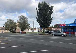 Fairfield Methodist Church and liquor store, Heaphy Terrace | |
| Country | New Zealand |
| Local authority | Hamilton, New Zealand |
| Electoral ward | Hamilton East |
| Established | 1949 |
| Population (2006 Census) | |
| • Total | 4,698 |
| Te Rapa | Chartwell | Chedworth Park |
| Forest Lake, Beerescourt |
|
Fairview Downs |
| Central Hamilton | Claudelands | Enderley |
History
Fairfield is named after the dairy farm of John Davies, who bought 100 acres (0.40 km2) from F. R. Claude. This area experienced rapid growth in the 1950s and 60s.[1]
Features of Fairfield
Fairfield Bridge
Fairfield Bridge crosses the Waikato River and connects Fairfield with suburbs west of the river. It is a 457-foot (139 m) reinforced concrete road bridge,[2] and well-known landmark.[3][4] The bridge was built by Caesar Roose in 1936. It has a twin further north on the Waikato River at Tuakau.
Demographics
According to the 2006 census, Fairfield has a population of 4698.[5] The Index of Socioeconomic Deprivation, ranked 1-10 from lowest to most deprived areas, lists Clarkin and Porritt statistical zones at 9/10 (high deprivation).[6] A study based on the 2013 census said that the suburb was a deprived and below-average area, apart from housing.[7]
Education
- Waikato Diocesan School is a private girls secondary school with boarding facilities. It has a decile rating of 10.
- Fairfield College is a co-educational state high school (years 9-13) with a decile rating of 4 and a roll of 1050 in 2011.[8] The school was founded in 1958.
- Fairfield Intermediate is a co-educational state intermediate (years 7-8) school. It has a decile rating of 5 and a roll of 720.[9]
- Fairfield Primary School is a co-educational contributing primary (years 1-6) state school. It has a decile rating of 1 and a roll of 314.[10]
- St. Joseph's Catholic School is a co-educational full primary school (years 1-8) a decile rating of 8 and a roll of 357.[11]
- Woodstock School is a co-educational contributing primary (years 1-6) school. It has a decile rating of 6 and a roll of 380. The school was founded in 1950.[12]
See also
References
- "Lugton's Real Estate>Suburb profile - Fairfield". Archived from the original on 15 October 2008. Retrieved 5 September 2009.
- "Fairfield Bridge". Hamilton City Libraries. Archived from the original on 23 October 2009. Retrieved 23 October 2009.
- "Fairfield Bridge". Register of Historic Places. Heritage New Zealand. Retrieved 23 October 2009.
- "Water levels may affect Hamilton bridge". The New Zealand Herald. 13 November 2002. Retrieved 23 October 2009.
- "Clarkin Quickfacts". Retrieved 1 November 2010.
- "Index of Socioeconomic Deprivation for Areas within the Hamilton East Electorate". Parliament New Zealand. Retrieved 1 November 2010.
- "Report reveals deep pockets of deprivation in the Waikato". Stuff (Fairfax). 31 May 2018.
- Education Counts: Fairfield College
- "Te Kete Ipurangi schools database". Retrieved 10 October 2010.
- "Te Kete Ipurangi schools database". Retrieved 10 October 2010.
- Education Counts: St Joseph's Catholic School
- "Te Kete Ipurangi schools database". Retrieved 10 October 2010.