Estral Beach, Michigan
Estral Beach is a village in Monroe County in the U.S. state of Michigan. The population was 418 at the 2010 census. The village is located within Berlin Charter Township.
Estral Beach, Michigan | |
|---|---|
 Fire department and village hall | |
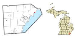 Location within Monroe County | |
 Estral Beach Location within the state of Michigan | |
| Coordinates: 41°59′03″N 83°14′09″W | |
| Country | United States |
| State | Michigan |
| County | Monroe |
| Township | Berlin |
| Incorporated | 1925 |
| Area | |
| • Total | 0.46 sq mi (1.2 km2) |
| • Land | 0.46 sq mi (1.2 km2) |
| • Water | 0.0 sq mi (0 km2) |
| Elevation | 571 ft (174 m) |
| Population | |
| • Total | 418 |
| • Estimate (2018)[3] | 400 |
| • Density | 911.36/sq mi (351.48/km2) |
| Time zone | UTC-5 (Eastern (EST)) |
| • Summer (DST) | UTC-4 (EDT) |
| ZIP code(s) | 48166 (Newport) |
| Area code(s) | 734 |
| FIPS code | 26-26460[4] |
| GNIS feature ID | 0625652[5] |
| Website | Official website |
History
Estral Beach was incorporated as a village in 1925.[6]
Geography
According to the United States Census Bureau, the village has a total area of 0.46 square miles (1.19 km2), all land.[7]
Demographics
| Historical population | |||
|---|---|---|---|
| Census | Pop. | %± | |
| 1940 | 78 | — | |
| 1950 | 188 | 141.0% | |
| 1960 | 254 | 35.1% | |
| 1970 | 419 | 65.0% | |
| 1980 | 463 | 10.5% | |
| 1990 | 430 | −7.1% | |
| 2000 | 486 | 13.0% | |
| 2010 | 418 | −14.0% | |
| Est. 2018 | 400 | [3] | −4.3% |
| U.S. Decennial Census[8] | |||
2010 census
As of the census[2] of 2010, there were 418 people, 183 households, and 114 families residing in the village. The population density was 908.7 inhabitants per square mile (350.9/km2). There were 220 housing units at an average density of 478.3 per square mile (184.7/km2). The racial makeup of the village was 99.3% White and 0.7% Native American. Hispanic or Latino of any race were 1.0% of the population.
There were 183 households of which 28.4% had children under the age of 18 living with them, 51.9% were married couples living together, 6.6% had a female householder with no husband present, 3.8% had a male householder with no wife present, and 37.7% were non-families. 33.3% of all households were made up of individuals and 8.8% had someone living alone who was 65 years of age or older. The average household size was 2.28 and the average family size was 2.95.
The median age in the village was 45 years. 19.9% of residents were under the age of 18; 7.1% were between the ages of 18 and 24; 22.9% were from 25 to 44; 36.4% were from 45 to 64; and 13.6% were 65 years of age or older. The gender makeup of the village was 53.3% male and 46.7% female.
2000 census
As of the census[4] of 2000, there were 486 people, 179 households, and 131 families residing in the village. The population density was 983.7 per square mile (383.0/km²). There were 211 housing units at an average density of 427.1 per square mile (166.3/km²). The racial makeup of the village was 93.00% White, 1.23% African American, 0.21% Native American, 0.41% from other races, and 5.14% from two or more races. Hispanic or Latino of any race were 2.67% of the population.
There were 179 households out of which 31.8% had children under the age of 18 living with them, 59.8% were married couples living together, 7.8% had a female householder with no husband present, and 26.8% were non-families. 20.7% of all households were made up of individuals and 7.3% had someone living alone who was 65 years of age or older. The average household size was 2.69 and the average family size was 3.15.
In the village, the population was spread out with 25.1% under the age of 18, 7.6% from 18 to 24, 30.0% from 25 to 44, 27.8% from 45 to 64, and 9.5% who were 65 years of age or older. The median age was 37 years. For every 100 females, there were 101.7 males. For every 100 females age 18 and over, there were 102.2 males.
The median income for a household in the village was $48,194, and the median income for a family was $53,750. Males had a median income of $32,188 versus $30,417 for females. The per capita income for the village was $21,873. About 3.6% of families and 7.2% of the population were below the poverty line, including 6.7% of those under age 18 and 5.5% of those age 65 or over.
References
Notes
- "2017 U.S. Gazetteer Files". United States Census Bureau. Retrieved Jan 3, 2019.
- "U.S. Census website". United States Census Bureau. Retrieved 2012-11-25.
- "Population and Housing Unit Estimates". Retrieved March 24, 2020.
- "U.S. Census website". United States Census Bureau. Retrieved 2008-01-31.
- "US Board on Geographic Names". United States Geological Survey. 2007-10-25. Retrieved 2008-01-31.
- Romig 1986, p. 187.
- "US Gazetteer files 2010". United States Census Bureau. Archived from the original on January 12, 2012. Retrieved 2012-11-25.
- "Census of Population and Housing". Census.gov. Retrieved June 4, 2015.
Sources
- Romig, Walter (October 1, 1986) [1973]. Michigan Place Names: The History of the Founding and the Naming of More Than Five Thousand Past and Present Michigan Communities. Great Lakes Books Series (Paperback). Detroit, Michigan: Wayne State University Press. ISBN 978-0-8143-1838-6.CS1 maint: ref=harv (link)
Municipalities and communities of Monroe County, Michigan, United States | ||
|---|---|---|
| Cities |  Map of Michigan highlighting Monroe County | |
| Villages | ||
| Charter townships | ||
| Civil townships | ||
| CDPs | ||
| Other unincorporated communities |
| |
| Ghost towns | ||
| Footnotes | ‡This populated place also has portions in an adjacent county or counties | |
| Authority control |
|
|---|