Ellington Airport (Texas)
Ellington Airport[1][2] (IATA: EFD, ICAO: KEFD, FAA LID: EFD) is a public and military use airport in Harris County, Texas, United States.[1] It is owned by the City of Houston and located 15 nautical miles (17 mi, 28 km) southeast of downtown Houston.[1] Formerly known as Ellington Field, then Ellington Air Force Base, then again as Ellington Field[3][4] it is included in the National Plan of Integrated Airport Systems for 2011–2015, which categorized it as a general aviation reliever airport.[5] The airport does not have scheduled commercial passenger service. However, Continental Airlines used to operate daily regional services between Ellington and Houston’s George Bush Intercontinental Airport between 1990 and 2004. On October 17, 2018, the City of Houston approved Phase 1 of the Houston Spaceport project on the Ellington Airport site.
Ellington Airport Ellington Field | |||||||||||||||||||
|---|---|---|---|---|---|---|---|---|---|---|---|---|---|---|---|---|---|---|---|
 USGS 1995 orthophoto | |||||||||||||||||||
| Summary | |||||||||||||||||||
| Airport type | Public / Military | ||||||||||||||||||
| Owner | City of Houston | ||||||||||||||||||
| Operator | Houston Airport System | ||||||||||||||||||
| Serves | Houston, Texas | ||||||||||||||||||
| Elevation AMSL | 32 ft / 10 m | ||||||||||||||||||
| Coordinates | 29°36′26″N 095°09′32″W | ||||||||||||||||||
| Website | http://www.fly2houston.com/ellington-airport/ | ||||||||||||||||||
| Map | |||||||||||||||||||
 EFD Location of airport in Texas / United States  EFD EFD (the United States) | |||||||||||||||||||
| Runways | |||||||||||||||||||
| |||||||||||||||||||
| Statistics (2009) | |||||||||||||||||||
| |||||||||||||||||||

History
Established by the Army Air Service on May 21, 1917, Ellington Field was one of the initial World War I Army Air Service installations when aviation was in its infancy. It is named for 1st Lt. Eric Ellington, a U.S. Army aviator who was killed in a plane crash in San Diego, California in 1913.[6] Originally created as a training facility, Ellington Airport is currently used by military, commercial, NASA aircraft and general aviation sectors. Ellington Airport is one of the few airfields built for World War I training purposes still in operation today.
For additional history related to Ellington's status as a military airfield, see Ellington Field Joint Reserve Base.
The City of Houston annexed Ellington Field in the late 1960s.[7]
In January 2009, a name change from Ellington Field to Ellington Airport was approved by the Houston City Council.[8] In August 2011, the city announced that the facility would be renamed Ellington International Airport.[9] However, as of May 2013, it is still listed as Ellington Airport by the Federal Aviation Administration and the Houston Airport System.[1][2]
In April 2014, Sierra Nevada Corporation signed an agreement with Houston Airport System officials to explore development of Ellington as a commercial Spaceport. The ultimate goal of the agreement is to use Ellington as a landing site for the company's Dream Chaser space plane. A feasibility study found it would cost US$48 million to $122 million to equip Ellington for landing and launching small space vehicles on a regular basis. With federal approval in June 2015, Ellington Airport was granted a Launch Site License from the Federal Aviation Administration that established the airport as the 10th commercial spaceport in the United States.[10] On October 17, 2018, the city council approved Phase 1 funding of $18.8 million for improvements to streets, water, wastewater, electrical power distribution facilities and communications facilities on the site.[11]
In September 2017, the Lone Star Flight Museum moved from Galveston's Scholes International Airport at Galveston to Ellington, a move that had been in the works since the aftermath of Hurricane Ike in 2008. The Museum built a brand new facility at Ellington to house its airworthy and static aircraft, as well as its Texas Aviation Hall of Fame. The facility is complete with training centers and administrative space, allowing the Museum to operate solely from Ellington.
Overview

Ellington Airport consists of three active runways (a 9,001 - foot ILS CAT I runway, an 8,001-foot (2,439 m) runway, and a 4,609-foot (1,405 m) runway).[12] The airport supports the operations of the United States military, NASA and a variety of general aviation tenants.[4] The field is a base for NASA's administrative, cargo transport and high-altitude aircraft, which also includes NASA's fleet of T-38 Talon jets bailed to the agency from USAF, Gulfstream Shuttle Training Aircraft, and a former USN C-9 nicknamed the "Weightless Wonder VI" which replaced the former USAF NKC-135 aircraft known as the Vomit Comet, a zero-g trainer.[13] The only two WB-57F aircraft (used for atmospheric research and reconnaissance) still flying in the world today are housed at Ellington.[14]
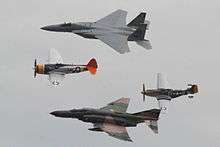
The Texas Air National Guard, Texas Army National Guard and the U.S. Coast Guard also maintain a presence at the base. The Coast Guard facility known as Coast Guard Air Station Houston operates 3 Eurocopter MH-65C "Dolphin" Short-Range Recovery (SRR) helicopters for search and rescue (SAR) and port security roles. Ellington Field is also home to the largest flying club in Texas and the annual "Wings Over Houston" airshow.[12]
Ellington Field once had scheduled commercial air service: Continental Express flights between Ellington Airport and George Bush Intercontinental Airport in north Houston ended in 2004. Prior to the cessation of commercial air service, the route flown between Bush Intercontinental and Ellington Field was the shortest fixed-wing route flown in the United States at only 25 nmi (46 km). Flight times were as short as six minutes, depending on direction of departure. To this day, Ellington Field serves as a reliever airport for both Bush Intercontinental and the William P. Hobby Airport, and handles diverted aircraft from those two airports during bad weather events and peak traffic times.[8] A Terminal Aerodrome Forecast is produced for the airfield 365 days a year at 20Z, 04Z, and 12Z by the 26th Operational Weather Squadron, a USAF weather squadron.
Facilities and aircraft
Ellington Field covers an area of 2,362 acres (956 ha) at an elevation of 32 feet (10 m) above mean sea level. It has three runways with concrete surfaces: 4/22 is 8,001 by 150 feet (2,439 x 46 m); 17R/35L is 9,001 by 150 feet (2,744 x 46 m); 17L/35R is 4,609 by 80 feet (1,405 x 24 m).[1]
For the 12-month period ending December 31, 2009, the airport had 126,702 aircraft operations, an average of 347 per day: 70% general aviation, 22% military, 6% air taxi, and 2% scheduled commercial. At that time there were 197 aircraft based at this airport: 46% single-engine, 28% jet, 12% multi-engine, 12% military, 2% helicopter, and 1% glider.[1]
The Lone Star Flight Museum, which was located at Scholes from 1985 until 2017, maintains a fleet of airworthy warbirds including: Lockheed Vega, B-17 Flying Fortress, North American B-25 Mitchell Bomber, Douglas A24 Banshee (Decorated as an SBD-5 Dauntless), Republic P-47 Thunderbolt, Vought F4U Corsair, General Motors (Eastern Aircraft) TBM Avenger, Grumman F6F Hellcat, General Motors FM-2 Wildcat, North American AT-6 Texan, Beech AT-11 Kansan, Cessna AT-17 Bobcat, Stinson L-5, Douglas DC-3, and Stearman PT-17.
Statistics
Annual traffic
| Year | Passengers | Year | Passengers | Year | Passengers |
|---|---|---|---|---|---|
| 1987 | 0 | 1997 | 111,405 | 2007 | 2 |
| 1988 | 0 | 1998 | 102,550 | 2008 | 0 |
| 1989 | 0 | 1999 | 96,943 | 2009 | 0 |
| 1990 | 35,908 | 2000 | 73,880 | 2010 | 1 |
| 1991 | 85,560 | 2001 | 60,255 | 2011 | 0 |
| 1992 | 108,976 | 2002 | 76,035 | 2012 | 0 |
| 1993 | 114,656 | 2003 | 80,306 | 2013 | 2 |
| 1994 | 117,895 | 2004 | 53,947 | 2014 | 4 |
| 1995 | 91,028 | 2005 | 0 | ||
| 1996 | 94,299 | 2006 | 0 |
References
- FAA Airport Master Record for EFD (Form 5010 PDF). Federal Aviation Administration. Effective May 2, 2013.
- "About Ellington Airport". Houston Airport System. May 31, 2013. Archived from the original on May 29, 2013.
- "KEFD – Ellington Field Airport". FAA data republished by AirNav. September 20, 2012. Archived from the original on November 1, 2012.
- "About Ellington Field". Houston Airport System. Archived from the original on March 2, 2007. Retrieved February 24, 2007.
- "2011–2015 NPIAS Report, Appendix A" (PDF). National Plan of Integrated Airport Systems. Federal Aviation Administration. October 4, 2010. Archived from the original (PDF, 2.03 MB) on 2012-09-27.
- World War I Group, Historical Division, Special Staff, United States Army, Order of Battle of the United States Land Forces in the World War (1917–1919)
- "Annexations in Houston Or How we grew to 667 square miles in 175 years." City of Houston Planning and Development Department. p. 39 of 62. Retrieved on February 21, 2017.
- "Ellington Field gets new name". Houston Business Journal. January 16, 2009. Retrieved August 8, 2009.
- McEver, Melissa. "Major expansion set at Ellington Airport." Houston Business Journal. August 12, 2011. Retrieved on August 15, 2011.
- "Houston Airport System plans from spaceport approved by FAA". fly2houston.com. June 30, 2015. Archived from the original on July 1, 2015. Retrieved July 1, 2015.
- "$18.8M for Phase 1 of Houston spaceport project approved". KHOU. Retrieved 2019-01-29.
- "Program Overview: Ellington Field". Houston Airport System. Archived from the original on March 13, 2007. Retrieved March 7, 2007.
- "Ellington Field Aircraft" (PDF). National Aeronautics and Space Administration. Retrieved February 24, 2007.
- "Study of Cloud Ice Crystals May Improve Climate Change Forecasts". Goddard Space Flight Center. July 16, 2012. Archived from the original on September 29, 2006. Retrieved February 24, 2007.
- Traffic Updates. Retrieved on Mar 28, 2015. Archived 2015-05-24 at the Wayback Machine
External links
| Wikimedia Commons has media related to Ellington Airport (Texas). |
- Official website
- Houston Airport System - Ellington Airport Master Plan
- Ellington Field at GlobalSecurity.org
- Wings Over Houston Airshow
- FAA Airport Diagram (PDF), effective June 18, 2020
- FAA Terminal Procedures for EFD, effective June 18, 2020
- Resources for this airport:
- FAA airport information for EFD
- AirNav airport information for KEFD
- ASN accident history for EFD
- FlightAware airport information and live flight tracker
- NOAA/NWS weather observations: current, past three days
- SkyVector aeronautical chart, Terminal Procedures