Dykh-Tau
Dykh-Tau or Dykhtau (Russian: Дыхтау, Karachay-Balkar: Дых тау that is derived from Turkic "dik dagh" which means Jagged Mount), is a mountain located in Kabardino-Balkaria, Russia; its peak stands about 5 km (3 mi) north of the border with Georgia. Dykh-Tau is the second highest of the Caucasus Mountains, after Mount Elbrus, and is the second highest mountain in Europe.
| Gora Dykh-Tau | |
|---|---|
 | |
| Highest point | |
| Elevation | 5,205 m (17,077 ft) |
| Prominence | 2,002 m (6,568 ft) |
| Isolation | 64 km (40 mi) |
| Listing | Seven Second Summits Ultra |
| Coordinates | 43°3′N 43°8′E |
| Geography | |
Gora Dykh-Tau Location of Dykh-Tau in the Caucasus mountains 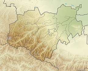 Gora Dykh-Tau Gora Dykh-Tau (Kabardino-Balkaria) | |
| Location | Kabardino-Balkaria, Russia |
| Country | |
| Parent range | Caucasus Mountains |
| Topo map | Map and Guide to the Caucasus: Bezingi, Bashil, Adaikhokh[1] |
Access
Dykh-Tau is best accessed from the north (Russia). Bezingi village may be reached from Nalchik in Kabardino-Balkaria with infrequent public transport, here a 4WD vehicle must be hired. Thus Bezingi Alpine Camp is reached at 2180m. From here it takes a further 2 days to reach the base of the climb.[2]
Climbing routes
This is one of the great Caucasian Peaks, facing the magnificent Bezingi Wall across the Bezingi Glacier. The first ascent in 1888 by Mummery and Zarfluh was a major achievement at the time. Their route up the SW Ridge is no longer used as the normal route which is now the North Ridge graded 4B (Russian Grading).
Starting from Misses Kosh the ridge is gained by first crossing the West Ridge of Misses-Tau then continuing to the Russian Bivouac located by a hanging glacier descending from the North Ridge of Dykhtau, 4 hours from Misses-Kosh. Once a notch between Misses-Tau and Dykhtau is gained, the North Ridge is followed to the summit. Allow 2 days from the Russian Bivouac, there are several good bivouac sites on the North Ridge (Details and map).
Mapping
Various maps of Soviet military origin may be found on the internet. These are in Cyrillic. Two maps cover the area[1].
References
- Map and Guide to the Caucasus: Bezingi, Bashil, Adaikhokh (Map) (1st ed.). 1:100,000 with mountaineering information. Cartography by EWP. EWP/WCP. 1994. ISBN 0-906227-53-4.
- Caucasus from Elbrus to Kazbek (Map) (1st ed.). 1:200,000 with general information. Map Guides. Cartography by EWP. Robin Collomb and Andrew Wielochowski. 1993. ISBN 0-906227-54-2.
External links
- "Gora Dykh-Tau, Russia". Peakbagger.com.
- summitpost.org: Dykhtau