Sarektjåkkå
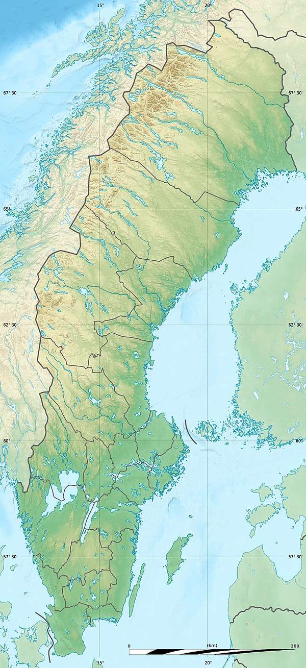
Sarektjåkkå is the second highest mountain in Sweden and the highest mountain in the Laponian area at 2,089 metres (6,854 ft) AMSL. The mountain is located close to the eastern border of Sarek National Park, about 23 kilometres (14 mi) south-west of Suorva.
| Sarektjåhkkå | |
|---|---|
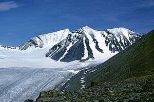 Sarektjåhkkå, Stortoppen to the left and Sydtoppen in the middle | |
| Highest point | |
| Elevation | 2,089 m (6,854 ft) [1] |
| Prominence | 1,519 m (4,984 ft) [2] |
| Isolation | 61 to 63 km (38 to 39 mi) |
| Listing | Ultra |
| Coordinates | 67°25′55″N 17°43′30″E [2] |
| Geography | |
 Sarektjåhkkå | |
| Parent range | Scandinavian Mountains |
| Climbing | |
| Easiest route | Hike |
Climbing
Sarektjåkkå is not easily accessible by any nearby roads, so the approach normally takes a day or more of backcountry hiking.
Accessing the north summit, at 2,056 metres (6,745 ft) altitude, is a moderate but steep hike up. The actual summit (Stortoppen) is located about 600 metres (2,000 ft) southwest of the north summit via a ridge and is not as easy to reach, requiring exposed scrambling. An alternative route is to scale the summit from the south by merely steep hiking, but this requires crossing glaciers.
See also
- List of European ultra prominent peaks
References
- "Statistisk årsbok 2011" (in Swedish). Statistics Sweden. p. 10. Archived from the original (PDF) on 5 July 2011. Retrieved 10 July 2011.
- "Europe Ultra-Prominences" Peaklist.org. Retrieved 2012-03-31.