Decatur, Indiana
Decatur is a city in Root and Washington townships, Adams County, Indiana, United States. It is the county seat of Adams County.[7] Decatur is home to Adams Memorial Hospital, which was designated as one of the "Top 100" Critical Access Hospitals in the United States. The population of Decatur was 9,405 at the 2010 census.
Decatur, Indiana | |
|---|---|
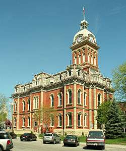
 Decatur downtown in 2006. | |
 Location of Decatur in Adams County, Indiana. | |
| Coordinates: 40°49′46″N 84°55′45″W | |
| Country | United States |
| State | Indiana |
| County | Adams |
| Township | Root, Washington |
| Government | |
| • Mayor | Dan Rickord |
| Area | |
| • Total | 6.03 sq mi (15.63 km2) |
| • Land | 6.03 sq mi (15.61 km2) |
| • Water | 0.01 sq mi (0.02 km2) |
| Elevation | 801 ft (244 m) |
| Population | |
| • Total | 9,405 |
| • Estimate (2018)[3] | 9,843 |
| • Density | 1,586.36/sq mi (612.53/km2) |
| Time zone | UTC-5 (EST) |
| • Summer (DST) | UTC-4 (EDT) |
| ZIP code | 46733 |
| Area code(s) | 260 |
| FIPS code | 18-17074[4] |
| GNIS feature ID | 0446543[5] |
| Website | http://www.decaturin.org/ |
| Historical population | |||
|---|---|---|---|
| Census | Pop. | %± | |
| 1850 | 231 | — | |
| 1860 | 532 | 130.3% | |
| 1870 | 858 | 61.3% | |
| 1880 | 1,905 | 122.0% | |
| 1890 | 3,142 | 64.9% | |
| 1900 | 4,148 | 32.0% | |
| 1910 | 4,471 | 7.8% | |
| 1920 | 4,762 | 6.5% | |
| 1930 | 5,156 | 8.3% | |
| 1940 | 5,861 | 13.7% | |
| 1950 | 7,271 | 24.1% | |
| 1960 | 8,327 | 14.5% | |
| 1970 | 8,445 | 1.4% | |
| 1980 | 8,649 | 2.4% | |
| 1990 | 8,644 | −0.1% | |
| 2000 | 9,528 | 10.2% | |
| 2010 | 9,405 | −1.3% | |
| Est. 2018 | 9,843 | [3] | 4.7% |
| U.S. Decennial Census[6] | |||
History
The first non-Native American settlers arrived in what is now Decatur in 1835. They arrived as a result of the end of the Black Hawk War as well as the completion of the Erie Canal. They consisted entirely of settlers from New England. These were "Yankee" settlers, that is to say they were descended from the English Puritans who settled New England in the colonial era. They were primarily members of the Congregational Church though due to the Second Great Awakening many of them had converted to Methodism and some had become Baptists before coming to what is now Decatur. The Congregational Church subsequently has gone through many divisions and some factions are now known as the Church of Christ and Church of God. When the New England settlers arrived in what is now Decatur there was nothing but a dense virgin forest and wild prairie.[8]
Decatur was founded in 1836.[9] It was named for Stephen Decatur, Jr., one of the captains of the original six frigates of the US navy.[10] The first post office in Decatur was established in 1837.[11]

Decatur was also known as a Sundown Town, where African Americans were discriminated against and eventually run out of the town completely in 1902. Over time people of color were slowly allowed to settle in the town with current demographics indicating an African American population of 2.2%.[12]
Geography
Decatur is located at 40°49′46″N 84°55′45″W (40.829581, -84.929185).[14]
According to the 2010 census, Decatur has a total area of 5.786 square miles (14.99 km2), of which 5.78 square miles (14.97 km2) (or 99.9%) is land and 0.006 square miles (0.02 km2) (or 0.1%) is water.[15]
Demographics
2010 census
As of the census[2] of 2010, there were 9,405 people, 4,011 households, and 2,511 families living in the city. The population density was 1,627.2 inhabitants per square mile (628.3/km2). There were 4,427 housing units at an average density of 765.9 per square mile (295.7/km2). The racial makeup of the city was 94.7% White, 0.5% African American, 0.4% Native American, 0.4% Asian, 2.6% from other races, and 1.4% from two or more races. 8.4% Hispanic or Latino of any race.
There were 4,011 households, of which 31.3% had children under the age of 18 living with them, 43.7% were married couples living together, 13.6% had a female householder with no husband present, 5.4% had a male householder with no wife present, and 37.4% were non-families. 33.1% of all households were made up of individuals, and 13% had someone living alone who was 65 years of age or older. The average household size was 2.32 and the average family size was 2.92.
The median age in the city was 37.2 years. 24.7% of residents were under the age of 18; 9.4% were between the ages of 18 and 24; 25.6% were from 25 to 44; 25.7% were from 45 to 64; and 14.6% were 65 years of age or older. The gender makeup of the city was 48.4% male and 51.6% female.
2000 census
As of the census[4] of 2000, there were 9,528 people, 3,960 households, and 2,570 families living in the city. The population density was 1,935.4 people per square mile (747.7/km2). There were 4,190 housing units at an average density of 851.1 per square mile (328.8/km2). The racial makeup of the city was 94.64% White, 0.24% African American, 0.35% Native American, 0.36% Asian, 0.06% Pacific Islander, 3.58% from other races, and 0.78% from two or more races. Hispanic or Latino of any race were 7.69% of the population.
There were 3,960 households, out of which 32.4% had children under the age of 18 living with them, 48.5% were married couples living together, 12.2% had a female householder with no husband present, and 35.1% were non-families. 31.4% of all households were made up of individuals, and 13.7% had someone living alone who was 65 years of age or older. The average household size was 2.39 and the average family size was 3.00.
In the city, the population was spread out, with 26.4% under the age of 18, 9.8% from 18 to 24, 28.7% from 25 to 44, 20.5% from 45 to 64, and 14.6% who were 65 years of age or older. The median age was 35 years. For every 100 females, there were 94.9 males. For every 100 females age 18 and over, there were 90.5 males.
The median income for a household in the city was $37,234, and the median income for a family was $44,722. Males had a median income of $31,819 versus $24,310 for females. The per capita income for the city was $18,186. About 5.6% of families and 7.7% of the population were below the poverty line, including 9.7% of those under age 18 and 11.3% of those age 65 or over.
Government
The government consists of a mayor and a city council. The mayor is elected in citywide vote. The city council consists of five members. Four are elected from individual districts. One is elected at-large. There is also a clerk-treasurer who is elected in citywide vote.
Education
The local high school in Decatur is Bellmont High School; approximately 700 students attend BHS. Local elementary and middle school students attend Bellmont Elementary School and Bellmont Middle School. St. Joseph Catholic School serves students in grades K-8. Zion Lutheran School, Wyneken Memorial Lutheran School, and St. Peter-Immanuel Lutheran School also serve students in grades PK-8.
Decatur has a public library, a branch of the Adams Public Library System.[16]
Economy
- Some of the larger employers in Decatur include Bunge Limited, Rev RV,[17] and Thunderbird Products also known as Formula Boats,.[18]
- Locally established restaurants and bars in Decatur include 224 Pub & Grill, Back 40 Junction, The Galley, Two Brothers Bar and Restaurant, the West End Restaurant, Vinnie's Bar, River View Tavern, The Wet Spot, Double Eagle Clubhouse Grille, Monster Pizza, Soul Pig BBQ, and Small Town Bar & Grill
- Lingenfelter Performance Engineering, well known for performance tuning and producing after-market parts for GM sports cars especially the Chevrolet Corvette is located in Decatur. The company is currently expanding under the leadership of Ken Lingenfelter, owner and CEO.

Notable people
- David Anspaugh, television and film director, Hoosiers, Rudy
- John Fetzer, former owner of Detroit Tigers
- Bob Hite, Sr., radio and television announcer for CBS
- David Smith, Sculptor
See also
References
- "2017 U.S. Gazetteer Files". United States Census Bureau. Retrieved Dec 30, 2018.
- "U.S. Census website". United States Census Bureau. Retrieved 2012-12-11.
- "Population and Housing Unit Estimates". Retrieved August 16, 2019.
- "U.S. Census website". United States Census Bureau. Retrieved 2008-01-31.
- "US Board on Geographic Names". United States Geological Survey. 2007-10-25. Retrieved 2008-01-31.
- "Census of Population and Housing". Census.gov. Retrieved June 4, 2015.
- "Find a County". National Association of Counties. Archived from the original on 2011-05-31. Retrieved 2011-06-07.
- Standard History of Adams and Wells Counties, Indiana by John Wilson Tyndall and Orlo Ervin Lesh, 1918
- Hellmann, Paul T. (14 February 2006). Historical Gazetteer of the United States. Routledge. p. 313. ISBN 1-135-94859-3.
- "Profile for Decatur, IN". ePodunk. Retrieved 26 August 2014.
- "Adams County". Jim Forte Postal History. Archived from the original on 27 August 2014. Retrieved 26 August 2014.
- http://worldpopulationreview.com/us-cities/decatur-in-population/
- http://www.bymattruff.com/my-novels/lovecraft-country/a-readers-guide-to-lovecraft-country/sundown-towns/
- "US Gazetteer files: 2010, 2000, and 1990". United States Census Bureau. 2011-02-12. Retrieved 2011-04-23.
- "G001 - Geographic Identifiers - 2010 Census Summary File 1". United States Census Bureau. Archived from the original on 2020-02-13. Retrieved 2015-07-28.
- "Homepage". Adams Public Library System. Retrieved 3 March 2018.
- fleetwoodrv.com
External links
| Wikimedia Commons has media related to Decatur, Indiana. |
Municipalities and communities of Adams County, Indiana, United States | ||
|---|---|---|
| Cities | Map of Indiana highlighting Adams County | |
| Towns | ||
| Townships | ||
| Unincorporated communities | ||
Fort Wayne–Huntington–Auburn Combined Statistical Area | ||
|---|---|---|
| Counties | 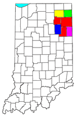 | |
| Municipalities with population over 10,000 in 2010 | ||
| Municipalities with population 1,000-10,000 in 2010 | ||
| Municipalities with population under 1,000 in 2010 | ||
| CDPs | ||
| Authority control |
|
|---|