Delphi, Indiana
Delphi (/ˈdɛlfaɪ/) is a city in and the county seat of Carroll County, in the U.S. state of Indiana.[7] Located twenty minutes northeast of Lafayette, it is part of the Lafayette, Indiana Metropolitan Statistical Area. The population was 2,893 at the 2010 census.
Delphi, Indiana | |
|---|---|
 Sign depicting a horse-drawn canal boat. | |
| Motto(s): "Home of the Wabash and Erie Canal"[1] | |
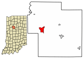 Location of Delphi in Carroll County, Indiana. | |
| Coordinates: 40°35′15″N 86°40′18″W | |
| Country | United States |
| State | Indiana |
| County | Carroll |
| Township | Deer Creek Township |
| Government | |
| • Mayor | Shane Evans (I) |
| Area | |
| • Total | 2.73 sq mi (7.06 km2) |
| • Land | 2.73 sq mi (7.06 km2) |
| • Water | 0.00 sq mi (0.00 km2) |
| Elevation | 568 ft (173 m) |
| Population | |
| • Total | 2,893 |
| • Estimate (2018)[4] | 2,891 |
| • Density | 1,057.23/sq mi (408.21/km2) |
| Time zone | UTC-5 (EST) |
| • Summer (DST) | UTC-4 (EDT) |
| ZIP code | 46923 |
| Area code(s) | 765 Exchange: 564 |
| FIPS code | 18-17614[5] |
| GNIS feature ID | 0433461[6] |
| Website | www.cityofdelphi.org |
History
Delphi was platted in 1828.[8] It took its name from the ancient city of Delphi, in Greece.[9] Several months after Delphi was founded, it was designated as the county seat.[10]
The Barnett-Seawright-Wilson House, Carroll County Courthouse, Delphi City Hall, Delphi Courthouse Square Historic District, Delphi Methodist Episcopal Church, Foreman-Case House, and Niewerth Building are listed on the National Register of Historic Places.[11][12]
Local heritage centers on the Wabash and Erie Canal, a canal and towpath that once bound together northern, central, and southern Indiana. The segment of the canal that passes through Delphi has been rewatered and serves as the focus of canal activities. A visitor center and museum, the Wabash & Erie Canal Interpretive Center, welcomes guests.
Delphi was the site of a widely publicized double murder in 2017.
Geography
Delphi is located at 40°35′15″N 86°40′18″W.[13]
According to the 2010 census, Delphi has a total area of 2.73 square miles (7.07 km2), all land.[14]
Demographics
| Historical population | |||
|---|---|---|---|
| Census | Pop. | %± | |
| 1850 | 1,381 | — | |
| 1860 | 1,395 | 1.0% | |
| 1870 | 1,614 | 15.7% | |
| 1880 | 2,040 | 26.4% | |
| 1890 | 1,928 | −5.5% | |
| 1900 | 2,135 | 10.7% | |
| 1910 | 2,161 | 1.2% | |
| 1920 | 2,087 | −3.4% | |
| 1930 | 1,929 | −7.6% | |
| 1940 | 2,213 | 14.7% | |
| 1950 | 2,530 | 14.3% | |
| 1960 | 2,517 | −0.5% | |
| 1970 | 2,582 | 2.6% | |
| 1980 | 3,042 | 17.8% | |
| 1990 | 2,531 | −16.8% | |
| 2000 | 3,015 | 19.1% | |
| 2010 | 2,893 | −4.0% | |
| Est. 2018 | 2,891 | [4] | −0.1% |
| U.S. Decennial Census[15] | |||
2010 census
At the 2010 census there were 2,893 people, 1,135 households, and 694 families living in the city. The population density was 1,059.7 inhabitants per square mile (409.2/km2). There were 1,270 housing units at an average density of 465.2 per square mile (179.6/km2). The racial makeup of the city was 91.7% White, 0.4% African American, 0.2% Native American, 0.2% Asian, 5.5% from other races, and 1.9% from two or more races. Hispanic or Latino of any race were 11.3%.[3]
Of the 1,135 households 32.8% had children under the age of 18 living with them, 44.1% were married couples living together, 11.2% had a female householder with no husband present, 5.8% had a male householder with no wife present, and 38.9% were non-families. 33.1% of households were one person and 16.2% were one person aged 65 or older. The average household size was 2.46 and the average family size was 3.12.
The median age was 37.5 years. 25.9% of residents were under the age of 18; 8.5% were between the ages of 18 and 24; 25.5% were from 25 to 44; 22.3% were from 45 to 64; and 18% were 65 or older. The gender makeup of the city was 47.9% male and 52.1% female.
2000 census
At the 2000 census there were 3,015 people, 1,161 households, and 748 families living in the city. The population density was 1,179.3 people per square mile (454.7/km²). There were 1,241 housing units at an average density of 485.4 per square mile (187.2/km²). The racial makeup of the city was 92.57% White, 0.13% African American, 0.20% Native American, 0.27% Asian, 5.87% from other races, and 0.96% from two or more races. Hispanic or Latino of any race were 12.17%.[5]
Of the 1,161 households 31.1% had children under the age of 18 living with them, 52.0% were married couples living together, 7.6% had a female householder with no husband present, and 35.5% were non-families. 31.3% of households were one person and 17.1% were one person aged 65 or older. The average household size was 2.50 and the average family size was 3.13.
The age distribution was 25.9% under the age of 18, 8.2% from 18 to 24, 29.6% from 25 to 44, 18.9% from 45 to 64, and 17.4% 65 or older. The median age was 35 years. For every 100 females, there were 96.7 males. For every 100 females age 18 and over, there were 90.9 males.
The median household income was $34,388 and the median family income was $45,878. Males had a median income of $31,360 versus $18,575 for females. The per capita income for the city was $16,703. About 7.4% of families and 13.4% of the population were below the poverty line, including 21.9% of those under age 18 and 6.0% of those age 65 or over.
Education
The Delphi Community School Corporation operates public schools, including Delphi Community High School.
The city has a free lending library, the Delphi Public Library.[16]
Notable people
- William "Dick the Bruiser" Afflis - professional wrestler
- Moses Clapp - Minnesota politician
- William V. Lucas - United States House of Representatives
- Doxie Moore - professional basketball coach
- John Gould Moyer - 31st Governor of American Samoa
- Robert H. Shaffer - pioneer in the field of college student personnel and student affairs
- Betty Wason - author/broadcast journalist
- Gregory Wasson (born 1958), president and CEO of Walgreens[17]
- Clarence Whistler, professional wrestler of the 1880s
- Walter B. Rogers, musician and bandleader
- Bob Olinger (Frontier Lawman), last victim of Billy The Kid
Gallery
 Historical marker at the county courthouse
 Site of Samuel Milroy's cabin
 The downtown area near the courthouse
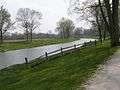 Wabash and Erie Canal (Canal Park)
 Looking south at Washington and Main
See also
- Soldiers and Sailors Monument in Delphi
- Murphy Memorial Drinking Fountain
- Murders of Abigail Williams and Liberty German, known as the "Delphi murders" (2017)
References
- "Homepage". City of Delphi, Indiana. Retrieved 2 June 2014.
- "2017 U.S. Gazetteer Files". United States Census Bureau. Retrieved Dec 30, 2018.
- "U.S. Census website". United States Census Bureau. Retrieved 2012-12-11.
- "Population and Housing Unit Estimates". Retrieved November 25, 2019.
- "U.S. Census website". United States Census Bureau. Retrieved 2008-01-31.
- "US Board on Geographic Names". United States Geological Survey. 2007-10-25. Retrieved 2008-01-31.
- "Find a County". National Association of Counties. Archived from the original on 2011-05-31. Retrieved 2011-06-07.
- "About the City of Delphi". City of Delphi, Indiana. Retrieved 2 June 2014.
- Gannett, Henry (1905). The Origin of Certain Place Names in the United States. Govt. Print. Off. pp. 103.
- Odell, John Curtis (1916). History of Carroll County, Indiana: Its People, Industries and Institutions. B.F. Bowen. p. 221.
- "National Register Information System". National Register of Historic Places. National Park Service. July 9, 2010.
- "National Register of Historic Places Listings". Weekly List of Actions Taken on Properties: 9/14/15 through 9/18/15. National Park Service. 2015-09-25.
- "US Gazetteer files: 2010, 2000, and 1990". United States Census Bureau. 2011-02-12. Retrieved 2011-04-23.
- "G001 - Geographic Identifiers - 2010 Census Summary File 1". United States Census Bureau. Archived from the original on 2020-02-13. Retrieved 2015-07-28.
- "Census of Population and Housing". Census.gov. Retrieved June 4, 2015.
- "Libraries". Carroll County, IN. Retrieved 4 March 2018.
- "Delphi native is Walgreen's new president and COO". Carroll County Comet. 2007-04-25. Archived from the original on 29 November 2014. Retrieved 3 November 2014.
External links
Municipalities and communities of Carroll County, Indiana, United States | ||
|---|---|---|
| City | Map of Indiana highlighting Carroll County | |
| Towns | ||
| Townships | ||
| Unincorporated communities |
| |
| Authority control |
|
|---|