Kendallville, Indiana
Kendallville is a city in Wayne Township, Noble County, in the U.S. state of Indiana.[6] The population was 9,862 at the 2010 census.
Kendallville, Indiana | |
|---|---|
| City of Kendallville | |
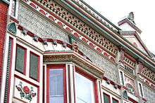
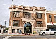
 Downtown Kendallville in October 2005. | |
 Location of Kendallville in Noble County, Indiana. | |
| Coordinates: 41°26′30″N 85°15′38″W | |
| Country | United States |
| State | Indiana |
| County | Noble |
| Township | Wayne |
| Government | |
| • Mayor | W. Suzanne Handshoe (R) |
| Area | |
| • Total | 6.27 sq mi (16.24 km2) |
| • Land | 6.04 sq mi (15.66 km2) |
| • Water | 0.22 sq mi (0.58 km2) |
| Elevation | 988 ft (301 m) |
| Population | |
| • Total | 9,862 |
| • Estimate (2018)[4] | 9,864 |
| • Density | 1,638.71/sq mi (632.73/km2) |
| Time zone | UTC-5 (Eastern (EST)) |
| • Summer (DST) | UTC-4 (EDT) |
| ZIP code | 46755 |
| Area code(s) | 260 |
| FIPS code | 18-39402[5] |
| GNIS feature ID | 437239 |
| Website | http://www.kendallville-in.org |
History
Kendallville was laid out in 1849.[7] The city was named for Amos Kendall, 8th United States Postmaster General.[8]
A post office has been in operation at Kendallville since 1837.[9]
The Iddings-Gilbert-Leader-Anderson Block and Kendallville Downtown Historic District are listed on the National Register of Historic Places.[10]
Geography
According to the 2010 census, Kendallville has a total area of 6.264 square miles (16.22 km2), of which 6.04 square miles (15.64 km2) (or 96.42%) is land and 0.224 square miles (0.58 km2) (or 3.58%) is water.[11]
Demographics
| Historical population | |||
|---|---|---|---|
| Census | Pop. | %± | |
| 1870 | 2,164 | — | |
| 1880 | 2,373 | 9.7% | |
| 1890 | 2,960 | 24.7% | |
| 1900 | 3,354 | 13.3% | |
| 1910 | 4,981 | 48.5% | |
| 1920 | 5,273 | 5.9% | |
| 1930 | 5,439 | 3.1% | |
| 1940 | 5,431 | −0.1% | |
| 1950 | 6,119 | 12.7% | |
| 1960 | 6,765 | 10.6% | |
| 1970 | 6,838 | 1.1% | |
| 1980 | 7,299 | 6.7% | |
| 1990 | 7,773 | 6.5% | |
| 2000 | 9,616 | 23.7% | |
| 2010 | 9,862 | 2.6% | |
| Est. 2018 | 9,864 | [4] | 0.0% |
| U.S. Decennial Census[12] | |||
2010 census
As of the census[3] of 2010, there were 9,862 people, 3,940 households, and 2,483 families living in the city. The population density was 1,630.1 inhabitants per square mile (629.4/km2). There were 4,382 housing units at an average density of 724.3 per square mile (279.7/km2). The racial makeup of the city was 94.1% White, 0.5% African American, 0.2% Native American, 0.5% Asian, 2.9% from other races, and 1.8% from two or more races. Hispanic or Latino of any race were 5.1% of the population.
There were 3,940 households, of which 36.1% had children under the age of 18 living with them, 42.2% were married couples living together, 14.4% had a female householder with no husband present, 6.4% had a male householder with no wife present, and 37.0% were non-families. 31.1% of all households were made up of individuals, and 11.9% had someone living alone who was 65 years of age or older. The average household size was 2.46 and the average family size was 3.06.
The median age in the city was 34.6 years. 27.4% of residents were under the age of 18; 8.9% were between the ages of 18 and 24; 27.3% were from 25 to 44; 23.5% were from 45 to 64; and 12.9% were 65 years of age or older. The gender makeup of the city was 48.2% male and 51.8% female.
2000 census
As of the census[5] of 2000, there were 9,616 people, 3,873 households, and 2,459 families living in the city. The population density was 1,890.0 people per square mile (729.4/km2). There were 4,172 housing units at an average density of 820.0 per square mile (316.5/km2). The racial makeup of the city was 96.66% White, 0.25% African American, 0.16% Native American, 0.59% Asian, 0.01% Pacific Islander, 1.37% from other races, and 0.96% from two or more races. Hispanic or Latino of any race were 3.16% of the population.
There were 3,873 households, out of which 35.9% had children under the age of 18 living with them, 46.0% were married couples living together, 13.3% had a female householder with no husband present, and 36.5% were non-families. 31.5% of all households were made up of individuals, and 12.7% had someone living alone who was 65 years of age or older. The average household size was 2.44 and the average family size was 3.07.
In the city, the population was spread out, with 28.0% under the age of 18, 10.3% from 18 to 24, 30.1% from 25 to 44, 17.7% from 45 to 64, and 13.8% who were 65 years of age or older. The median age was 32 years. For every 100 females, there were 89.1 males. For every 100 females age 18 and over, there were 86.2 males.
The median income for a household in the city was $33,899, and the median income for a family was $42,341. Males had a median income of $33,258 versus $23,851 for females. The per capita income for the city was $16,335. About 7.9% of families and 9.9% of the population were below the poverty line, including 10.7% of those under age 18 and 8.6% of those age 65 or over.
Annual cultural events
- Apple Festival
- Christmas Parade
- County Fair
- Tri-State Bluegrass Festival
- Fireworks at Bixler Lake (4 July)
- The Kendallville Open
- Kendallville Main Street Car Show
Education
Schools in the Kendallville area include:
- East Noble High School
- East Noble Middle School
- South Side Elementary School
- North Side Elementary School
- Wayne Center Elementary School
- St. John Lutheran School
The town has a lending library, the Kendallville Public Library.[13]
Media
The News Sun is the city's daily newspaper; and it also covers the rest of Noble and LaGrange counties. It is the successor of the Noble County Journal, a weekly founded c. 1860, and is now owned by KPC Media Group, a chain of three dailies, three weeklies, and several monthly publications in northeastern Indiana. It has its headquarters on Main Street in Kendallville.[14]
The Kendallville Mall mails 14,000 community newspapers to Kendallville homes, and the surrounding area, and hosts a local news and local ads website. NewsKendallville is a local website and Facebook page for community news, free to read. Scher Maihem Publishing Media Group emailed Indiana's first email newspaper in 2009, Avilla eNooZ, a weekly newspaper. The company also produces videos for local businesses and for KendallvilleTV. The local publishing company also is a leader in digital publishing and broadcasting.
Notable people
- Arthur Mapes, poet, born and raised in Kendallville, wrote Indiana's state poem and recognized in 1977 as the Poet Laureate for Indiana.
- David M. McIntosh, member of the U.S. House of Representatives from 1995–2001; Republican nominee for governor of Indiana in 2000
- Brad Miller, two-time NBA All-Star, Center; 2003 - Indiana Pacers, 2004 - Sacramento Kings, retired in 2012.
- George A. Mitchell, founder of Cadillac, Michigan
- William Mitchell, United States Representative from Indiana
- Alvin M. Strauss, architect, born to German immigrant parents in Kendallville, best known for Lincoln Bank Tower
- Amy Yoder Begley, middle- and long-distance runner, competed at the 2008 Summer Olympics
References
- "2016 U.S. Gazetteer Files". United States Census Bureau. Retrieved Jul 28, 2017.
- "US Board on Geographic Names". United States Geological Survey. 2007-10-25. Retrieved 2008-01-31.
- "U.S. Census website". United States Census Bureau. Retrieved 2012-12-11.
- "Population and Housing Unit Estimates". Retrieved August 16, 2019.
- "U.S. Census website". United States Census Bureau. Retrieved 2008-01-31.
- "Kendallville, Indiana". Geographic Names Information System. United States Geological Survey. Retrieved 2017-05-05.
- A Biographical History of Eminent and Self-made Men of the State of Indiana ... Western Biographical Publishing Company. 1880. p. 184.
- Counties of LaGrange and Noble, Indiana: Historical and Biographical. F.A. Battey & Company. 1882. p. 120.
- "Noble County". Jim Forte Postal History. Retrieved May 5, 2017.
- "National Register Information System". National Register of Historic Places. National Park Service. July 9, 2010.
- "G001 - Geographic Identifiers - 2010 Census Summary File 1". United States Census Bureau. Archived from the original on 2020-02-13. Retrieved 2015-07-28.
- "Census of Population and Housing". Census.gov. Retrieved June 4, 2015.
- "Indiana public library directory" (PDF). Indiana State Library. Retrieved 14 March 2018.
- http://www.kpcnews.com/?x=about
External links
- Kendallville Mall-NooZ community newspaper
- City of Kendallville, Indiana website
- Star 88.3 WLAB (89.7 FM in Kendallville)
- Kendallville News-Sun Reflections of a Century
- The Kendallville Open
- Northern Indiana Bluegrass Association
Municipalities and communities of Noble County, Indiana, United States | ||
|---|---|---|
| Cities | Map of Indiana highlighting Noble County | |
| Towns | ||
| Townships | ||
| CDP | ||
| Unincorporated communities | ||
| Footnotes | ‡This populated place also has portions in an adjacent county or counties | |
Fort Wayne–Huntington–Auburn Combined Statistical Area | ||
|---|---|---|
| Counties | 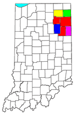 | |
| Municipalities with population over 10,000 in 2010 | ||
| Municipalities with population 1,000-10,000 in 2010 | ||
| Municipalities with population under 1,000 in 2010 | ||
| CDPs | ||
| Authority control |
|
|---|