Dansville, Michigan
Dansville is a village in Ingham Township, Ingham County in the U.S. state of Michigan. It lies 22 miles (35 km) southeast of downtown Lansing, Michigan's capital city. The population was 563 at the 2010 census.
Dansville, Michigan | |
|---|---|
 | |
| Coordinates: 42°33′23″N 84°18′14″W | |
| Country | United States |
| State | Michigan |
| County | Ingham |
| Area | |
| • Total | 1.01 sq mi (2.61 km2) |
| • Land | 1.00 sq mi (2.60 km2) |
| • Water | 0.00 sq mi (0.00 km2) |
| Elevation | 961 ft (293 m) |
| Population | |
| • Total | 563 |
| • Estimate (2018)[3] | 571 |
| • Density | 562.19/sq mi (216.96/km2) |
| Time zone | UTC-5 (Eastern (EST)) |
| • Summer (DST) | UTC-4 (EDT) |
| ZIP code | 48819 |
| Area code(s) | 517 |
| FIPS code | 26-19780[4] |
| GNIS feature ID | 0624307[5] |
Description
Dansville is a small village, with much of its economy based on agriculture. While the village is in proximity to the state capital and Michigan State University, it has seen little commercial development over its history. The small town's economy is supported primarily by small business, agriculture research and production.
History
As far as European settlement is concerned, the area that is now the village of Dansville was originally settled by Samuel Crossman in 1844, who, like many settlers at the time, had come from the state of New York in search of a new life. Samuel Crossman's son, Daniel Crossman, officially platted the village in 1857, naming it after himself and the village's first postmaster, Dr. Daniel T. Weston. The settlement was not actually incorporated as a village until 1867.
Dansville is one of the earliest settlements in Ingham County. Permanent home-seekers located there as early as 1836-40, and the first business establishment was a small store, with a general stock, opened by Samuel Crossman about 1847. The first hotel was the Union Hotel, built in 1856-7 by David D. Fox. A post office was established in the southern part of Ingham Township in 1846, and was first kept by John B. Lobdell. Later it was moved to Hayne’s Corners, one and one-half mile south of the present village, and Henry Densmore was postmaster. It finally came to Dansville, where Daniel T. Weston was the first postmaster in 1855. The original plat of the village was laid out May BG, 1857, by Samuel Crossman and Ephraim Hillaird. D. L. Crossman and Dakin and Otis made additions in 1866.[6]
Geography
According to the United States Census Bureau, the village has a total area of 1.00 square mile (2.59 km2), all land.[7]
Demographics
| Historical population | |||
|---|---|---|---|
| Census | Pop. | %± | |
| 1870 | 443 | — | |
| 1880 | 440 | −0.7% | |
| 1890 | 366 | −16.8% | |
| 1900 | 374 | 2.2% | |
| 1910 | 349 | −6.7% | |
| 1920 | 299 | −14.3% | |
| 1930 | 315 | 5.4% | |
| 1940 | 351 | 11.4% | |
| 1950 | 433 | 23.4% | |
| 1960 | 453 | 4.6% | |
| 1970 | 486 | 7.3% | |
| 1980 | 479 | −1.4% | |
| 1990 | 437 | −8.8% | |
| 2000 | 429 | −1.8% | |
| 2010 | 563 | 31.2% | |
| Est. 2018 | 571 | [3] | 1.4% |
| U.S. Decennial Census[8] | |||
2010 census
As of the census[2] of 2010, there were 563 people, 193 households, and 154 families living in the village. The population density was 563.0 inhabitants per square mile (217.4/km2). There were 206 housing units at an average density of 206.0 per square mile (79.5/km2). The racial makeup of the village was 95.6% White, 0.7% African American, 1.1% Native American, 0.7% Asian, 0.4% from other races, and 1.6% from two or more races. Hispanic or Latino of any race were 1.6% of the population.
There were 193 households, of which 48.2% had children under the age of 18 living with them, 55.4% were married couples living together, 20.7% had a female householder with no husband present, 3.6% had a male householder with no wife present, and 20.2% were non-families. 15.0% of all households were made up of individuals, and 4.6% had someone living alone who was 65 years of age or older. The average household size was 2.92 and the average family size was 3.16.
The median age in the village was 33.4 years. 31.8% of residents were under the age of 18; 8.3% were between the ages of 18 and 24; 28.6% were from 25 to 44; 23.3% were from 45 to 64; and 8.2% were 65 years of age or older. The gender makeup of the village was 49.2% male and 50.8% female.
2000 census
As of the census[4] of 2000, there were 429 people, 142 households, and 111 families living in the village. The population density was 429.0 per square mile (165.6/km2). There were 148 housing units at an average density of 148.0 per square mile (57.1/km2). The racial makeup of the village was 95.80% White, 0.23% African American, 0.93% Native American, 0.70% Asian, 1.63% from other races, and 0.70% from two or more races. Hispanic or Latino of any race were 3.26% of the population.
There were 142 households, out of which 47.9% had children under the age of 18 living with them, 61.3% were married couples living together, 12.7% had a female householder with no husband present, and 21.8% were non-families. 17.6% of all households were made up of individuals, and 4.9% had someone living alone who was 65 years of age or older. The average household size was 2.98 and the average family size was 3.40.
In the village, the population was spread out, with 30.8% under the age of 18, 8.6% from 18 to 24, 35.7% from 25 to 44, 18.9% from 45 to 64, and 6.1% who were 65 years of age or older. The median age was 32 years. For every 100 females, there were 91.5 males. For every 100 females age 18 and over, there were 94.1 males.
The median income for a household in the village was $48,214, and the median income for a family was $51,964. Males had a median income of $36,528 versus $25,500 for females. The per capita income for the village was $16,951. About 4.3% of families and 4.3% of the population were below the poverty line, including 5.0% of those under age 18 and 17.9% of those age 65 or over.
Octagon House
Visible throughout the village is the Dr. D. J. Weston Octagon House.[9] This drew extensive media attention as a base for state aid during droughts of 1986. Military personnel rationed and supplied additional water supplies when required during the summer months, with these images often entering state news broadcasts at the time.
The Burning Bed
Dansville is the town where the events in the book The Burning Bed happened and Francine Hughes lived.
Notable people
- Sam Williams, American football player.
- Lindsay Bowen, women's basketball player.
References
- "2017 U.S. Gazetteer Files". United States Census Bureau. Retrieved Jan 3, 2019.
- "U.S. Census website". United States Census Bureau. Retrieved 2012-11-25.
- "Population and Housing Unit Estimates". Retrieved March 14, 2020.
- "U.S. Census website". United States Census Bureau. Retrieved 2008-01-31.
- "US Board on Geographic Names". United States Geological Survey. 2007-10-25. Retrieved 2008-01-31.
- http://www.ingham.org/bc/hist/pioneer%20history%20of%20ingham%20county/chapter%208.pdf
- "US Gazetteer files 2010". United States Census Bureau. Archived from the original on 2012-01-25. Retrieved 2012-11-25.
- "Census of Population and Housing". Census.gov. Retrieved June 4, 2015.
- Inventory of Octagon Houses in Michigan by county
External links
Municipalities and communities of Ingham County, Michigan, United States | ||
|---|---|---|
| Cities | 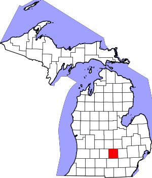 Map of Michigan highlighting Ingham County | |
| Villages | ||
| Charter townships | ||
| General law townships | ||
| CDPs | ||
| Other unincorporated communities | ||
| Footnotes | ‡This populated place also has portions in an adjacent county or counties | |
| Authority control |
|---|