Counselor, New Mexico
Counselor is an unincorporated community in Sandoval County, New Mexico, United States.[2] Counselor is located at the junction of U.S. Route 550 and New Mexico State Road 403. It is a chapter of the Navajo Nation.[3]
Counselor, New Mexico | |
|---|---|
 Counselor, New Mexico | |
| Coordinates: 36°12′33″N 107°27′28″W | |
| Country | United States |
| State | New Mexico |
| County | Sandoval |
| Elevation | 7,027 ft (2,142 m) |
| Time zone | UTC-7 (Mountain (MST)) |
| • Summer (DST) | UTC-6 (MDT) |
| ZIP code | 87018[1] |
| Area code(s) | 505 |
| GNIS feature ID | 902808[2] |
References
- United States Postal Service (2012). "USPS - Look Up a ZIP Code". Retrieved 2012-02-15.
- "Counselor". Geographic Names Information System. United States Geological Survey.
- "About Us". counselor.navajochapters.org. Retrieved 2020-02-19.
Municipalities and communities of Sandoval County, New Mexico, United States | ||
|---|---|---|
| City | 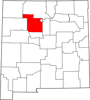 Map of New Mexico highlighting Sandoval County | |
| Towns | ||
| Villages | ||
| CDPs | ||
| Unincorporated community | ||
| Indian reservations |
| |
| Footnotes | ‡This populated place also has portions in an adjacent county or counties | |
This article is issued from Wikipedia. The text is licensed under Creative Commons - Attribution - Sharealike. Additional terms may apply for the media files.