Colfax, North Dakota
Colfax is a city in Richland County, North Dakota, United States. The population was 121 at the 2010 census.[5] Colfax was founded in 1881. It is part of the Wahpeton, ND–MN Micropolitan Statistical Area. In the mid-1960s it billed itself as the "smallest town in the U.S. with a public swimming pool".
Colfax, North Dakota | |
|---|---|
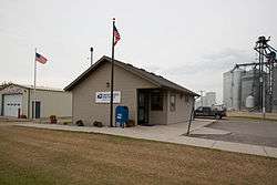 Post office in Colfax | |
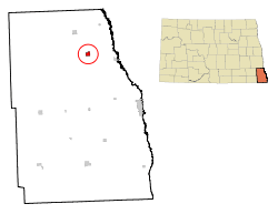 Location of Colfax, North Dakota | |
| Coordinates: 46°28′12″N 96°52′32″W | |
| Country | United States |
| State | North Dakota |
| County | Richland |
| Area | |
| • Total | 1.02 sq mi (2.64 km2) |
| • Land | 1.02 sq mi (2.64 km2) |
| • Water | 0 sq mi (0 km2) |
| Elevation | 961 ft (293 m) |
| Population | |
| • Total | 121 |
| • Estimate (2018)[3] | 155 |
| • Density | 120/sq mi (46/km2) |
| Time zone | UTC-6 (Central (CST)) |
| • Summer (DST) | UTC-5 (CDT) |
| ZIP code | 58018 |
| Area code(s) | 701 |
| FIPS code | 38-15180 |
| GNIS feature ID | 1028421[4] |
Geography
Colfax is located at 46°28′12″N 96°52′32″W (46.469999, -96.875426).[6]
According to the United States Census Bureau, the city has a total area of 1.02 square miles (2.64 km2), all of it land.[1]
Demographics
| Historical population | |||
|---|---|---|---|
| Census | Pop. | %± | |
| 1960 | 98 | — | |
| 1970 | 70 | −28.6% | |
| 1980 | 101 | 44.3% | |
| 1990 | 80 | −20.8% | |
| 2000 | 91 | 13.8% | |
| 2010 | 121 | 33.0% | |
| Est. 2018 | 155 | [3] | 28.1% |
| U.S. Decennial Census[7] 2018 Estimate[8] | |||
2010 census
As of the census[2] of 2010, there were 121 people, 46 households, and 36 families residing in the city. The population density was 118.6 inhabitants per square mile (45.8/km2). There were 48 housing units at an average density of 47.1 per square mile (18.2/km2). The racial makeup of the city was 100.0% White.
There were 46 households, of which 34.8% had children under the age of 18 living with them, 67.4% were married couples living together, 8.7% had a female householder with no husband present, 2.2% had a male householder with no wife present, and 21.7% were non-families. 19.6% of all households were made up of individuals, and 10.9% had someone living alone who was 65 years of age or older. The average household size was 2.63 and the average family size was 2.94.
The median age in the city was 37.4 years. 28.9% of residents were under the age of 18; 4.2% were between the ages of 18 and 24; 33.8% were from 25 to 44; 19.8% were from 45 to 64; and 13.2% were 65 years of age or older. The gender makeup of the city was 55.4% male and 44.6% female.
2000 census
As of the census of 2000, there were 91 people, 40 households, and 28 families residing in the city. The population density was 102.5 people per square mile (39.5/km2). There were 44 housing units at an average density of 49.6 per square mile (19.1/km2). The racial makeup of the city was 100.00% White. Hispanic or Latino of any race were 1.10% of the population.
There were 40 households, out of which 27.5% had children under the age of 18 living with them, 60.0% were married couples living together, 10.0% had a female householder with no husband present, and 30.0% were non-families. 27.5% of all households were made up of individuals, and 22.5% had someone living alone who was 65 years of age or older. The average household size was 2.28 and the average family size was 2.79.
In the city, the population was spread out, with 25.3% under the age of 18, 3.3% from 18 to 24, 29.7% from 25 to 44, 22.0% from 45 to 64, and 19.8% who were 65 years of age or older. The median age was 42 years. For every 100 females, there were 78.4 males. For every 100 females age 18 and over, there were 78.9 males.
The median income for a household in the city was $33,333, and the median income for a family was $55,833. Males had a median income of $28,333 versus $25,417 for females. The per capita income for the city was $19,635. There were no families and 7.0% of the population living below the poverty line, including no under eighteens and 12.5% of those over 64.
References
- "US Gazetteer files 2010". United States Census Bureau. Archived from the original on June 1, 2012. Retrieved June 14, 2012.
- "U.S. Census website". United States Census Bureau. Retrieved June 14, 2012.
- "Population and Housing Unit Estimates". Retrieved June 27, 2019.
- "US Board on Geographic Names". United States Geological Survey. October 25, 2007. Retrieved January 31, 2008.
- "2010 Census Redistricting Data (Public Law 94-171) Summary File". American FactFinder. United States Census Bureau. Retrieved May 2, 2011.
- "US Gazetteer files: 2010, 2000, and 1990". United States Census Bureau. February 12, 2011. Retrieved April 23, 2011.
- United States Census Bureau. "Census of Population and Housing". Retrieved October 31, 2013.
- "Population Estimates". United States Census Bureau. Retrieved June 27, 2019.
Municipalities and communities of Richland County, North Dakota, United States | ||
|---|---|---|
| Cities |  Map of North Dakota highlighting Richland County | |
| Townships | ||
| Unincorporated communities | ||
| Indian reservations | ||
| Footnotes | ‡This populated place also has portions in an adjacent county or counties | |
| Authority control |
|
|---|