Barney, North Dakota
Barney is a city in Richland County, North Dakota, United States. The population was 52 at the 2010 census.[5] Barney was founded in 1899. It is part of the Wahpeton, ND–MN Micropolitan Statistical Area.
Barney, North Dakota | |
|---|---|
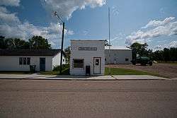 Post office in Barney | |
 | |
| Coordinates: 46°16′3″N 97°0′1″W | |
| Country | United States |
| State | North Dakota |
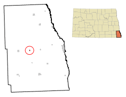
| County | Richland |
| Area | |
| • Total | 0.16 sq mi (0.41 km2) |
| • Land | 0.16 sq mi (0.41 km2) |
| • Water | 0 sq mi (0 km2) |
| Elevation | 1,033 ft (315 m) |
| Population | |
| • Total | 52 |
| • Estimate (2018)[3] | 50 |
| • Density | 330/sq mi (130/km2) |
| Time zone | UTC-6 (Central (CST)) |
| • Summer (DST) | UTC-5 (CDT) |
| ZIP code | 58008 |
| Area code(s) | 701 |
| FIPS code | 38-04940 |
| GNIS feature ID | 1035851[4] |
Geography
Barney is located at 46°16′3″N 97°0′1″W (46.267428, -97.000220).[6]
According to the United States Census Bureau, the city has a total area of 0.16 square miles (0.41 km2), all of it land.[1]
Demographics
| Historical population | |||
|---|---|---|---|
| Census | Pop. | %± | |
| 1960 | 115 | — | |
| 1970 | 81 | −29.6% | |
| 1980 | 70 | −13.6% | |
| 1990 | 79 | 12.9% | |
| 2000 | 69 | −12.7% | |
| 2010 | 52 | −24.6% | |
| Est. 2018 | 50 | [3] | −3.8% |
| U.S. Decennial Census[7] 2018 Estimate[8] | |||
2010 census
As of the census[2] of 2010, there were 52 people, 24 households, and 14 families residing in the city. The population density was 325.0 inhabitants per square mile (125.5/km2). There were 28 housing units at an average density of 175.0 per square mile (67.6/km2). The racial makeup of the city was 98.1% White and 1.9% from two or more races.
There were 24 households, of which 20.8% had children under the age of 18 living with them, 54.2% were married couples living together, 4.2% had a female householder with no husband present, and 41.7% were non-families. 37.5% of all households were made up of individuals, and 25% had someone living alone who was 65 years of age or older. The average household size was 2.17 and the average family size was 2.71.
The median age in the city was 49 years. 15.4% of residents were under the age of 18; 11.5% were between the ages of 18 and 24; 17.2% were from 25 to 44; 40.5% were from 45 to 64; and 15.4% were 65 years of age or older. The gender makeup of the city was 48.1% male and 51.9% female.
2000 census
As of the census of 2000, there were 69 people, 25 households, and 17 families residing in the city. The population density was 432.5 people per square mile (166.5/km2). There were 28 housing units at an average density of 175.5 per square mile (67.6/km2). The racial makeup of the city was 100.00% White.
There were 25 households, out of which 36.0% had children under the age of 18 living with them, 56.0% were married couples living together, 8.0% had a female householder with no husband present, and 32.0% were non-families. 16.0% of all households were made up of individuals, and 12.0% had someone living alone who was 65 years of age or older. The average household size was 2.76 and the average family size was 3.35.
In the city, the population was spread out, with 33.3% under the age of 18, 7.2% from 18 to 24, 21.7% from 25 to 44, 26.1% from 45 to 64, and 11.6% who were 65 years of age or older. The median age was 36 years. For every 100 females, there were 76.9 males. For every 100 females age 18 and over, there were 91.7 males.
As of 2000 the median income for a household was $36,875, and the median income for a family was $46,667. Males had a median income of $34,375 versus $19,375 for females. The per capita income for the city was $14,079. There were no families and 7.6% of the population living below the poverty line, including no under eighteens and 20.0% of those over 64.
Interesting Facts
The city's zip code spells BOOBS in Calculator spelling. In the cartoon series The Simpsons the character Moe mentions the local zip code also spells Boobs.[9]
References
- "US Gazetteer files 2010". United States Census Bureau. Archived from the original on January 12, 2012. Retrieved June 14, 2012.
- "U.S. Census website". United States Census Bureau. Retrieved June 14, 2012.
- "Population and Housing Unit Estimates". Retrieved July 16, 2019.
- "US Board on Geographic Names". United States Geological Survey. October 25, 2007. Retrieved January 31, 2008.
- "2010 Census Redistricting Data (Public Law 94-171) Summary File". American FactFinder. United States Census Bureau. Retrieved May 2, 2011.
- "US Gazetteer files: 2010, 2000, and 1990". United States Census Bureau. February 12, 2011. Retrieved April 23, 2011.
- United States Census Bureau. "Census of Population and Housing". Retrieved October 31, 2013.
- "Population Estimates". United States Census Bureau. Retrieved July 16, 2019.
- "Ten Best Cartoon Restaurants & Pubs". gunaxin. Retrieved 1 November 2019.
Municipalities and communities of Richland County, North Dakota, United States | ||
|---|---|---|
| Cities |  Map of North Dakota highlighting Richland County | |
| Townships | ||
| Unincorporated communities | ||
| Indian reservations | ||
| Footnotes | ‡This populated place also has portions in an adjacent county or counties | |
| Authority control |
|
|---|