Clermont-d'Excideuil
Clermont-d'Excideuil (Occitan dialect: Clarmont d'Eissiduelh) is a commune in the Dordogne department in Nouvelle-Aquitaine in southwestern France.
Clermont-d'Excideuil | |
|---|---|
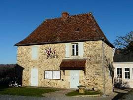 Town hall | |
Location of Clermont-d'Excideuil 
| |
 Clermont-d'Excideuil  Clermont-d'Excideuil | |
| Coordinates: 45°21′57″N 1°03′07″E | |
| Country | France |
| Region | Nouvelle-Aquitaine |
| Department | Dordogne |
| Arrondissement | Nontron |
| Canton | Isle-Loue-Auvézère |
| Government | |
| • Mayor (2008–2014) | Claude Eymery |
| Area 1 | 9.99 km2 (3.86 sq mi) |
| Population (2017-01-01)[1] | 232 |
| • Density | 23/km2 (60/sq mi) |
| Time zone | UTC+01:00 (CET) |
| • Summer (DST) | UTC+02:00 (CEST) |
| INSEE/Postal code | 24124 /24160 |
| Elevation | 156–333 m (512–1,093 ft) (avg. 260 m or 850 ft) |
| 1 French Land Register data, which excludes lakes, ponds, glaciers > 1 km2 (0.386 sq mi or 247 acres) and river estuaries. | |
Population
| Historical population | ||
|---|---|---|
| Year | Pop. | ±% |
| 1962 | 277 | — |
| 1968 | 289 | +4.3% |
| 1975 | 253 | −12.5% |
| 1982 | 255 | +0.8% |
| 1990 | 255 | +0.0% |
| 1999 | 253 | −0.8% |
| 2008 | 266 | +5.1% |
History
Until the end of the 18th century, there was a number of megaliths in Clermont, aligned like those in Carnac. They stood between the hamlets La Valade to the north and Le Verdier to the south. The name of the locality Pierres Brunes is a reminder of the megaliths. They were exploited by blacksmiths, and nothing of them remains. Several modern historians place them on a great ancient commercial route between Vannes in Armorica and Marseille on the Mediterranean Sea via Mende.
See also
References
- "Populations légales 2017". INSEE. Retrieved 6 January 2020.
| Wikimedia Commons has media related to Clermont-d'Excideuil. |
| Authority control |
|
|---|
This article is issued from Wikipedia. The text is licensed under Creative Commons - Attribution - Sharealike. Additional terms may apply for the media files.