Childers, Queensland
Childers is a rural town and locality in the Bundaberg Region, Queensland, Australia.[2][3] In the 2016 census, Childers had a population of 1,584 people.[1]
| Childers Queensland | |||||||||||||||
|---|---|---|---|---|---|---|---|---|---|---|---|---|---|---|---|
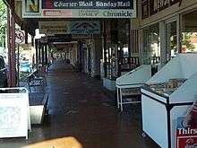
 Childers Main Street | |||||||||||||||
 Childers | |||||||||||||||
| Coordinates | 25.2363°S 152.2775°E | ||||||||||||||
| Population | 1,584 (2016 census)[1] | ||||||||||||||
| • Density | 82.50/km2 (213.7/sq mi) | ||||||||||||||
| Established | 1885 | ||||||||||||||
| Postcode(s) | 4660 | ||||||||||||||
| Elevation | 109.0 m (358 ft) | ||||||||||||||
| Area | 19.2 km2 (7.4 sq mi) | ||||||||||||||
| Time zone | AEST (UTC+10:00) | ||||||||||||||
| Location |
| ||||||||||||||
| LGA(s) | Bundaberg Region | ||||||||||||||
| State electorate(s) | Burnett | ||||||||||||||
| Federal Division(s) | Hinkler | ||||||||||||||
| |||||||||||||||
| |||||||||||||||


Geography
Childers is in the Wide Bay-Burnett region of Queensland, Australia, situated on the Bruce Highway and lies 325 kilometres (202 mi) north of the state capital Brisbane and 52 kilometres (32 mi) south-west of Bundaberg. The Isis Highway runs south from the Bruce Highway in Childers.[4]
The township is set on a ridge overlooking fields of rich volcanic soil.
History
Gureng Gureng (also known as Gooreng Gooreng, Goreng Goreng, Goeng, Gurang, Goorang Goorang, Korenggoreng) is an Australian Aboriginal language spoken by the Gureng Gureng people. The Gooreng Gooreng language region includes the towns of Bundaberg, Gin Gin and Miriam Vale extending south towards Childers, inland to Monto and Mt Perry.[5]
The Childers area was traditionally inhabited by the Dundaburra group who are part of Kabi Kabi tribes of the Wide Bay Burnett in the northernmost area. Their descendants still live in the area.[6]
Europeans first arrived in the area in the 1850s. Pastoralists established properties soon after to raise cattle on the fertile lands. Back then, sugar was (as it is now) the key crop grown in the Isis.
The town was established in 1885. The Isis railway line to Childers opened in 1887 and was pivotal in the early development of the area. Childers Post Office opened on 14 November 1887.[7] The town is reportedly named after Hugh Childers, British statesman, who was the Auditor-General of Victoria in the 1850s.[8]
Isistown Provisional School opened circa 1888 and closed circa 1890.[9]
Childers Provisional School opened on 28 January 1889. In 1891 it became Childers State School. A secondary department was added in January 1913 and operated until Isis District State High School was established in 1961. A pre school was added in 1976.[9]
Isis Central Mill Provisional School opened on 23 January 1899. On 1 January 1909 it became Isis Central Mill State School. It closed on 11 December 1987.[9]
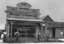
A 1902 fire destroyed much of the town centre.
St Joseph's Catholic School was established on 24 January 1926 by the Sisters of St Joseph of the Sacred Heart.[9][10]
The railway line closed in 1964.
The town made international headlines in June 2000, when an arsonist set fire to the Palace Backpackers Hostel, claiming the lives of 15 tourists. The Palace Building reopened in 2002, and includes a memorial to those lost in the blaze, a Regional Art Gallery and an Information Centre.
The Childers Library opened in 2000 with a major refurbishment in 2014.[11]
Population
In the 2016 Census, there were 1,584 people in Childers. 80.1% of people were born in Australia and 87.0% of people spoke only English at home. The most common responses for religion were No Religion 23.0%, Anglican 21.2% and Catholic 17.8%.[1]
Heritage listings
Childers has a number of heritage-listed sites, including:
- Bruce Highway: Childers Post Office[12]
- Churchill Street: Childers Court House[13]
- Macrossan Street: Christ Church[14]
- 6 North Street: Old Butcher's shop[15]
- 18 Macrossan Street: Isis Masonic Lodge[16]
- 45 Churchill Street: Isis District War Memorial and Shire Council Chambers[17]
- 50 Churchill Street: Queensland National Bank[18]
- 54-58 Churchill Street: Shops and Cafe[19]
- 55 Churchill Street: Childers RSL Club[20]
- 59 Churchill Street: Hotel Childers[21]
- 60 Churchill Street: Chemist[22]
- 61 Churchill Street: National Australia Bank[23]
- 62 Churchill Street: Ellwood & Co Drapery[24]
- 63 Churchill Street: Pizzey Memorial Clock[25]
- 66-70 Churchill Street: Jeffery's Building[26]
- 69 Churchill Street: Childers Ambulance Station[27]
- 71 Churchill Street: Federal Hotel[28]
- 72 Churchill Street: Palace Hotel[29]
- 74-78 Churchill Street: Hardware Store[30]
- 75 Churchill Street: Paragon Theatre[31]
- 80 Churchill Street: Lloyd's Barber Shop[32]
- 82 Churchill Street: Bakery[33]
- 84-86 Churchill Street: Kerr's Building[34]
- 88-90 Churchill Street: Childers Pharmaceutical Museum[35]
- 92-94 Churchill Street: Dittmer's Store[36]
- 102-108 Churchill Street: Coronation Building[37]
- 106-110 Churchill Street: Grand Hotel, Childers[38]
Economy
Childers is renowned for its heritage character and is classified a National Trust town. The historic colonial buildings of the main street (Bruce Highway) are set amongst large, shady leopard trees. The sugar cane industry features prominently in Childers and has sustained the town over the years. Fruit and vegetable cropping is common on the lands around town. Tourism is a growing industry in Childers, with a number of the preserved historic buildings in town becoming tourist attractions.
Childers acts as a major economic centre in the Wide Bay-Burnett Region and is undergoing considerable growth.
Childers retains much of its historic significance, although many of the streets were redeveloped under a 'Streetscape' project that continues today.
The local tourism organisation "Stay in Childers" is a not for profit incorporated association made up of local businesses.[39]
Services
The Isis Town and Country is the town's local newspaper, available once a week on Thursday. Childers is also served by a monthly community newspaper, the Childers Chit Chat, as well as its own radio station, 88.0FM Red Dirt Radio and commercial radio station Rebel 106.7.
In addition, the town services the surrounding areas with its small hospital. Childers has its own courthouse. The town has several emergency service faculties including a police station, ambulance station and fire station housing Fire and Rescue Queensland Staff and Queensland Rural Fire Service volunteers. It also hosts a branch of the State Emergency Service and PCYC Emergency Services Cadets program
Childers has many general local servicess, an art gallery (Bundaberg Regional Art Gallery- BRAG) and Information Centre. Cultural entertainment facilitated through the Childers Cultural Centre- a town hall hired through the Bundaberg Regional Council.
Bundaberg Regional Libraries operate a public library at 49 Churchill Street.[40]
The Childers branch of the Queensland Country Women's Association meets at 1 Crescent Street.[41]
Education
Childers State School is a government primary (Early Childhood-6) school for boys and girls at Mungomery Street (25.2311°S 152.2803°E).[42][43] In 2017, the school had an enrolment of 308 students with 24 teachers (22 full-time equivalent) and 20 non-teaching staff (14 full-time equivalent).[44] It includes a special education program.[42]
Isis District State High School is a government secondary (7-12) school for boys and girls at 3 Ridgway Street (25.2331°S 152.2739°E).[42][45] In 2017, the school had an enrolment of 504 students with 48 teachers (46 full-time equivalent) and 33 non-teaching staff (22 full-time equivalent).[44] It includes a special education program.[42]
St Joseph's School is a Catholic primary (Prep-6) school for boys and girls at 40 Churchill Street (25.2359°S 152.2811°E).[42][46] In 2017, the school had an enrolment of 75 students with 8 teachers (7 full-time equivalent) and 9 non-teaching staff (5 full-time equivalent).[44]
Festivals
Childers holds a Multicultural Festival once a year on the final weekend in July.[47] The town also hosts an agricultural show; which in the past was held in early August, but is now hosted in late May or early June.
As a celebration of its cultural heritage, Childers also hosts events in October to celebrate the Crush Festival- a region-wide event to mark the end of the sugar-cane crushing season.
References
- Australian Bureau of Statistics (27 June 2017). "Childers (SSC)". 2016 Census QuickStats. Retrieved 20 October 2018.

- "Childers - town in Bundaberg Region (entry 7062)". Queensland Place Names. Queensland Government. Retrieved 28 November 2019.
- "Childers - locality in Bundaberg Region (entry 50192)". Queensland Place Names. Queensland Government. Retrieved 28 November 2019.
- Google (13 August 2019). "Childers, Queensland" (Map). Google Maps. Google. Retrieved 13 August 2019.
- "Gureng Gureng". State Library of Queensland. 21 January 2020.
- Bunn, John. "Indigenous residents". Goodwood State School. Archived from the original on 25 December 2017. Retrieved 25 December 2017.
- Premier Postal History. "Post Office List". Premier Postal Auctions. Retrieved 10 May 2014.
- "Childers - town (entry 7062)". Queensland Place Names. Queensland Government. Retrieved 21 June 2017.
- Queensland Family History Society (2010), Queensland schools past and present (Version 1.01 ed.), Queensland Family History Society, ISBN 978-1-921171-26-0
- "About Us". St Joseph's Catholic Primary School. Retrieved 28 November 2019.
- "Public Libraries Statistical Bulletin 2016-17" (PDF). Public Libraries Connect. State Library of Queensland. November 2017. p. 15. Archived (PDF) from the original on 30 January 2018. Retrieved 30 January 2018.
- "Childers Post Office (former) (entry 600619)". Queensland Heritage Register. Queensland Heritage Council. Retrieved 7 July 2013.
- "Childers Court House (entry 600620)". Queensland Heritage Register. Queensland Heritage Council. Retrieved 7 July 2013.
- "Christ Church, Childers (entry 601994)". Queensland Heritage Register. Queensland Heritage Council. Retrieved 7 July 2013.
- "The Old Butcher's shop complex (entry 600631)". Queensland Heritage Register. Queensland Heritage Council. Retrieved 7 July 2013.
- "Isis Masonic Lodge (entry 602123)". Queensland Heritage Register. Queensland Heritage Council. Retrieved 7 July 2013.
- "Isis District War Memorial and Shire Council Chambers (entry 601507)". Queensland Heritage Register. Queensland Heritage Council. Retrieved 7 July 2013.
- "Queensland National Bank (former) (entry 600610)". Queensland Heritage Register. Queensland Heritage Council. Retrieved 7 July 2013.
- "Shops and Cafe 54-58 Churchill Street (entry 600612)". Queensland Heritage Register. Queensland Heritage Council. Retrieved 7 July 2013.
- "Childers RSLA Club (entry 600613)". Queensland Heritage Register. Queensland Heritage Council. Retrieved 7 July 2013.
- "Hotel Childers (entry 600614)". Queensland Heritage Register. Queensland Heritage Council. Retrieved 7 July 2013.
- "Chemist 60 Churchill St (entry 600615)". Queensland Heritage Register. Queensland Heritage Council. Retrieved 7 July 2013.
- "National Australia Bank (entry 600616)". Queensland Heritage Register. Queensland Heritage Council. Retrieved 7 July 2013.
- "Ellwood & Co Drapery (former) (entry 600617)". Queensland Heritage Register. Queensland Heritage Council. Retrieved 7 July 2013.
- "Clock - Pizzey Memorial (entry 600618)". Queensland Heritage Register. Queensland Heritage Council. Retrieved 7 July 2013.
- "Jeffery's Building (entry 600609)". Queensland Heritage Register. Queensland Heritage Council. Retrieved 7 July 2013.
- "Childers QATB (former) (entry 600621)". Queensland Heritage Register. Queensland Heritage Council. Retrieved 7 July 2013.
- "Federal Hotel (entry 600622)". Queensland Heritage Register. Queensland Heritage Council. Retrieved 7 July 2013.
- "Palace Hotel (entry 600623)". Queensland Heritage Register. Queensland Heritage Council. Retrieved 7 July 2013.
- "Hardware Store (former) (entry 600624)". Queensland Heritage Register. Queensland Heritage Council. Retrieved 7 July 2013.
- "Paragon Theatre (entry 601618)". Queensland Heritage Register. Queensland Heritage Council. Retrieved 7 July 2013.
- "Lloyd's Barber Shop (former) (entry 600625)". Queensland Heritage Register. Queensland Heritage Council. Retrieved 7 July 2013.
- "Bakery (entry 600626)". Queensland Heritage Register. Queensland Heritage Council. Retrieved 7 July 2013.
- "Kerr's Building (entry 600627)". Queensland Heritage Register. Queensland Heritage Council. Retrieved 7 July 2013.
- "Childers Pharmaceutical Museum & Tourist Information Centre (entry 600628)". Queensland Heritage Register. Queensland Heritage Council. Retrieved 7 July 2013.
- "Dittmer's Store/Isis Town and Country (entry 600630)". Queensland Heritage Register. Queensland Heritage Council. Retrieved 7 July 2013.
- "Shops at 102-108 Churchill St (entry 600629)". Queensland Heritage Register. Queensland Heritage Council. Retrieved 7 July 2013.
- "Grand Hotel (entry 600608)". Queensland Heritage Register. Queensland Heritage Council. Retrieved 7 July 2013.
- "Stay in Childers | Childers stayinchilders". stayinchilders. Retrieved 28 October 2019.
- "Locations & Hours". Bundaberg Regional Council. Archived from the original on 30 January 2018. Retrieved 31 January 2018.
- "Branch Locations". Queensland Country Women's Association. Archived from the original on 26 December 2018. Retrieved 26 December 2018.
- "State and non-state school details". Queensland Government. 9 July 2018. Archived from the original on 21 November 2018. Retrieved 21 November 2018.
- "Childers State School". Retrieved 21 November 2018.
- "ACARA School Profile 2017". Archived from the original on 22 November 2018. Retrieved 22 November 2018.
- "Isis District State High School". Retrieved 21 November 2018.
- "St Joseph's School". Retrieved 21 November 2018.
- "Childers Festival of Cultures". RACQ. Archived from the original on 11 September 2013. Retrieved 8 August 2013.
External links
| Wikimedia Commons has media related to Childers, Queensland. |
- "Childers". Queensland Places. Centre for the Government of Queensland, University of Queensland.
- Town map of Childers, 1975
| Authority control |
|
|---|